Review: Patterns and Projections of High Tide Flooding Along the U.S. Coastline Using a Common Impact Threshold
Reviewing: Patterns and Projections of High Tide Flooding Along the U.S. Coastline Using a Common Impact Threshold
Goals:
- Prove I can read.
Outcomes and Takeaways:
- A shared understanding of the methods and efforts our giants have provided.
- A better appreciation of how this effort leaned on previous efforts.
Sweet et al. (2018)
Methods
Question:
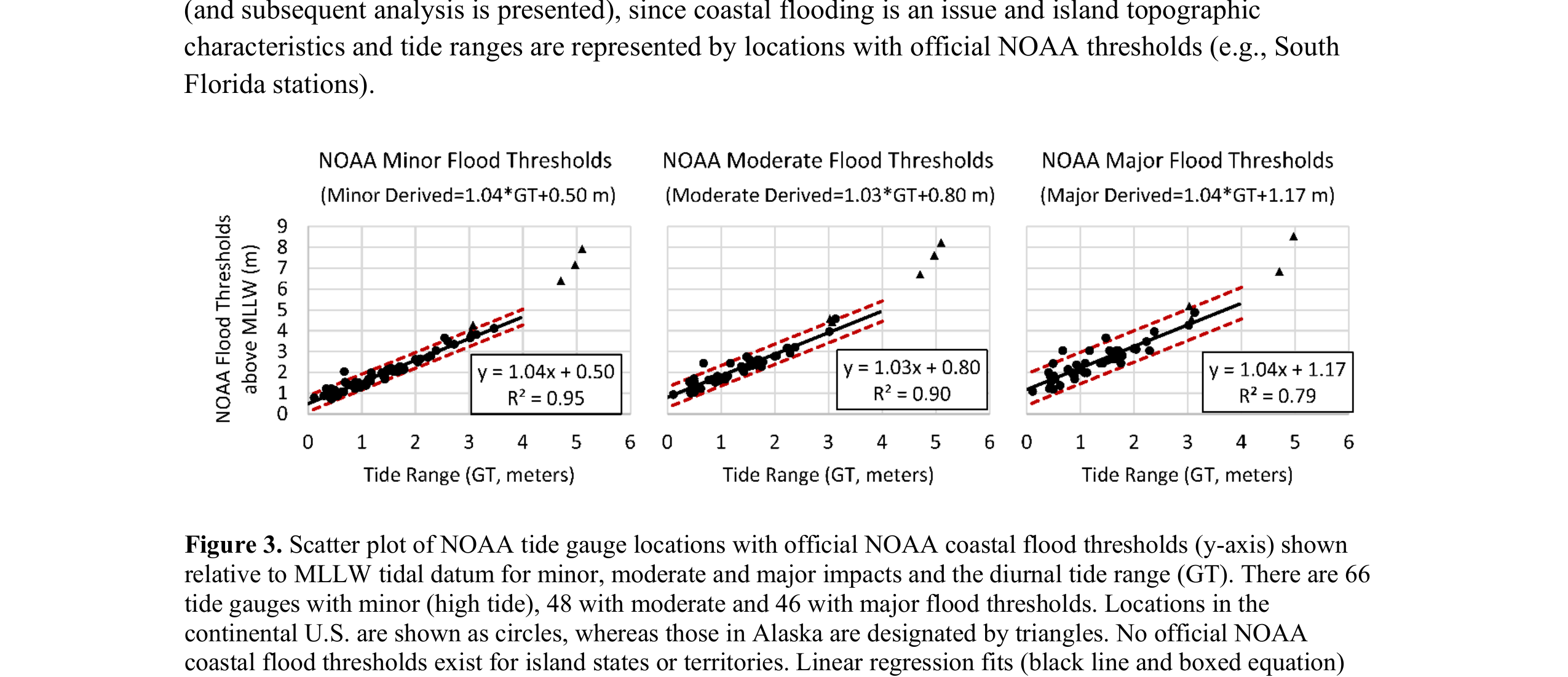
- How to establish an objective and nationally consistent set of impact thresholds for minor/moderate/major coastal flooding.
Methods:
- Extensive literature synthesis
- Trend analysis across NOAA threasholds

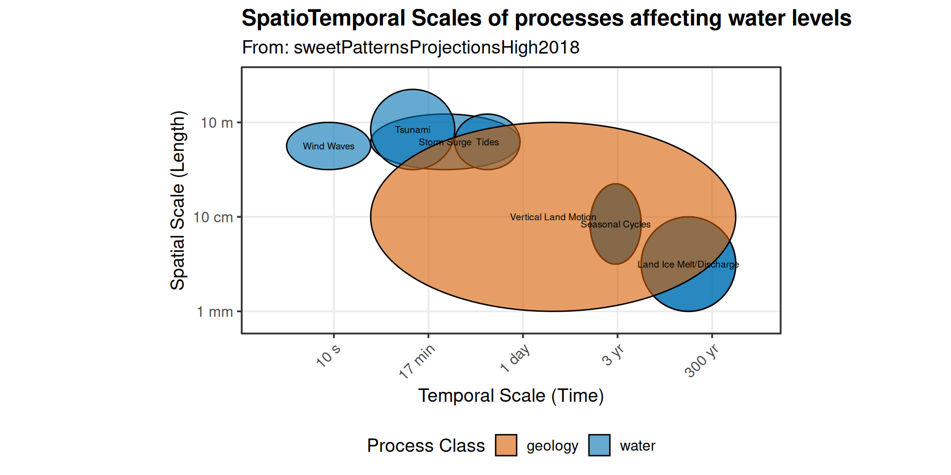
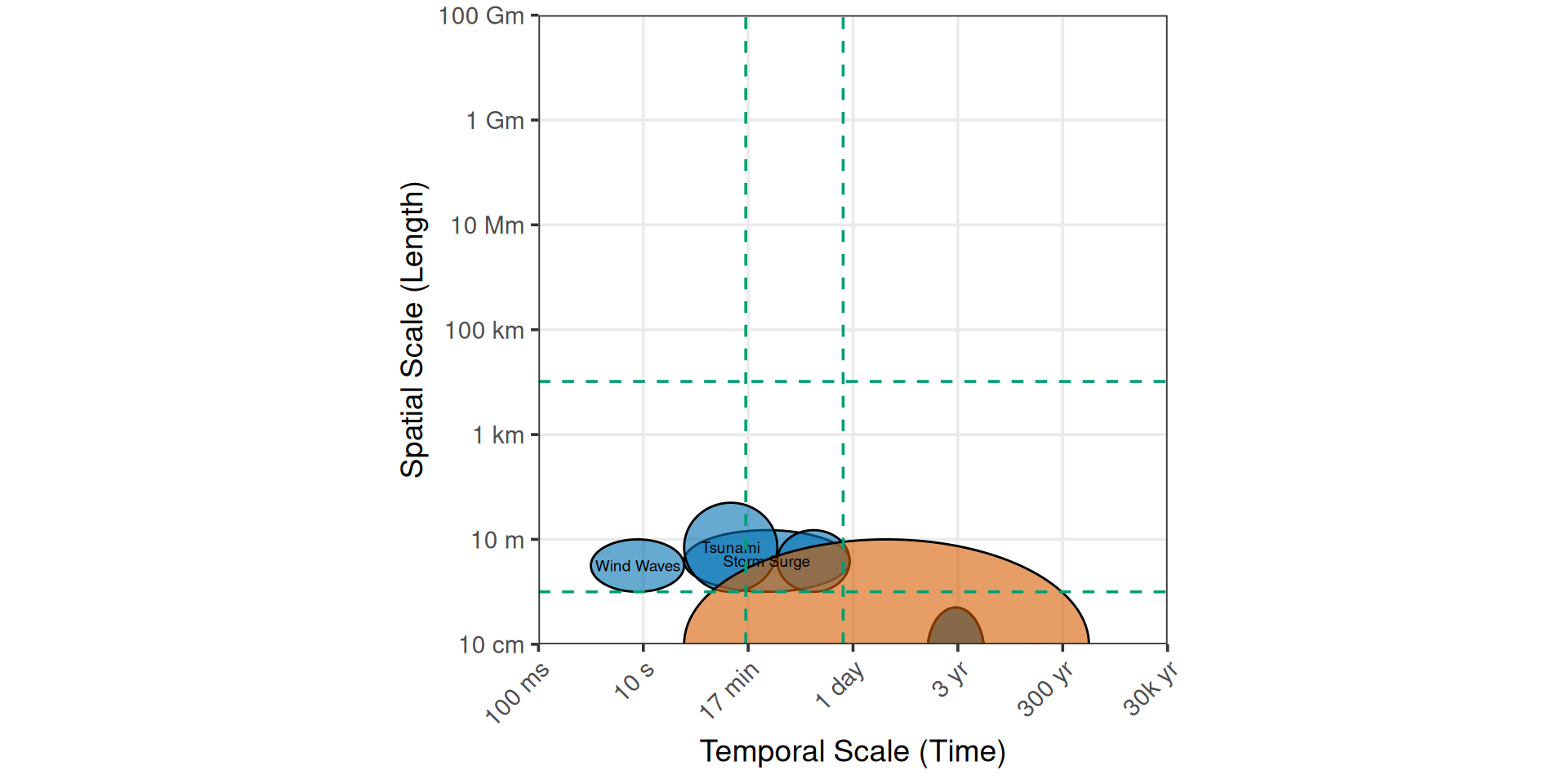
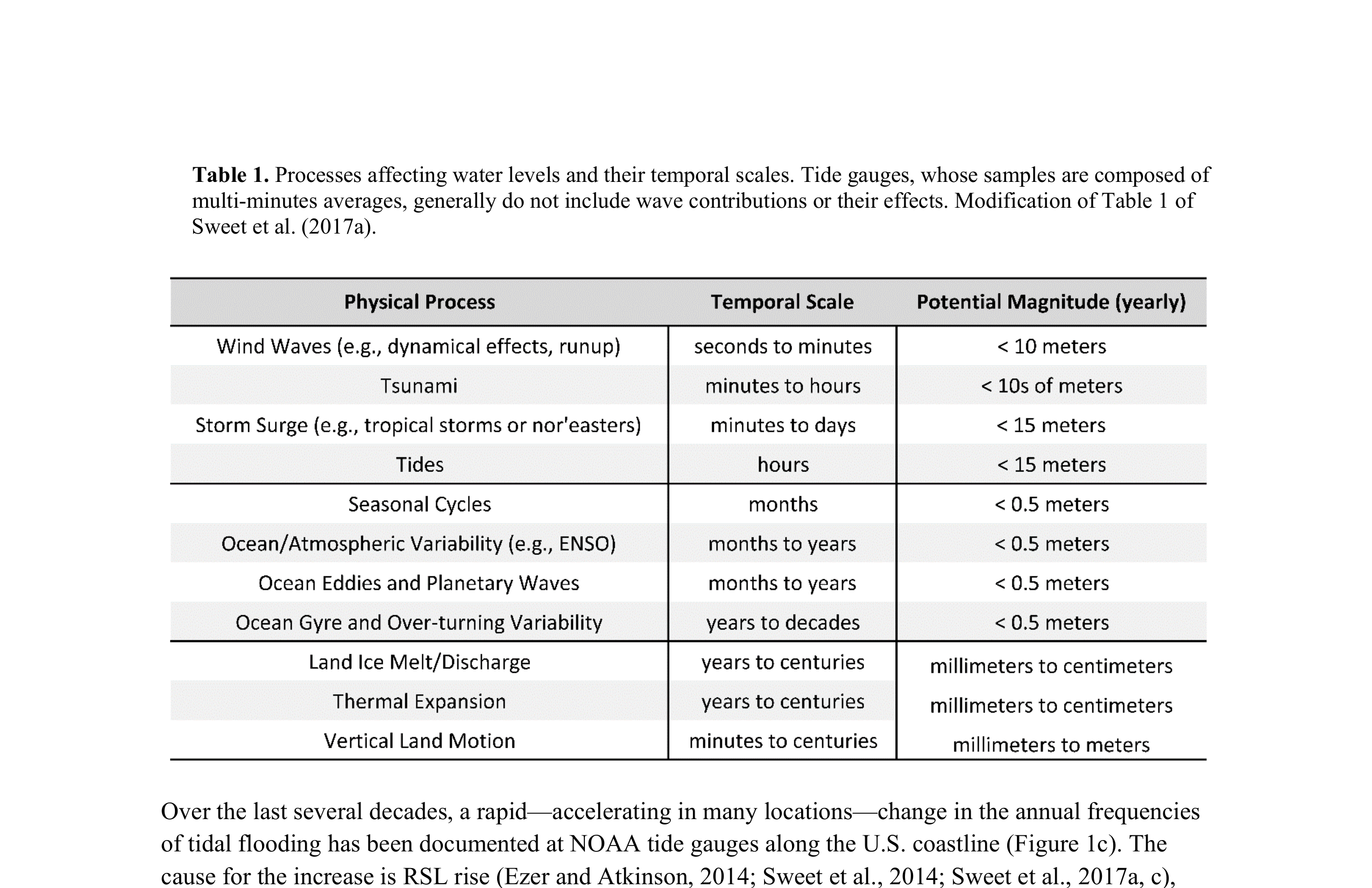
Scales of process
What have we learned?
- The derived flood thresholds are not intended to supplant local knowledge or existing products concerning flood risk but rather provide spatial insights about national infrastructure vulnerabilities along the coast where such information is lacking.
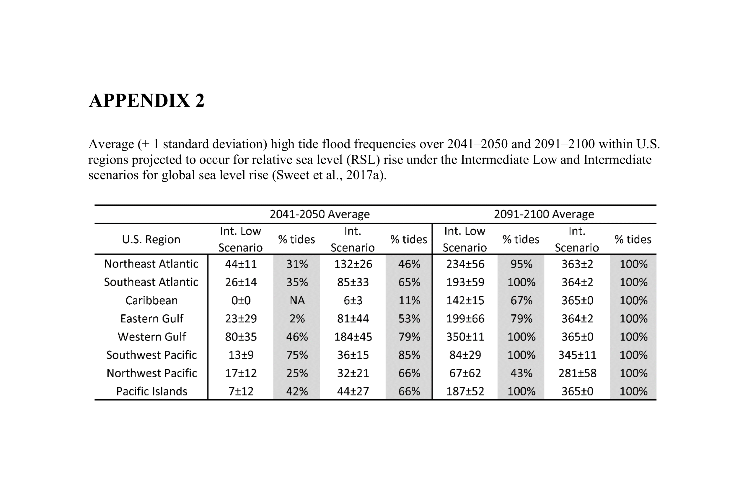
- Between 2000 and 2015, annual frequencies have increased on average by about 125% (1.3 to 3.0 days/year) along the Southeast Atlantic, by 75% (3.4 to 6.0 days/year) along the Northeast Atlantic and by (median values) 75% (1.4 to 2.5 days/year) along the Western Gulf