The Hydrologic Unit Scales
Goals:
- Walk from continental catchment down to basin scale
Outcomes and Takeaways:
- A better understanding of the National Hydrography data sechmanitcs
- A deeper intuition of how the scales of your concepts and data definitions interact
Drawing heavy inspiration from the USGS NHDPlus page

Slide layout: default Items linked/bordered in green are cited in the tooltip on hover.
: narrative-oriented Items linked/bordered in blue are hyperlinked to relevant resources.
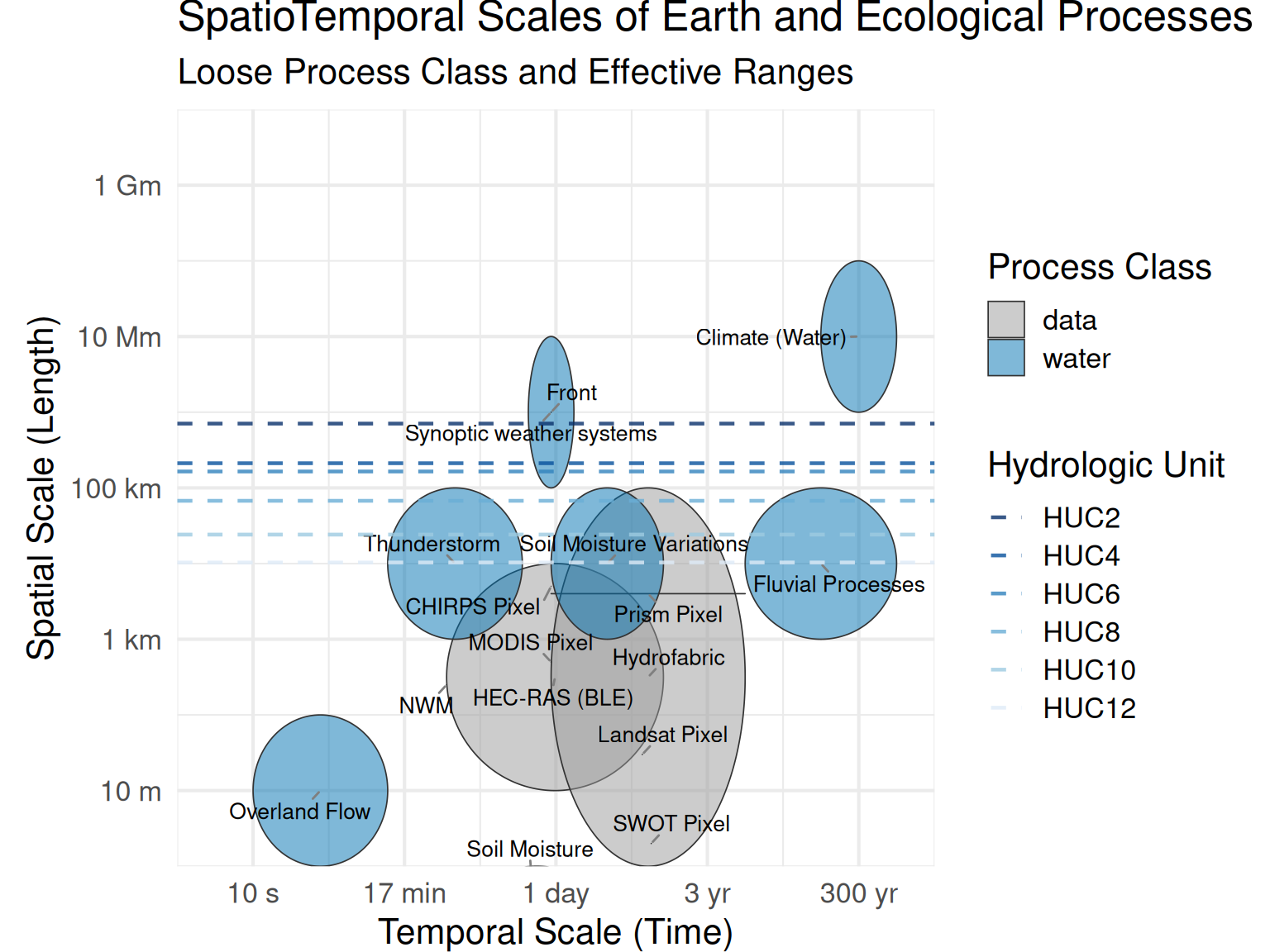
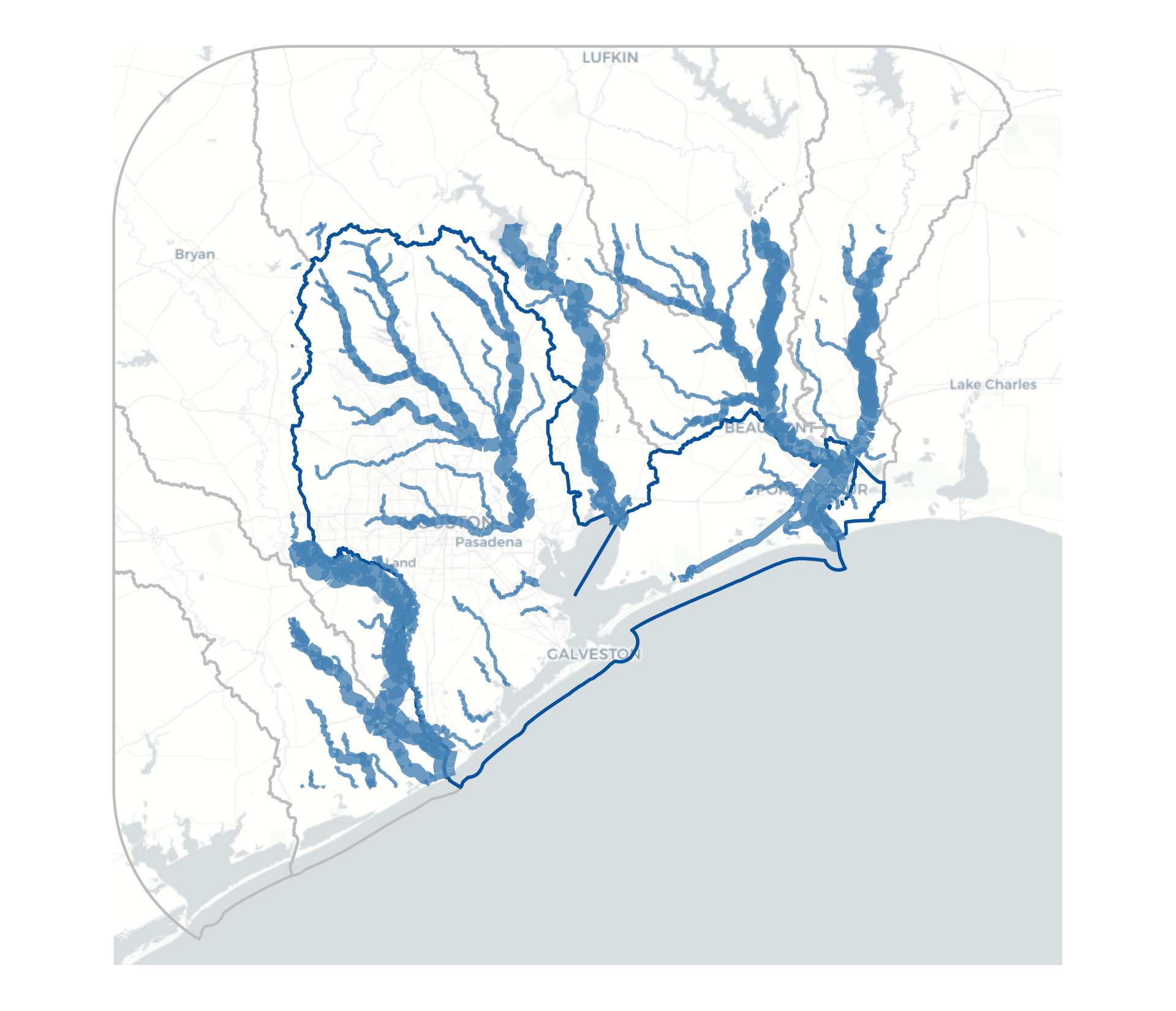
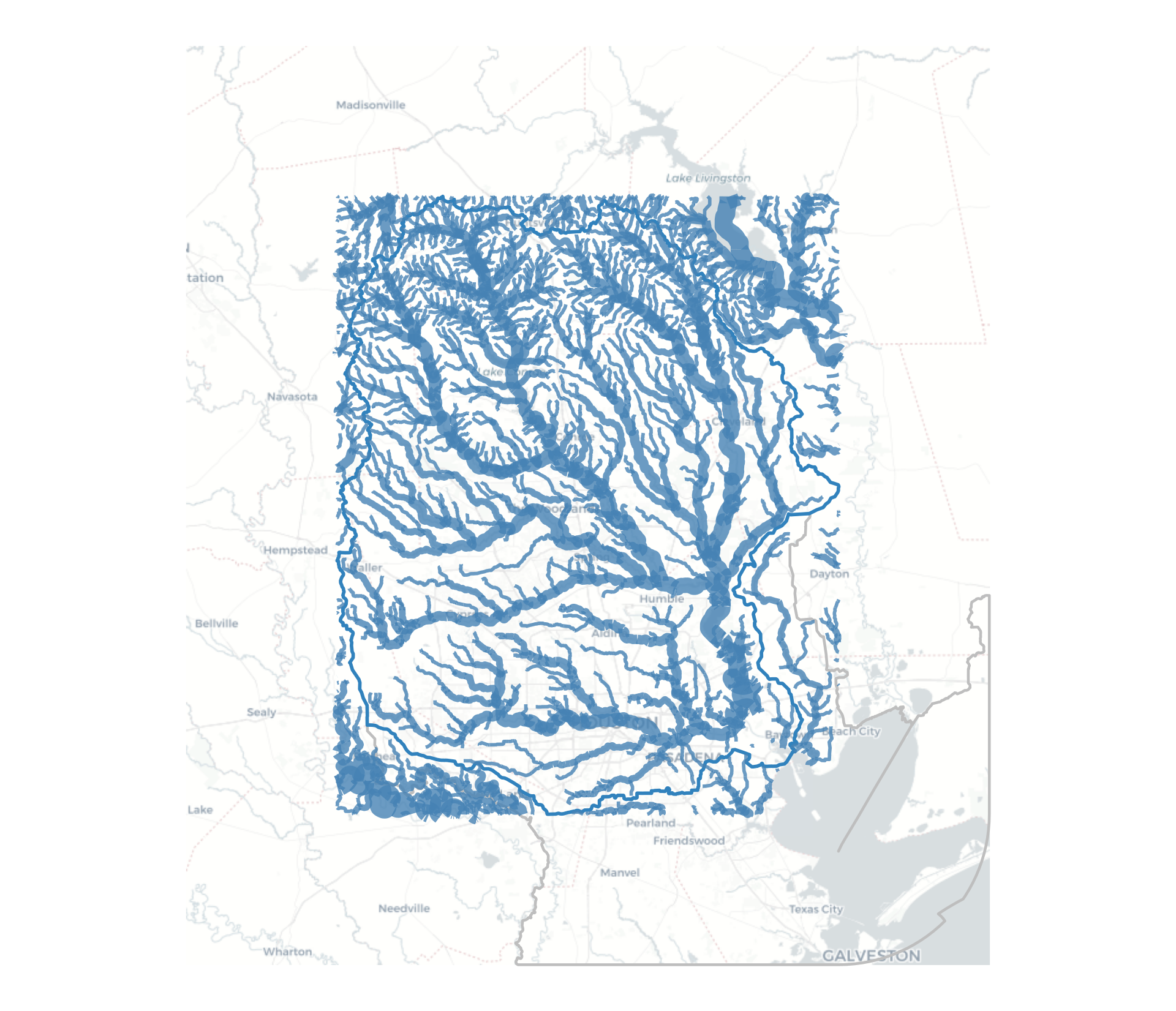
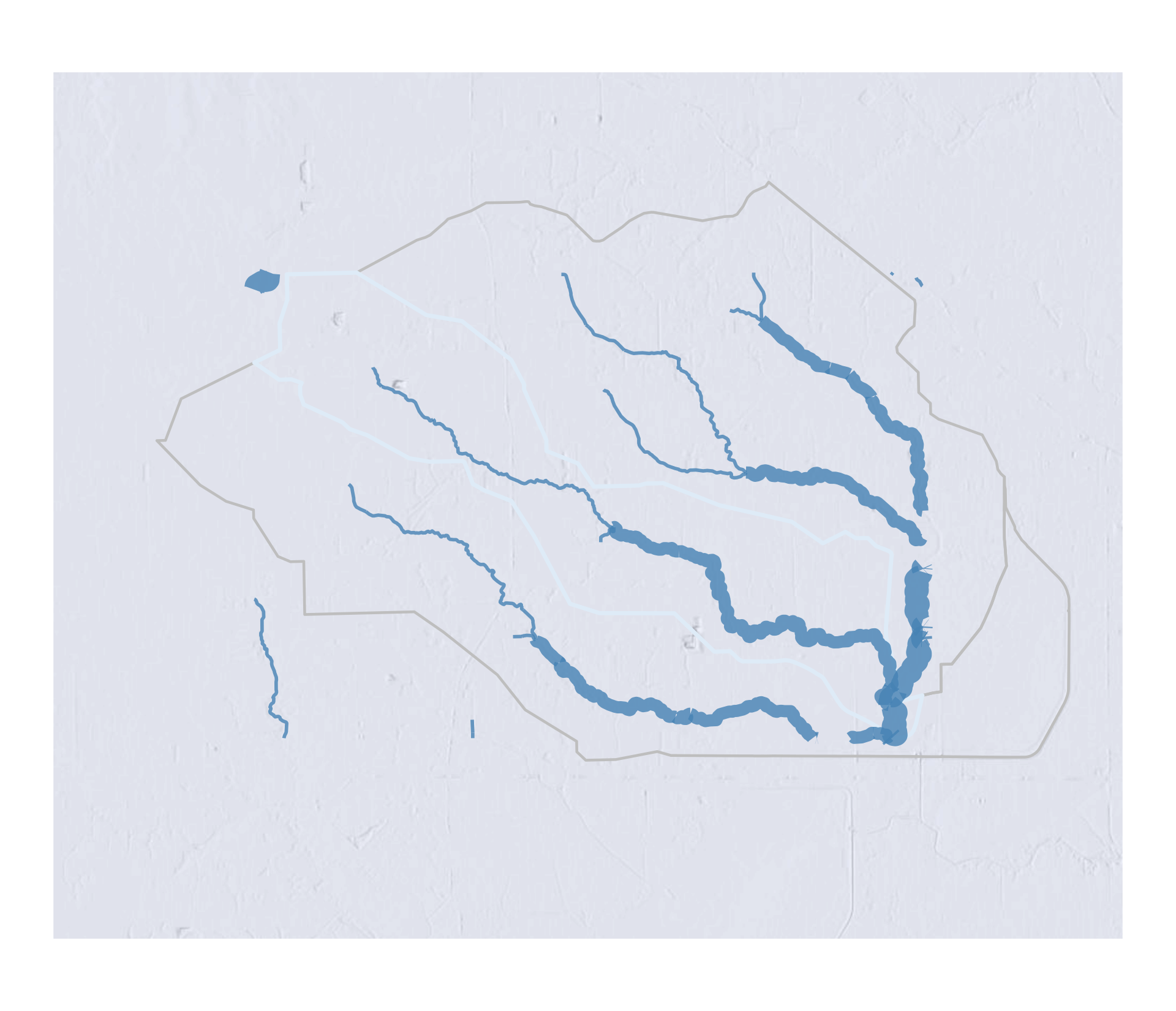
Context around spatial scales
![]()
Context around spatial scales
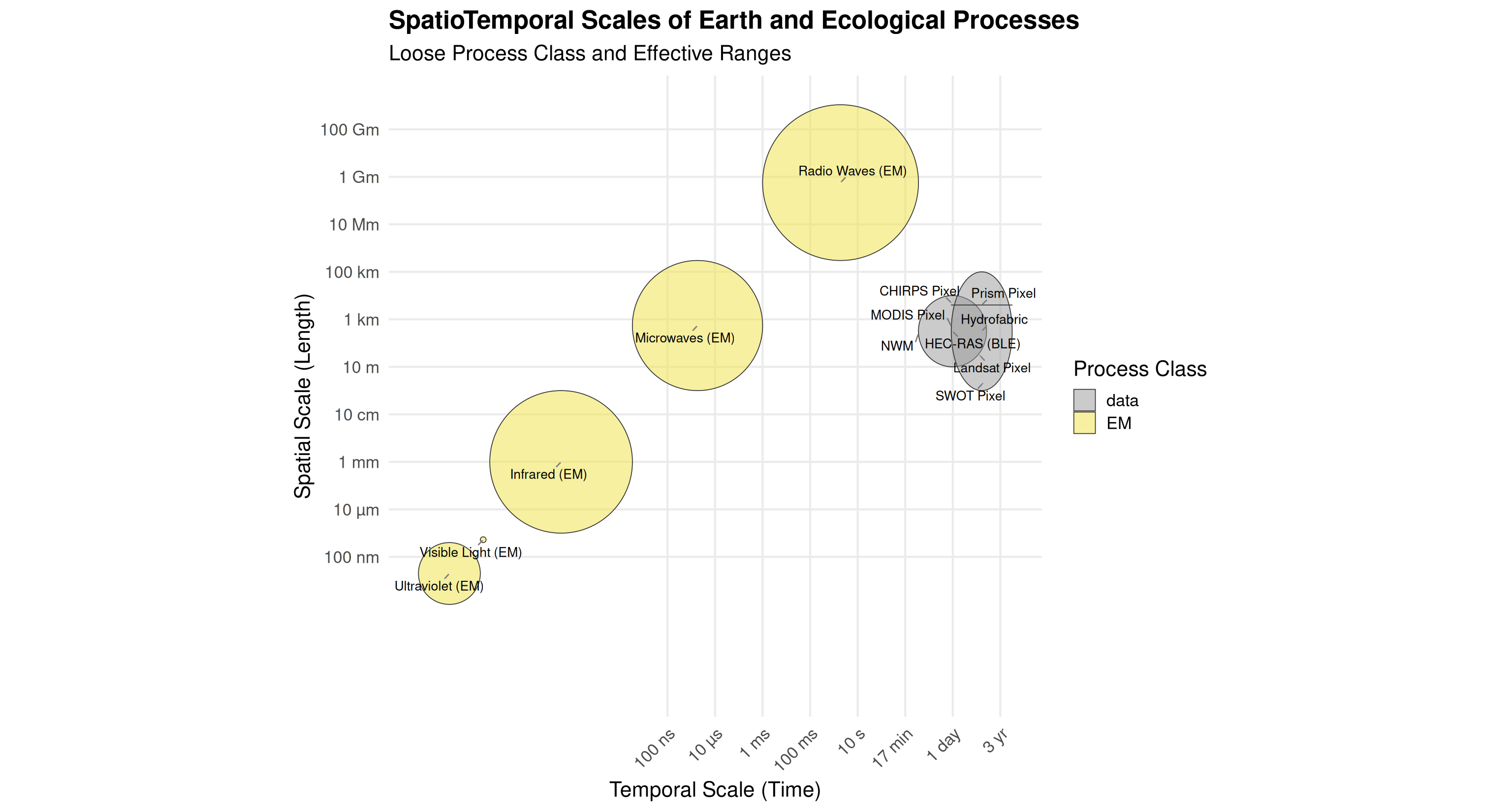
Context around spatial scales
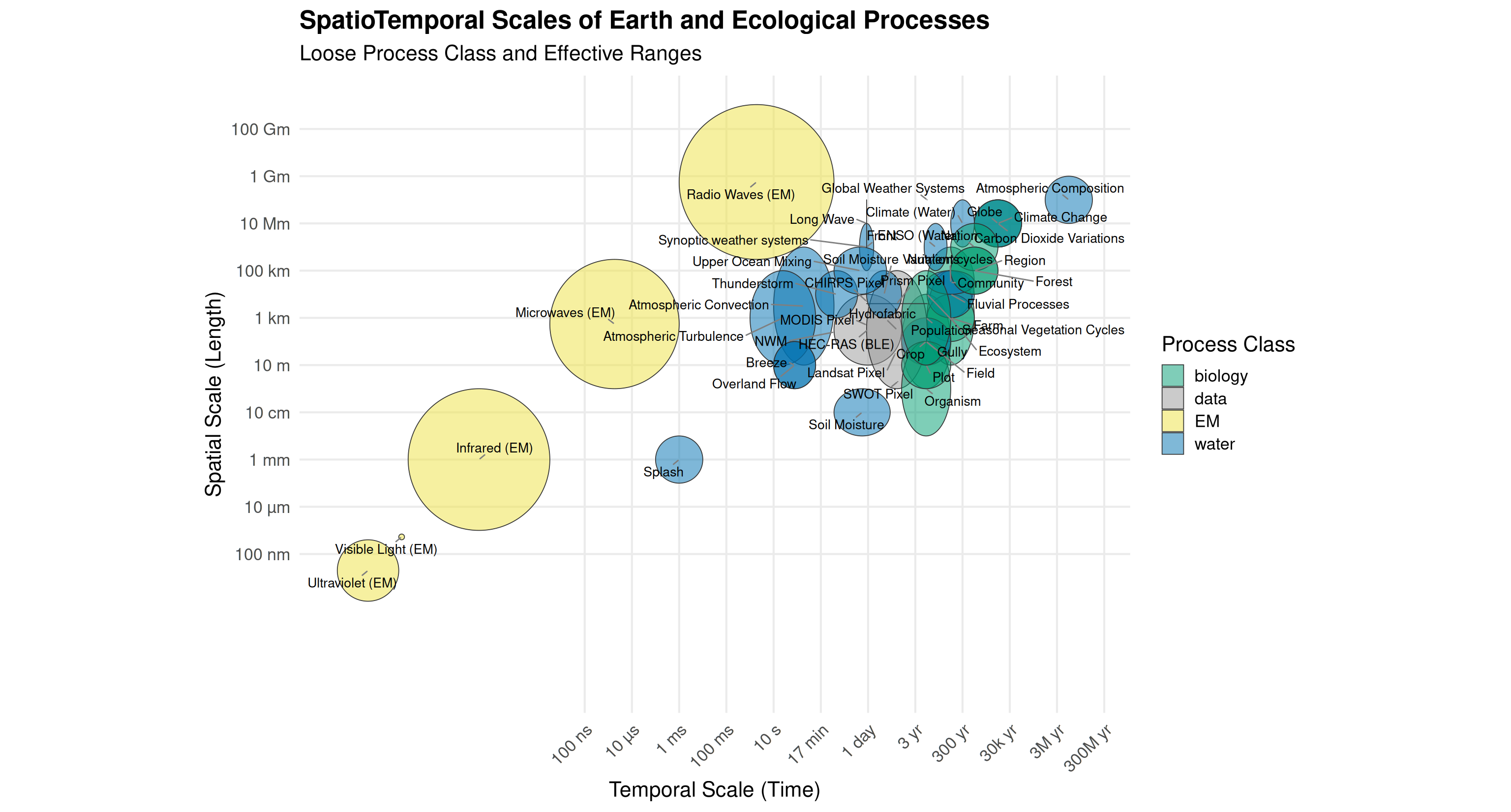
Context around spatial scales
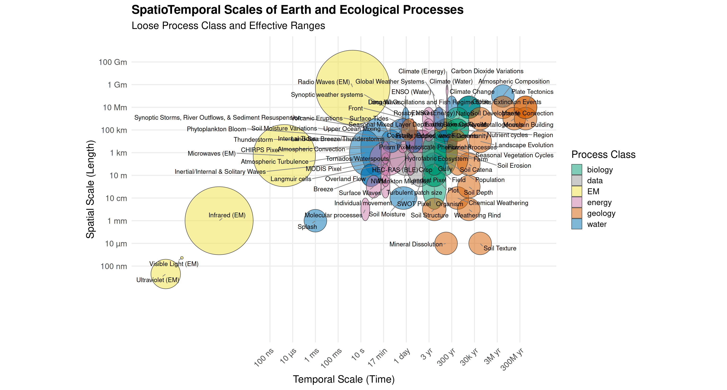
Context around spatial scales
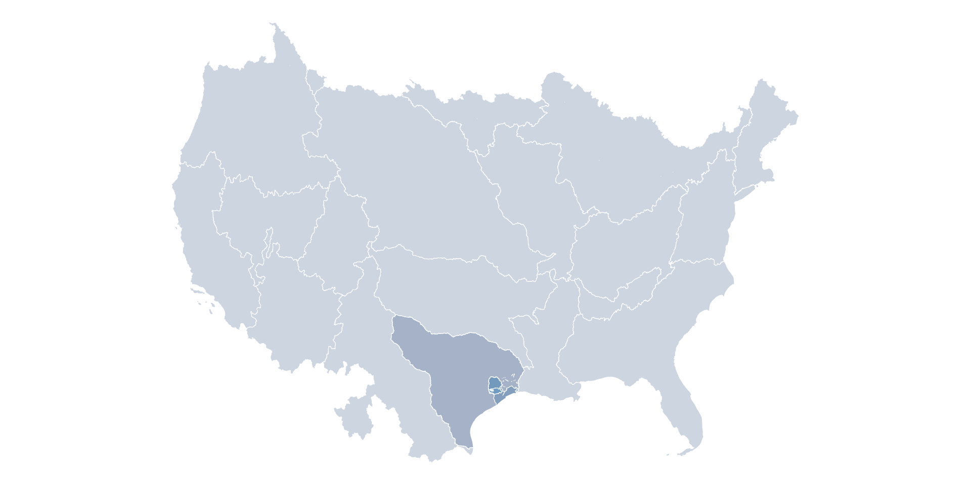
2-digit Hydrologic Units (Regions)
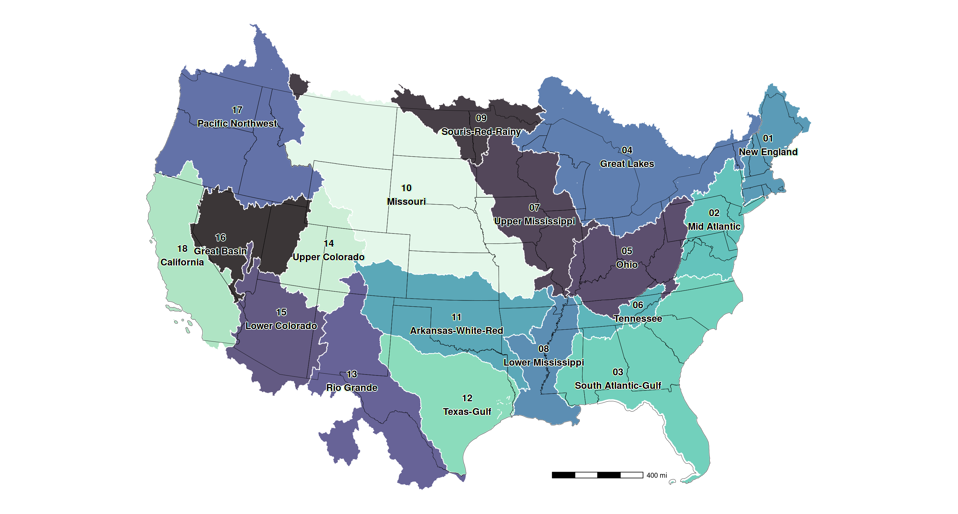
2-digit Hydrologic Units (Regions)
120401040202
Region > Subregion > Basin > Subbasin > Watershed > Subwatershed
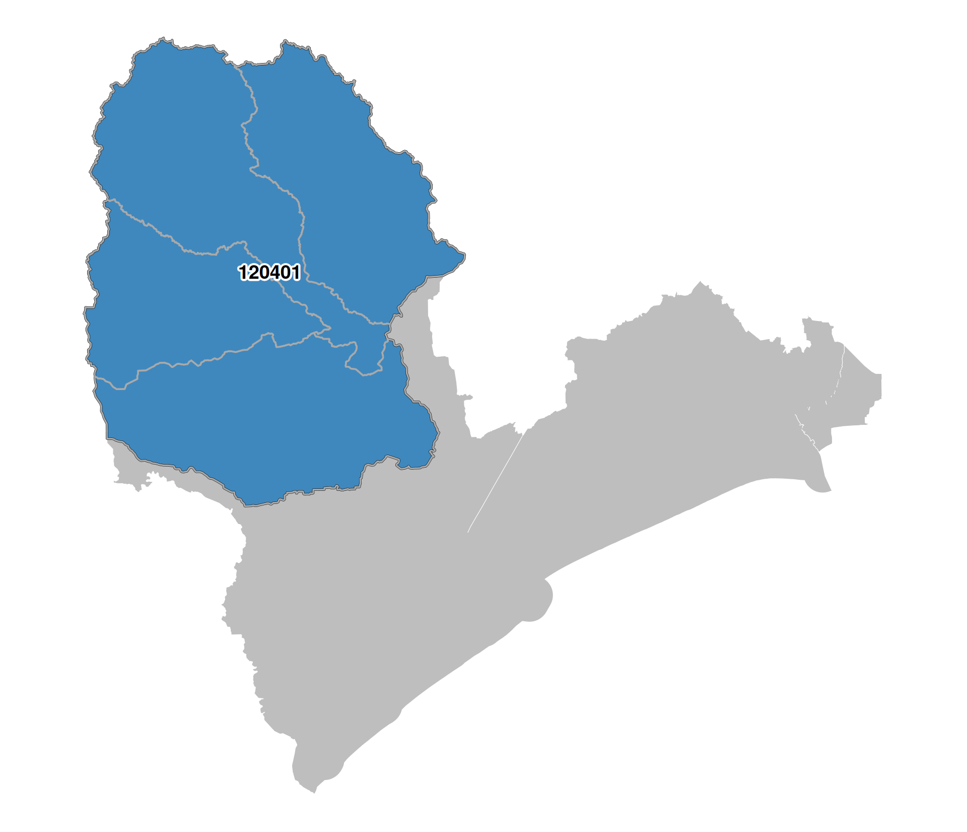
4-digit Hydrologic Units (Subregions)
120401040202
Region > Subregion > Basin > Subbasin > Watershed > Subwatershed
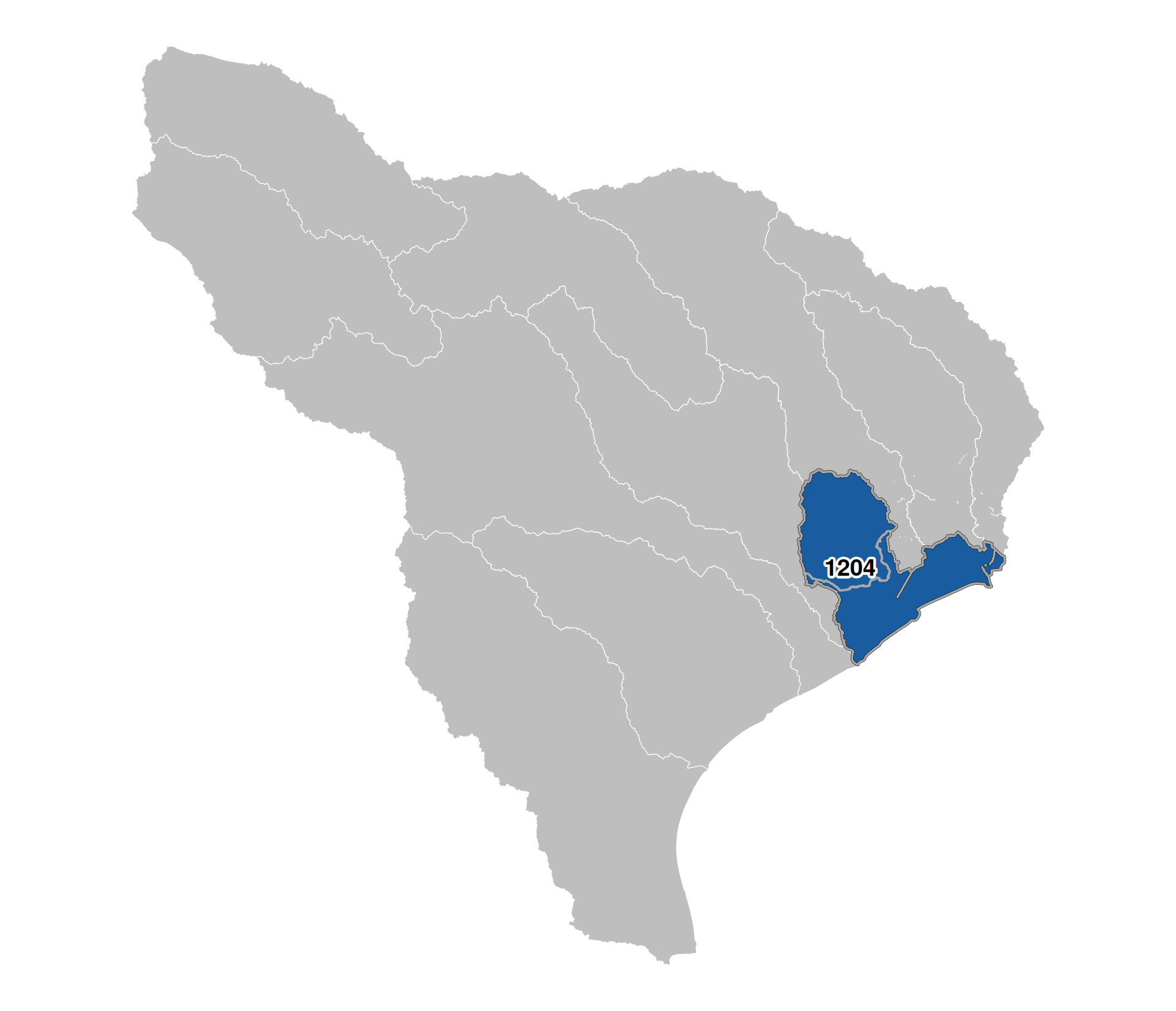
6-digit Hydrologic Units (Basins)
120401040202
Region > Subregion > Basin > Subbasin > Watershed > Subwatershed
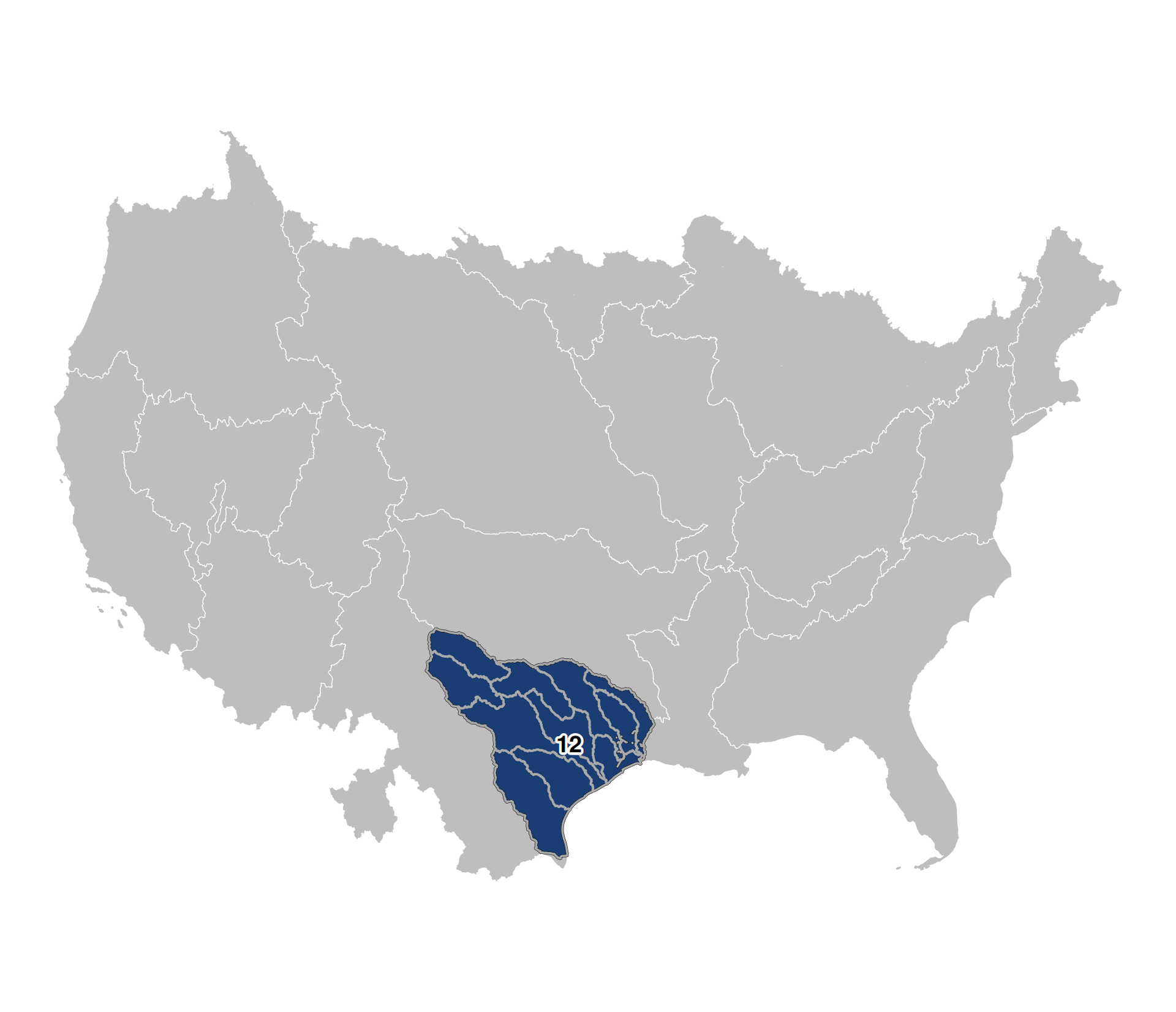
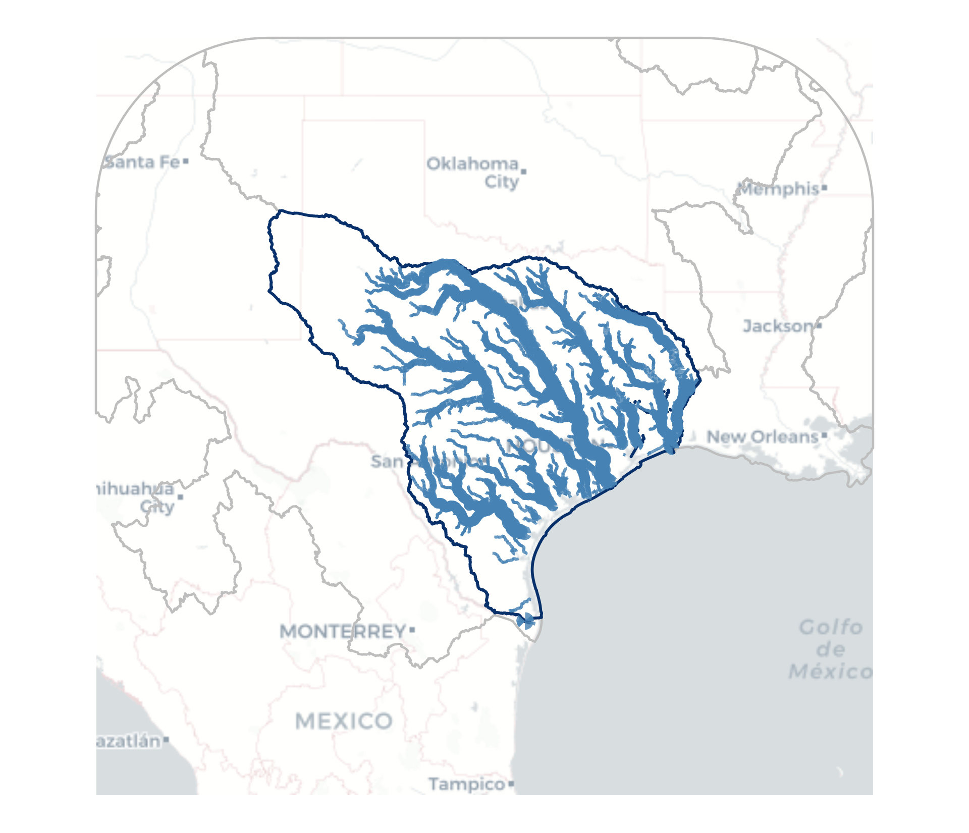
8-digit Hydrologic Units (Subbasins)
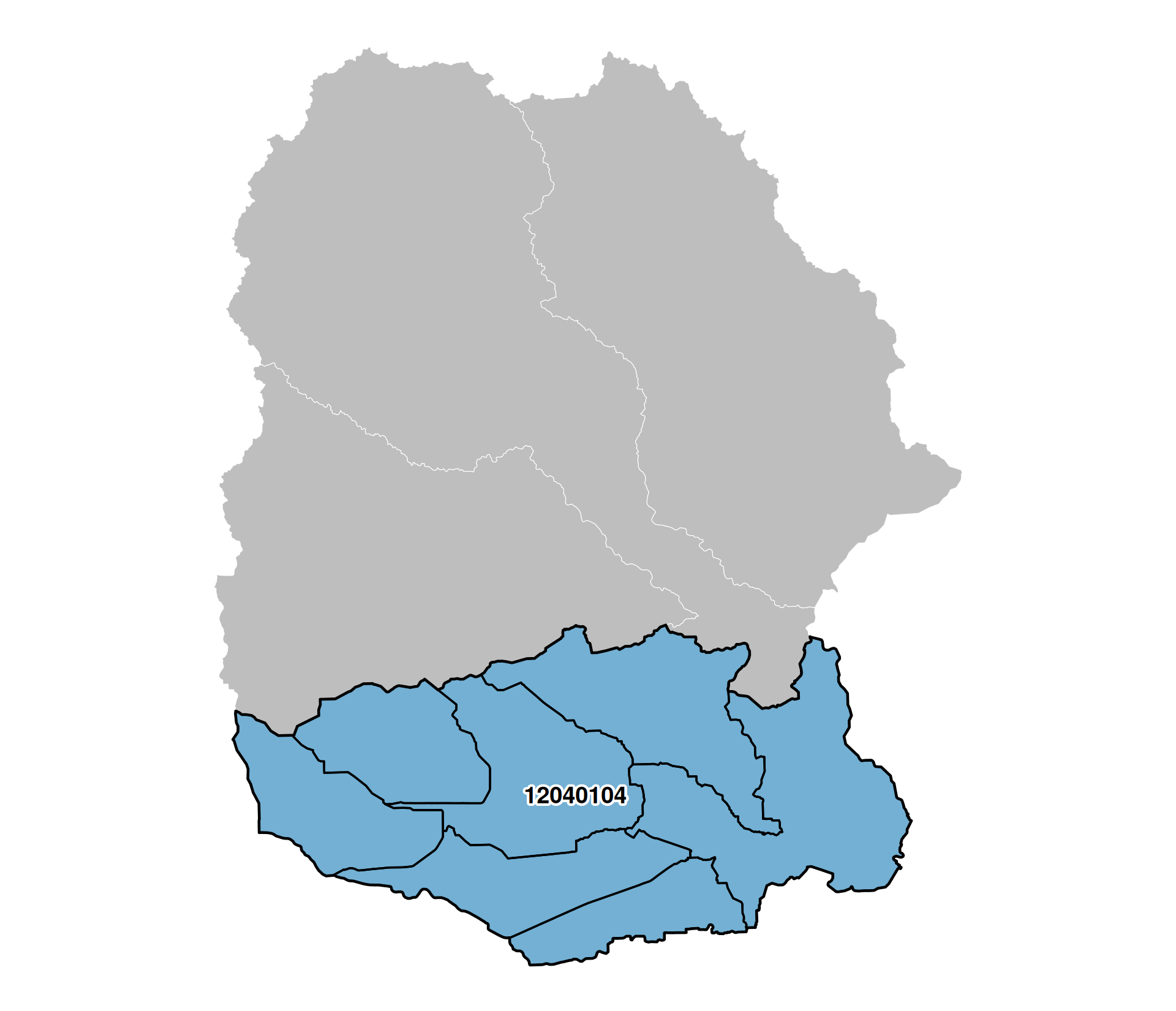
120401040202
Region > Subregion > Basin > Subbasin > Watershed > Subwatershed
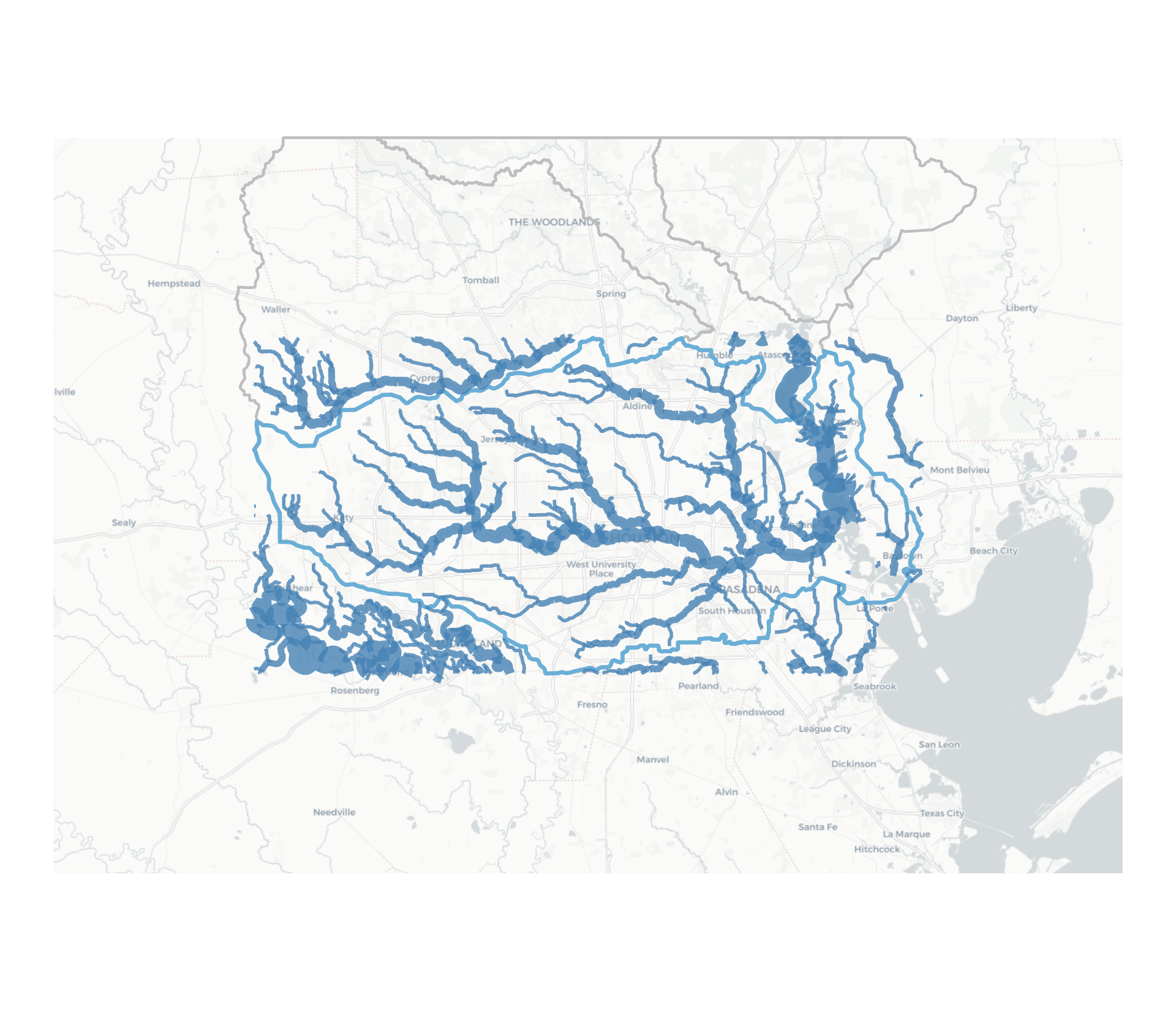
10-digit Hydrologic Units (Watersheds)
120401040202
Region > Subregion > Basin > Subbasin > Watershed > Subwatershed
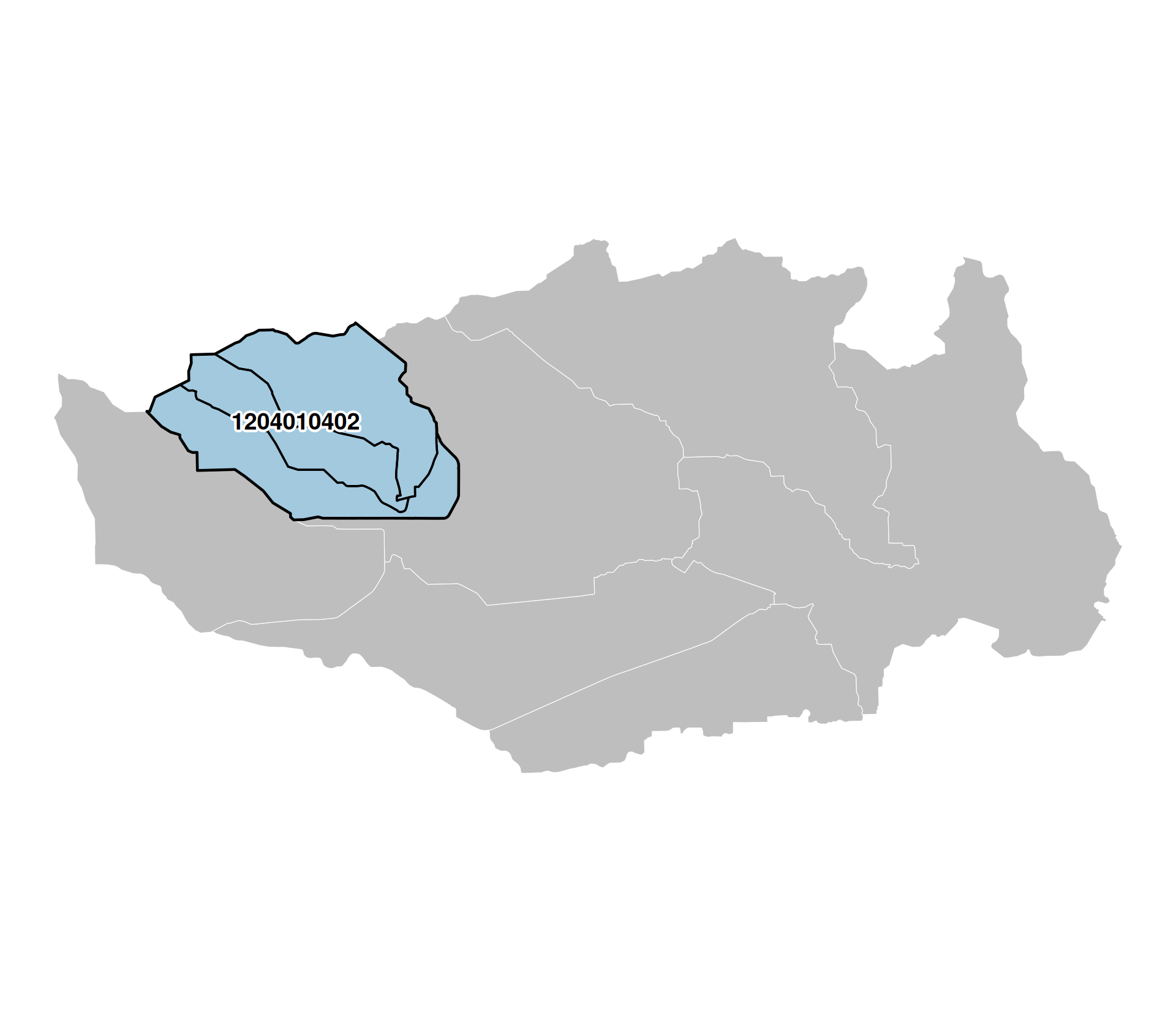
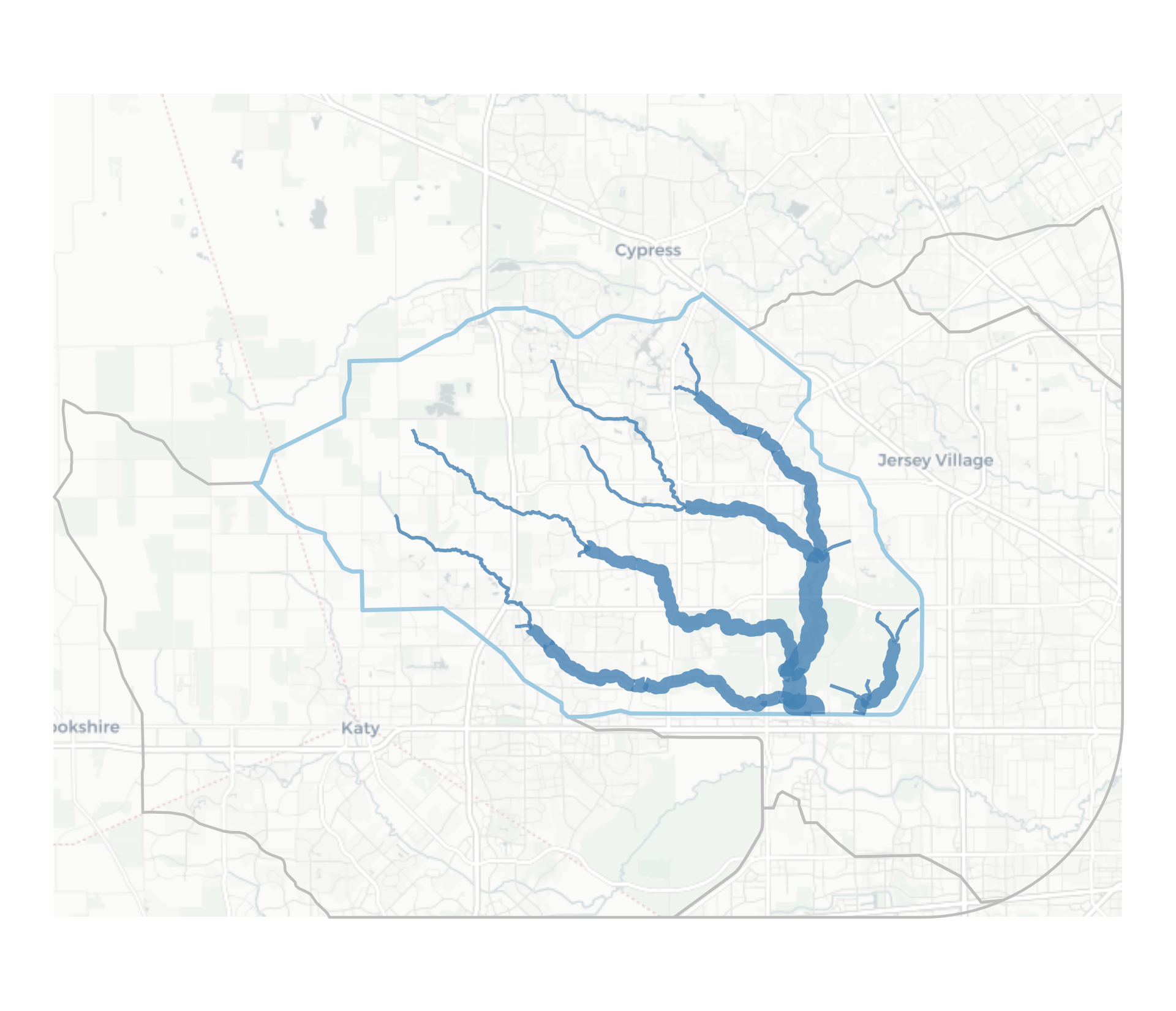
12-digit Hydrologic Units (Subwatersheds)
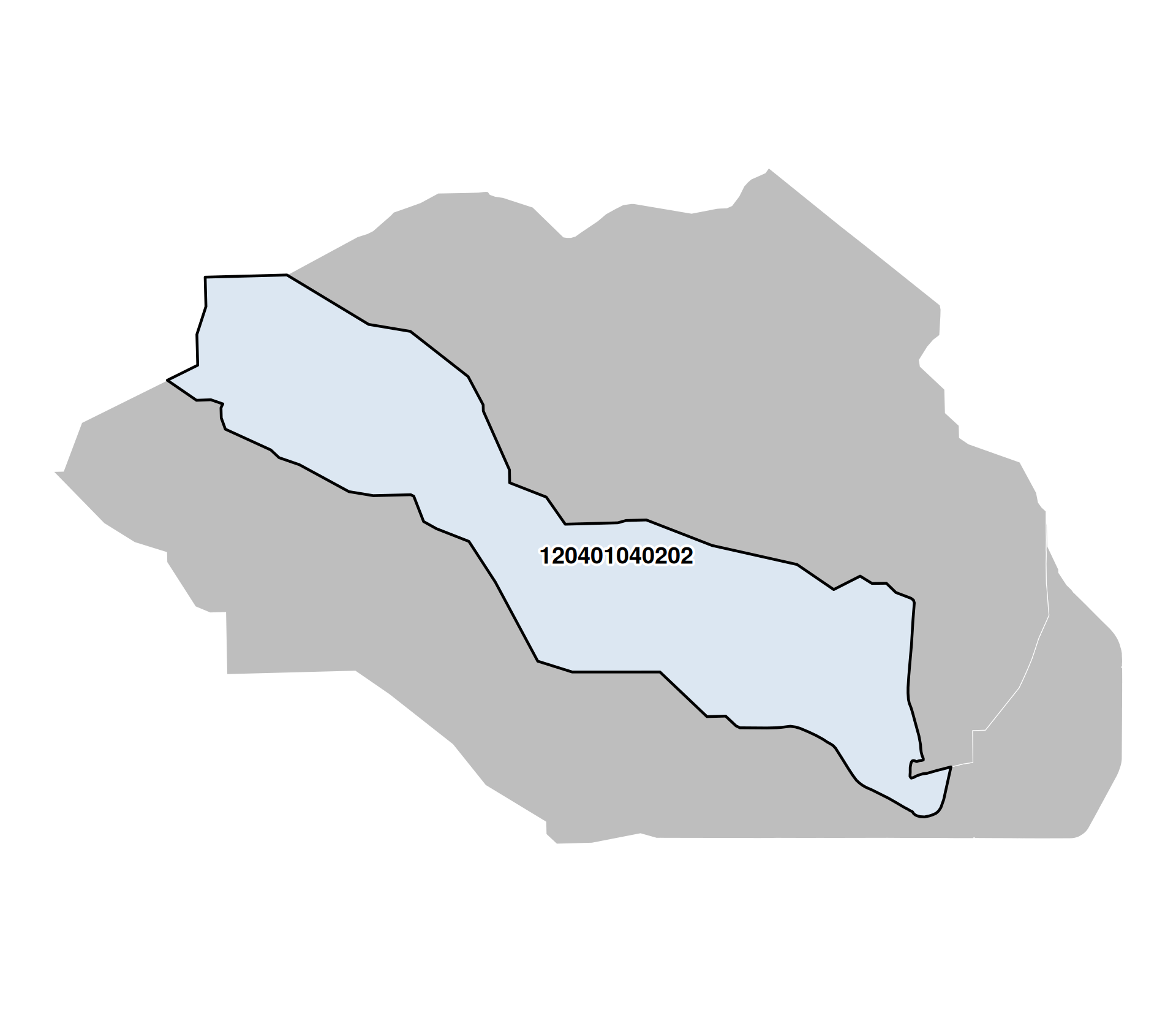
120401040202
Region > Subregion > Basin > Subbasin > Watershed > Subwatershed
Thank you!
Outcomes and Takeaways:
- I’ve been doing kickflips in the parking lot
- Real cool guy shit here
Next Steps: