The History of FIM according to Jim

Goals:
Outcomes:
- A better understanding of why we use the tools and methods we use.
- More context on the approaches we take to FIM.
Slide layout: default Items linked/bordered in green are cited in the tooltip on hover.
: interactive elements Items linked/bordered in blue are hyperlinked to relevant resources.
Presentation Navigation Tips
Slide layout : This deck has one axis, use any key to advance.
: This deck is narrative-oriented
Items linked/bordered in green are cited in the tooltip on hover.
Items linked/bordered in blue are hyperlinked to relevant resources.
Photos are Allowed | Questions are Encouraged
: ~5 minutes | Last updated:09/10/2026 13:47:40
! PLEASE !
Interrupt me and ask questions or clarifications.
I’m here to talk with you now, not to these slides.
Control tips
My preferred (FOSS) flavor of slidedecks, revealjs, has intuitive but none the less unconventional PowerPoint presentation controls:
- Slides dynamically resize to use the entirety of the browser window, but you can still fullscreen with
F.- This slide has a red border indicating the content extent.
- Slide navigation is mode dependent. If there are vertical slides, press
space,N, or thedown arrowkey, not theright arrowto advance slides - Press
Mto open to the menu, PressOfor the slide deck overview, PressBto black out the presentation screen, PressSfor a speaker view. - You can use the chalkboard to freemouse/touchpad draw.
- Slides should render as designed1 but you can press
Alt/Opt+ click on the slide to zoom in. Increase text size withAlt/Opt++,Alt/Opt+-to decrease, andAlt/Opt+0reset to the default scale. - Press
Cto declare victory and head home.2

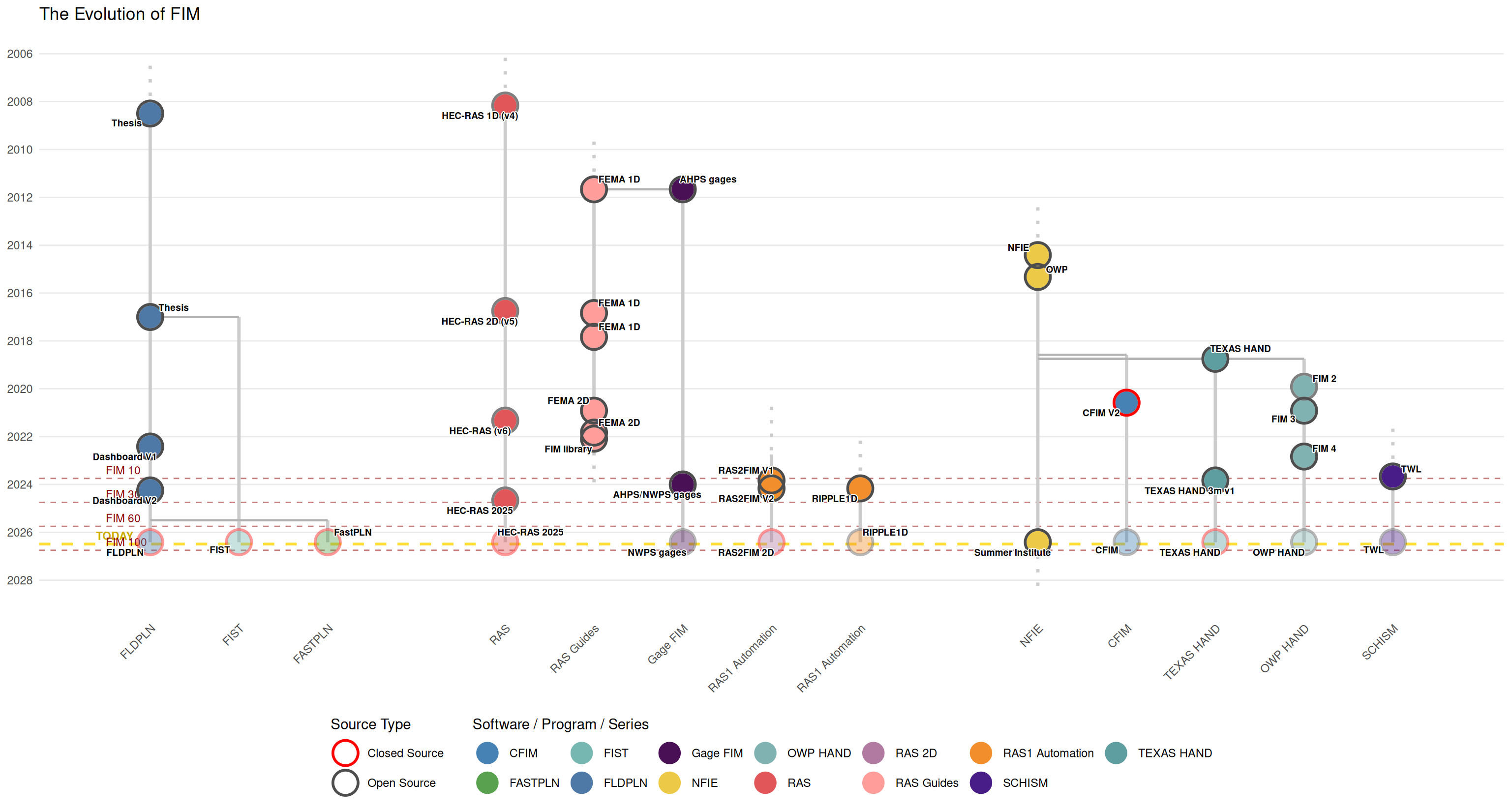
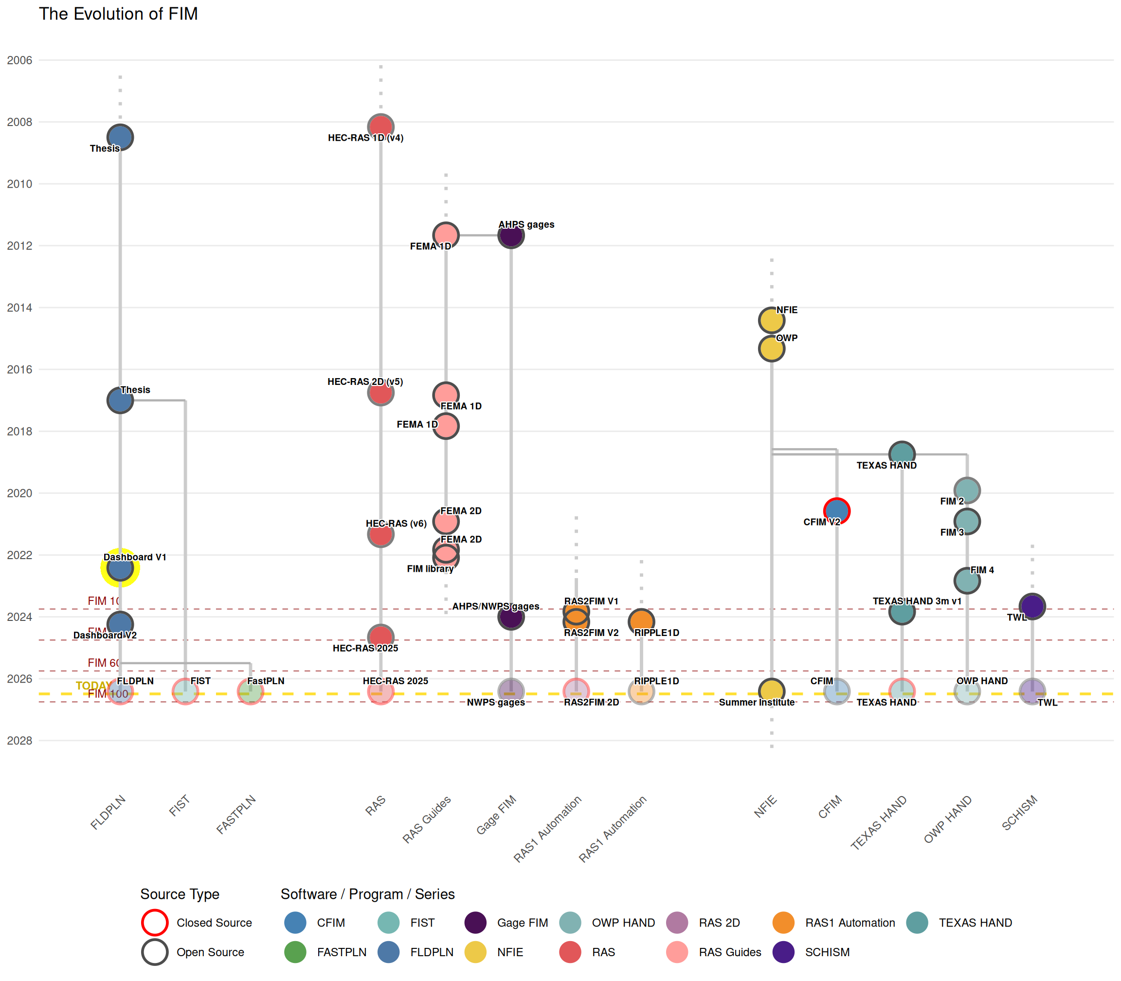
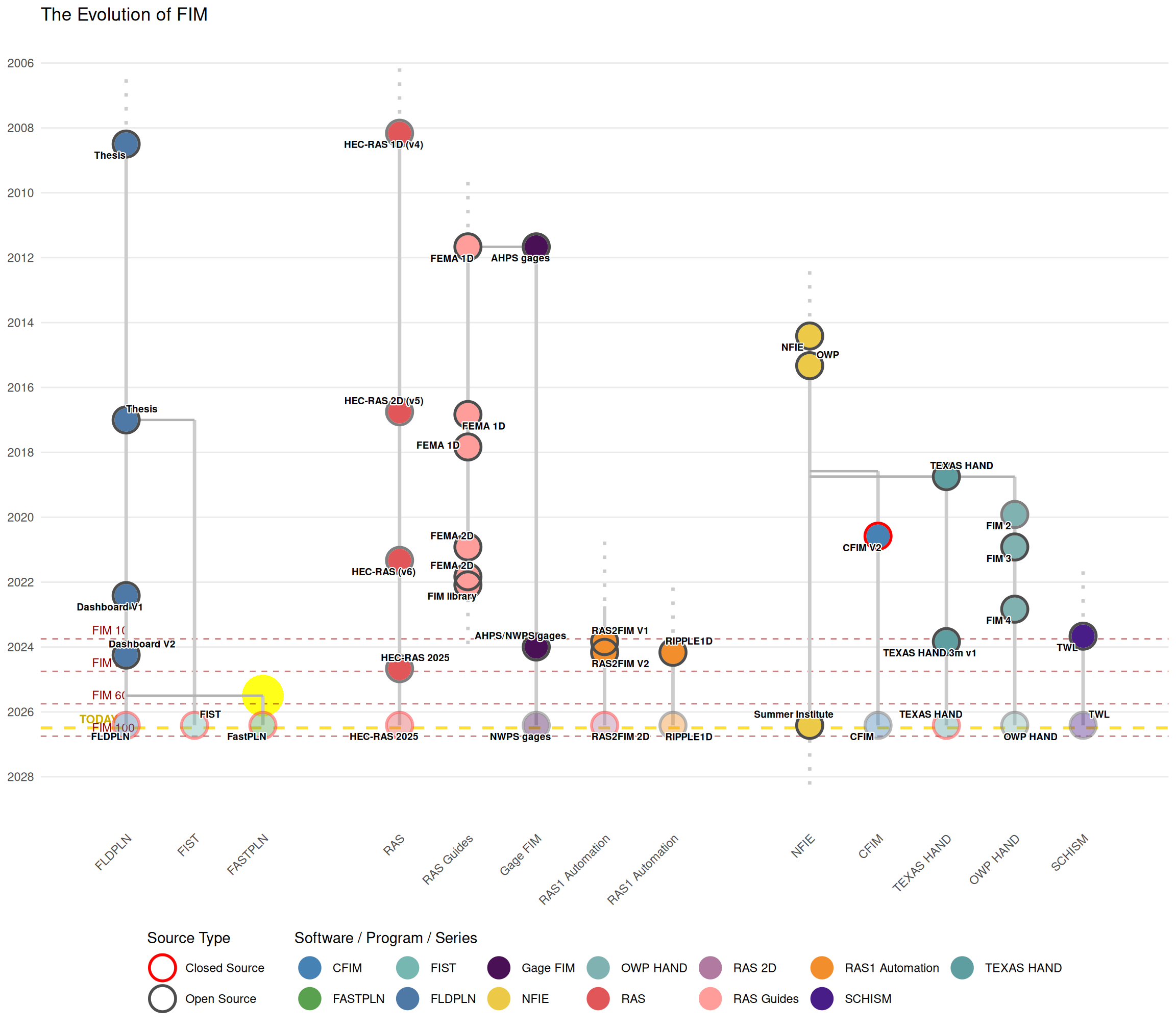
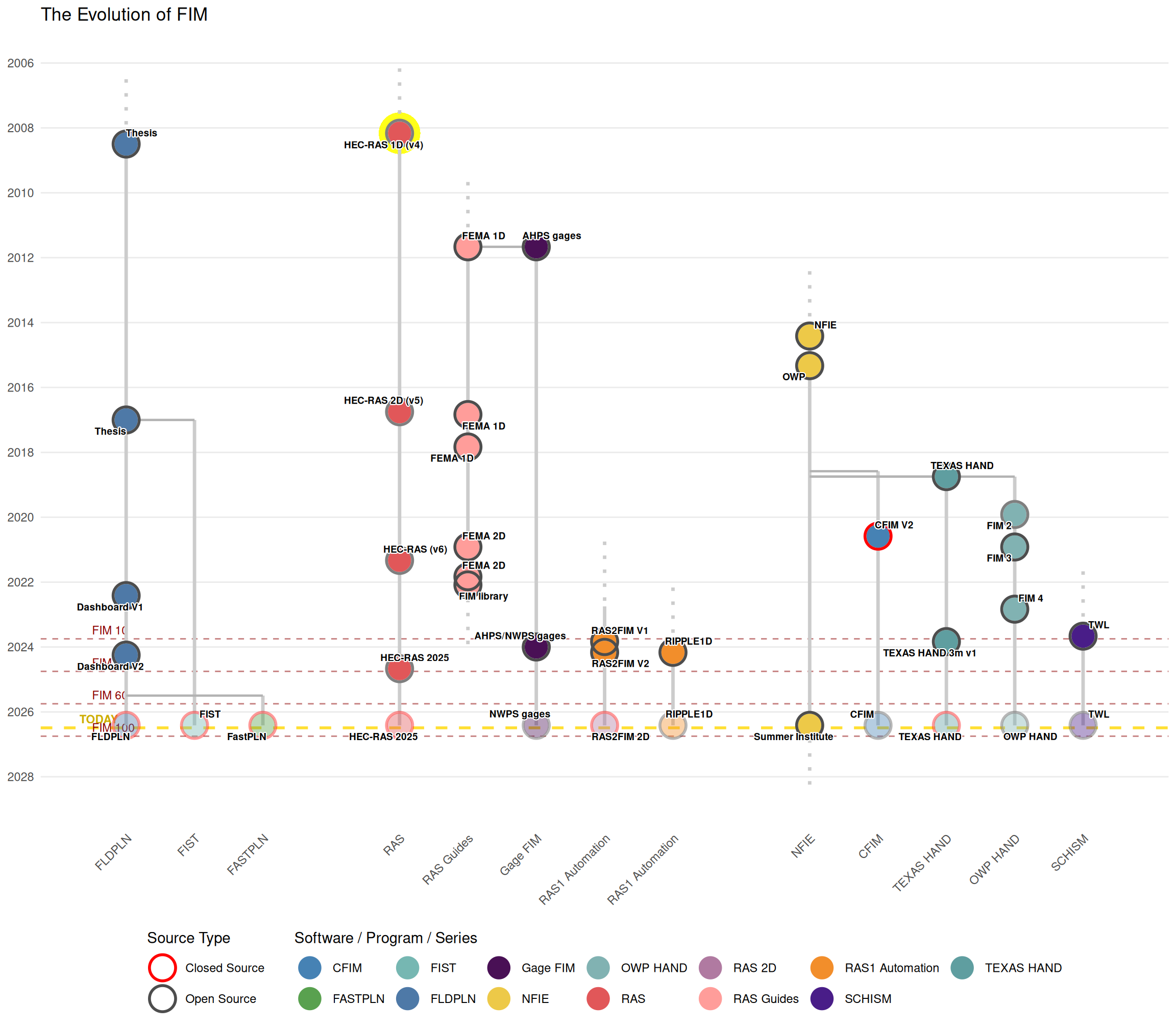
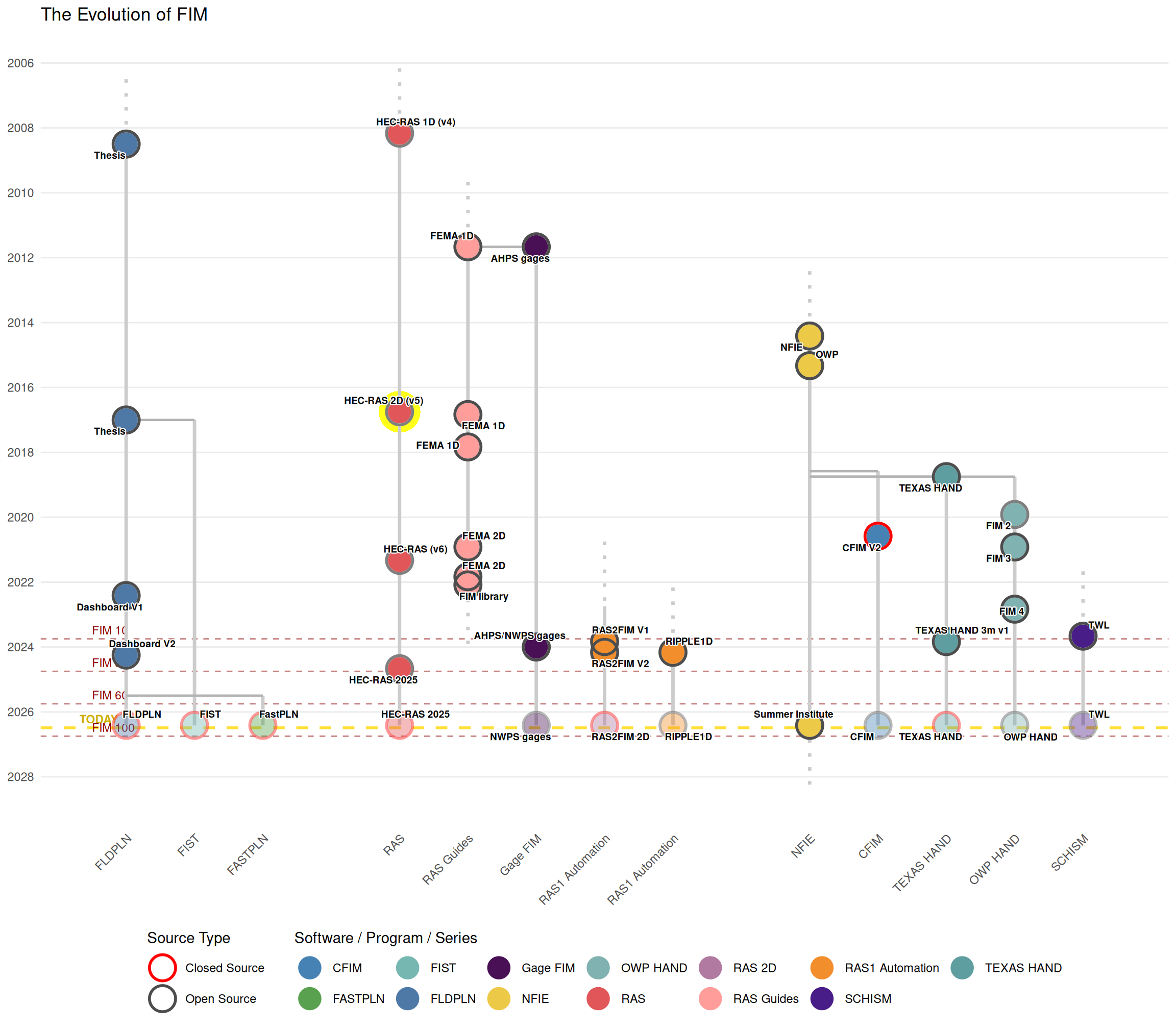
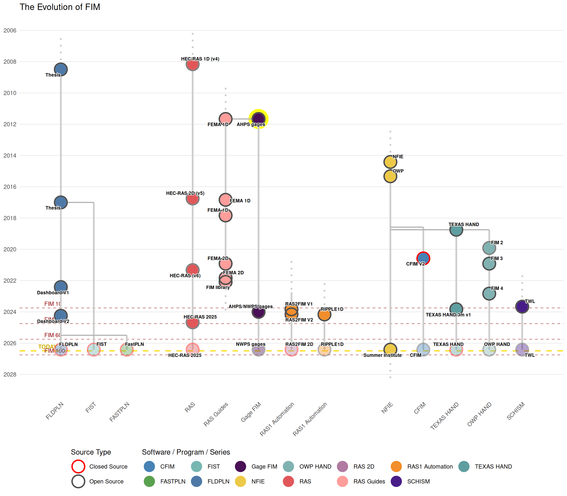
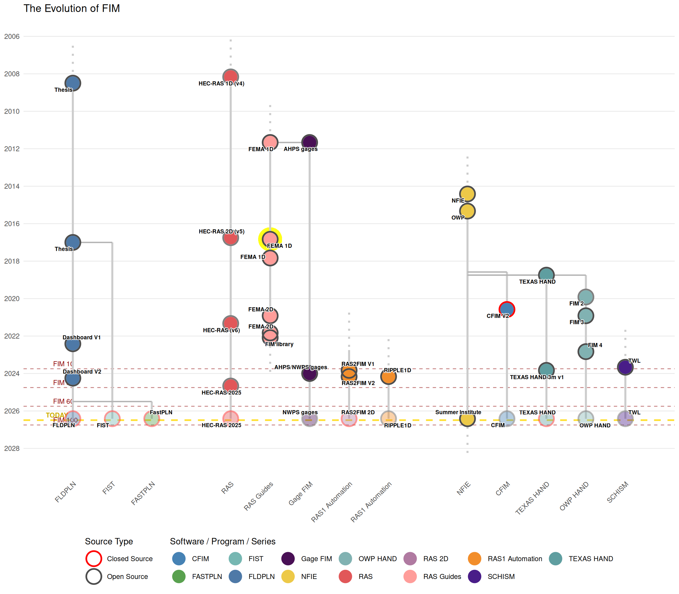
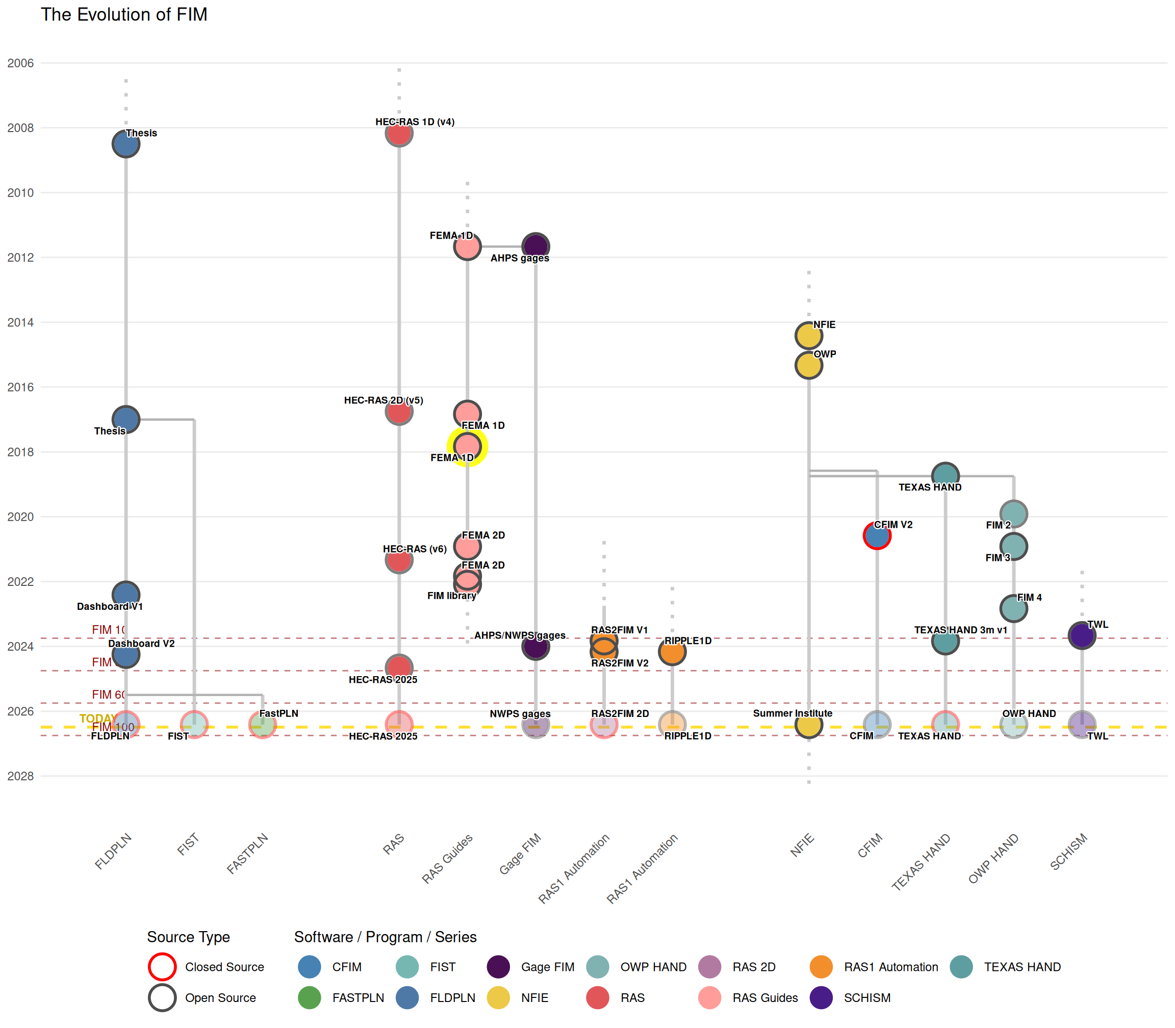
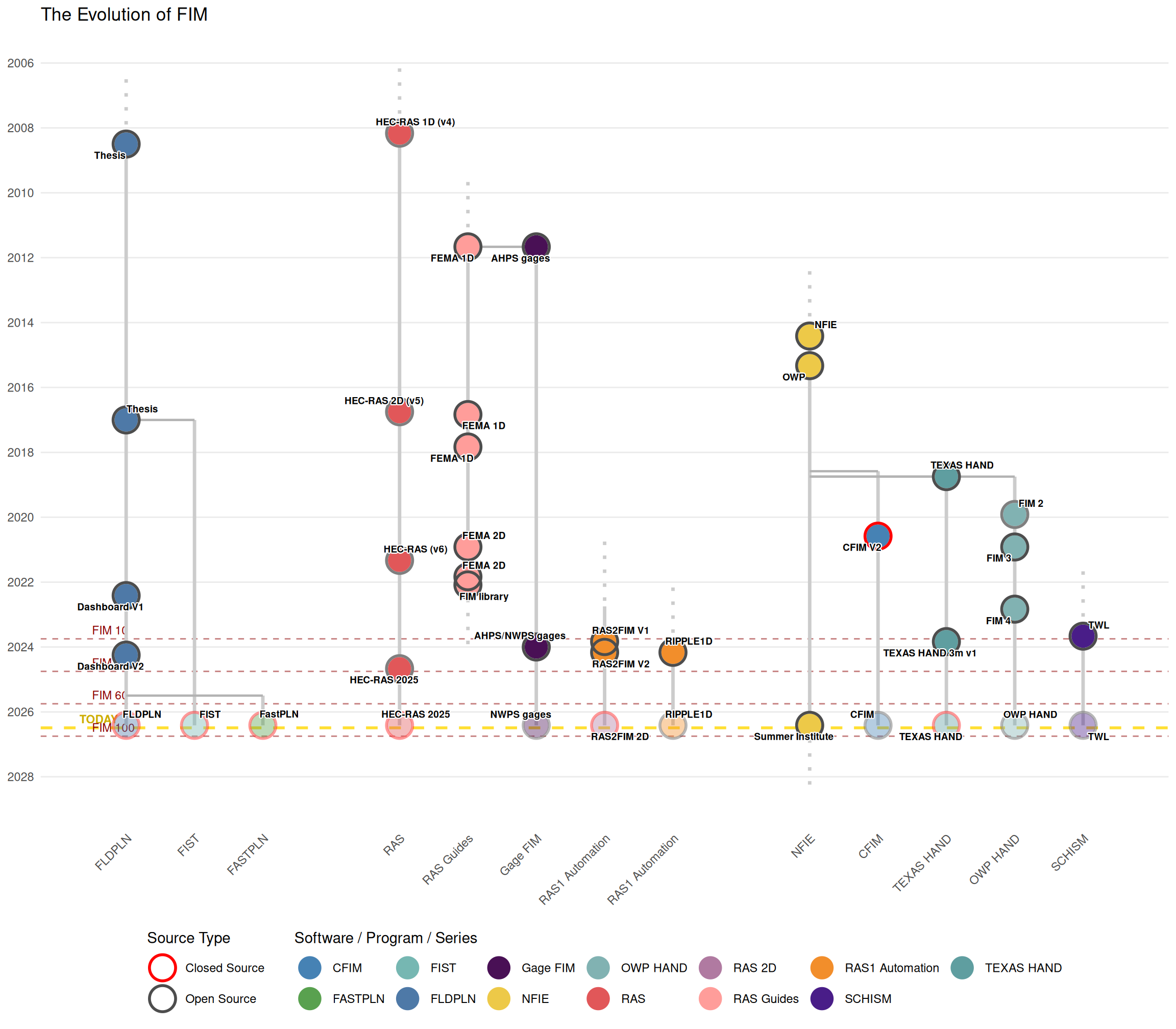
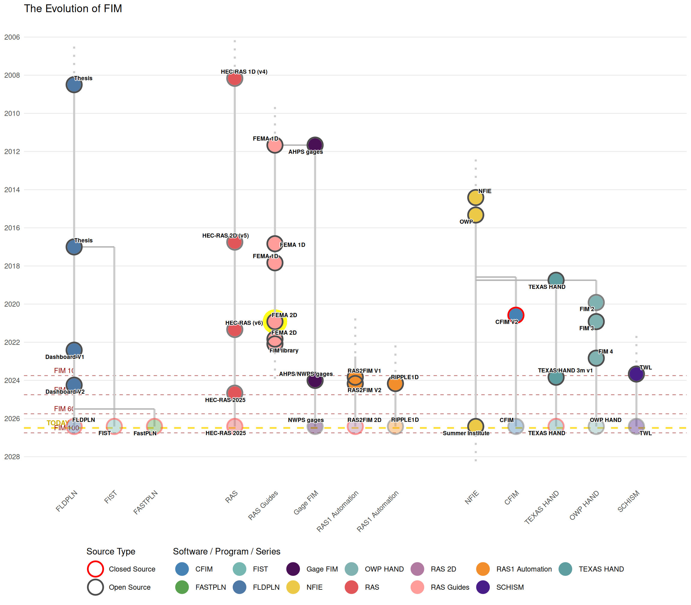
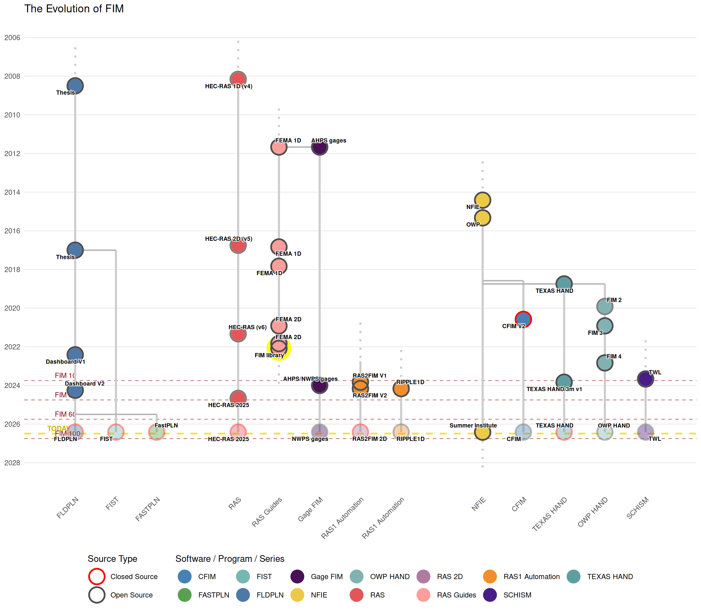
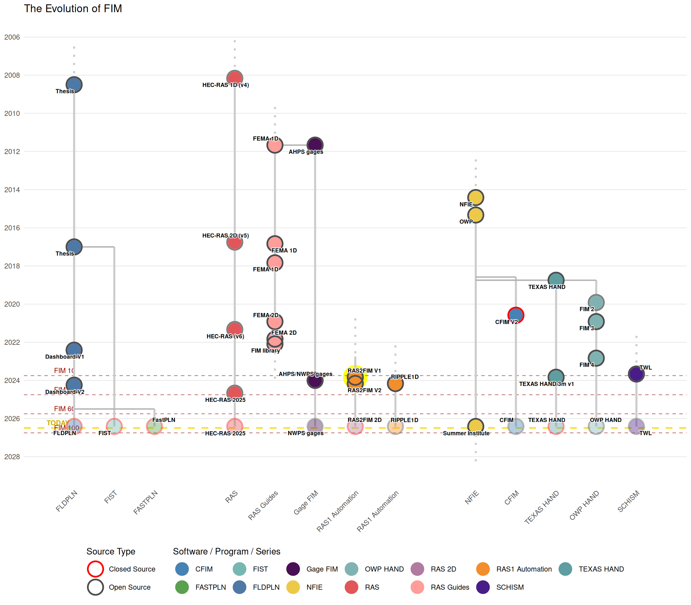
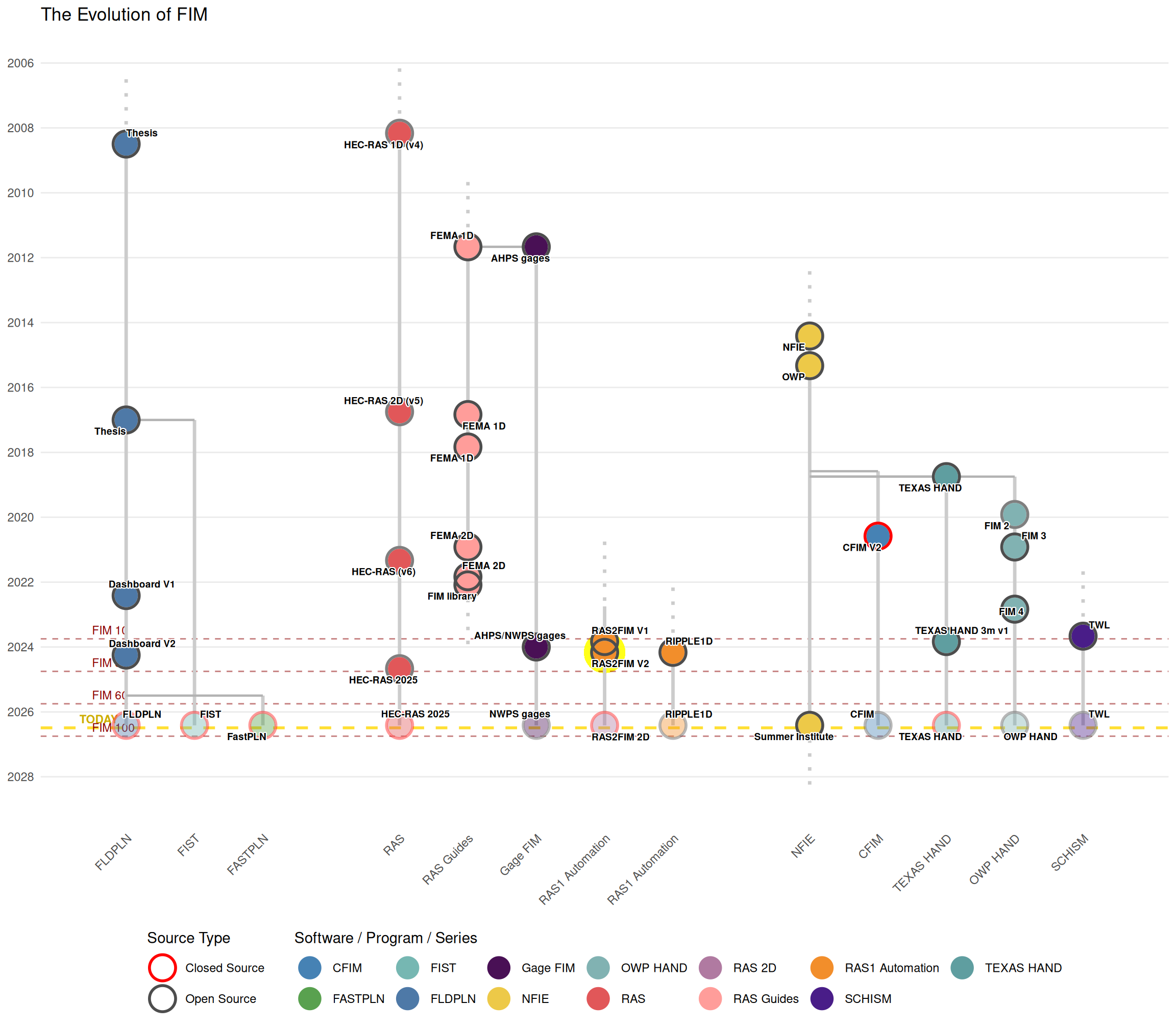
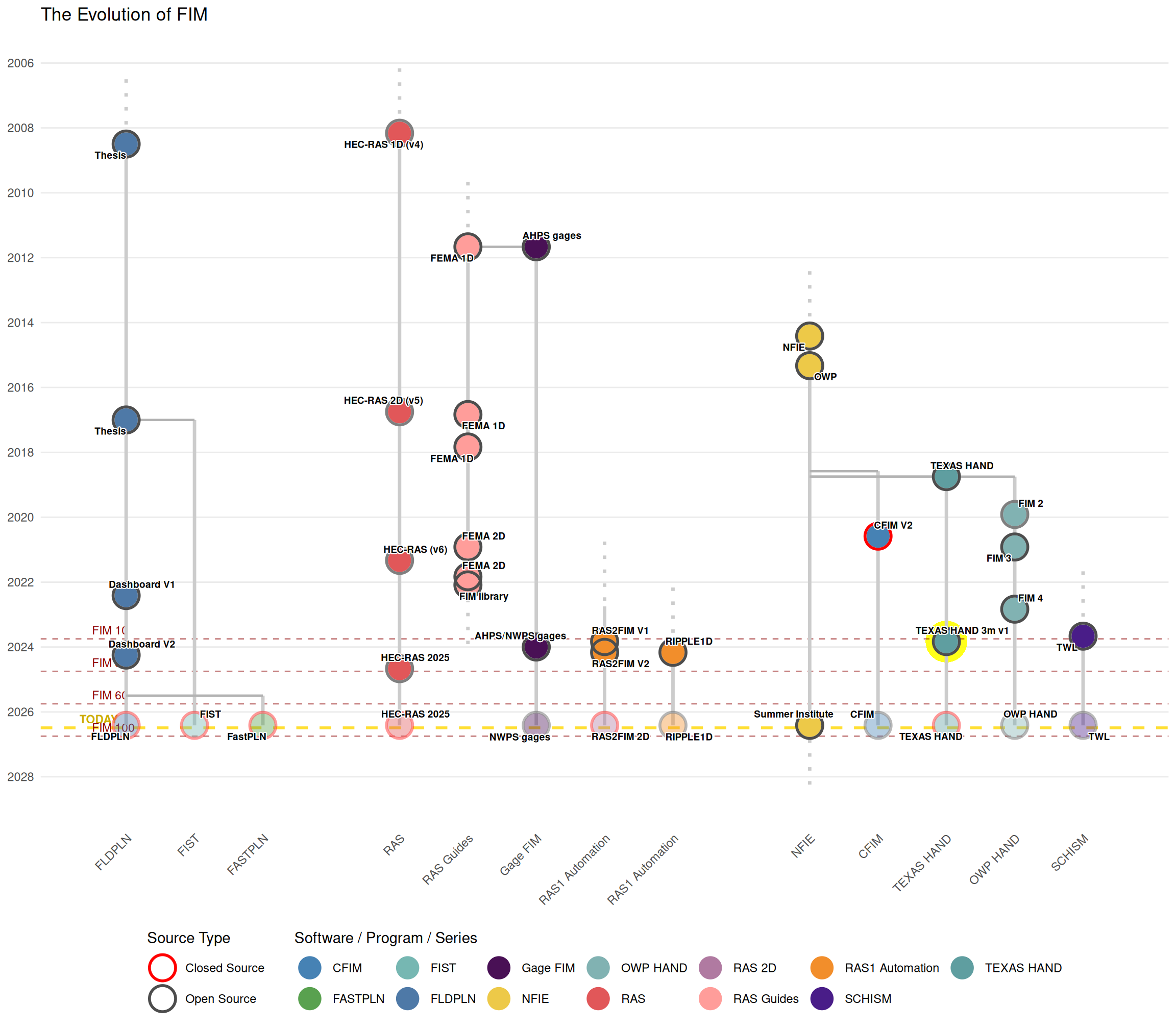
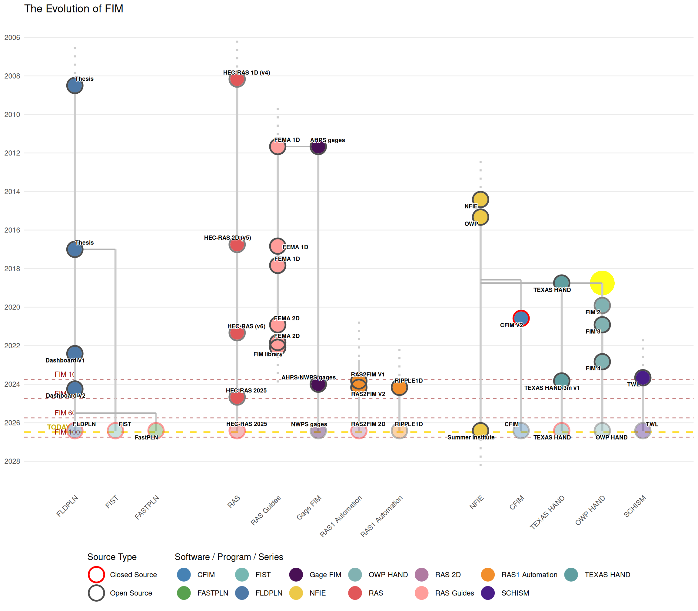
Timeline Scope
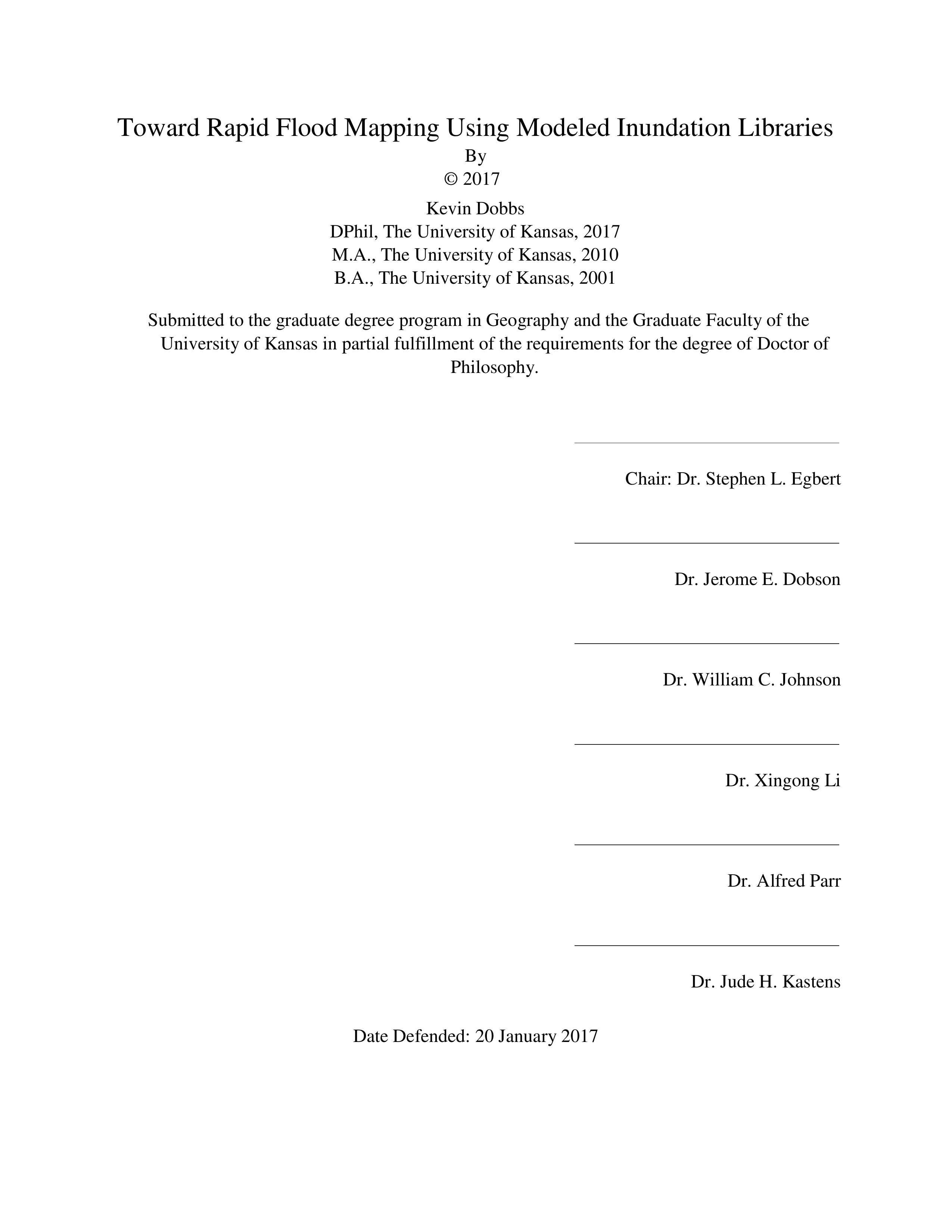
Review: Toward Rapid Flood Mapping Using Modeled Inunda…
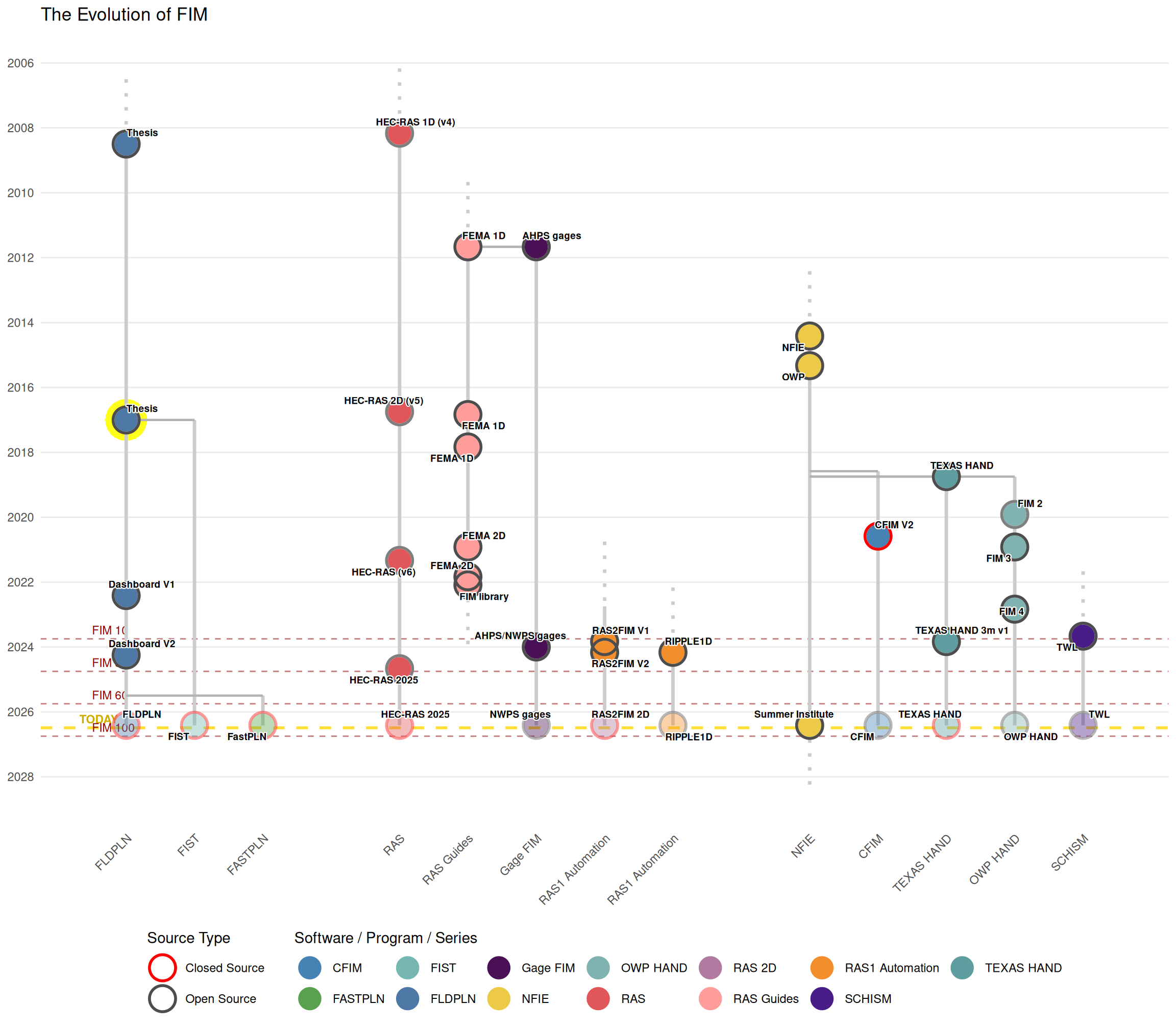
Review: Dashboard V1
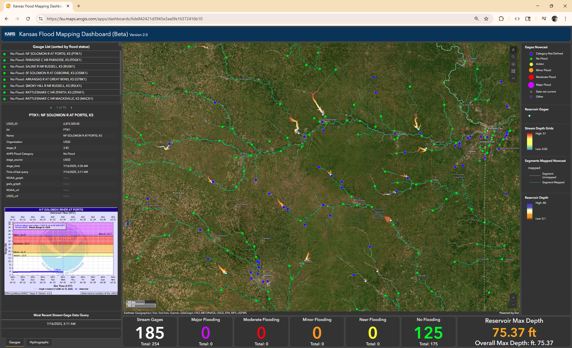
Review: FastPLN
 `
`
Review: A Modern HEC-RAS

Review: The First 2D HEC-RAS
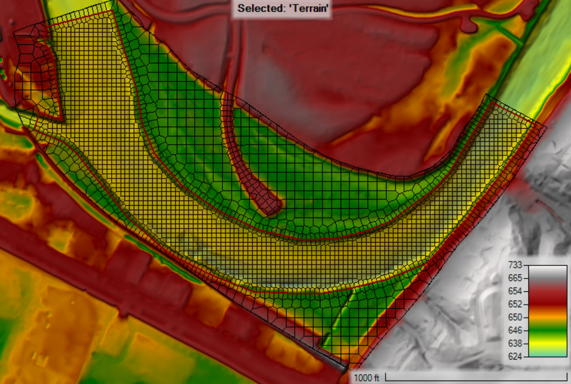
Review: HEC-RAS 2025
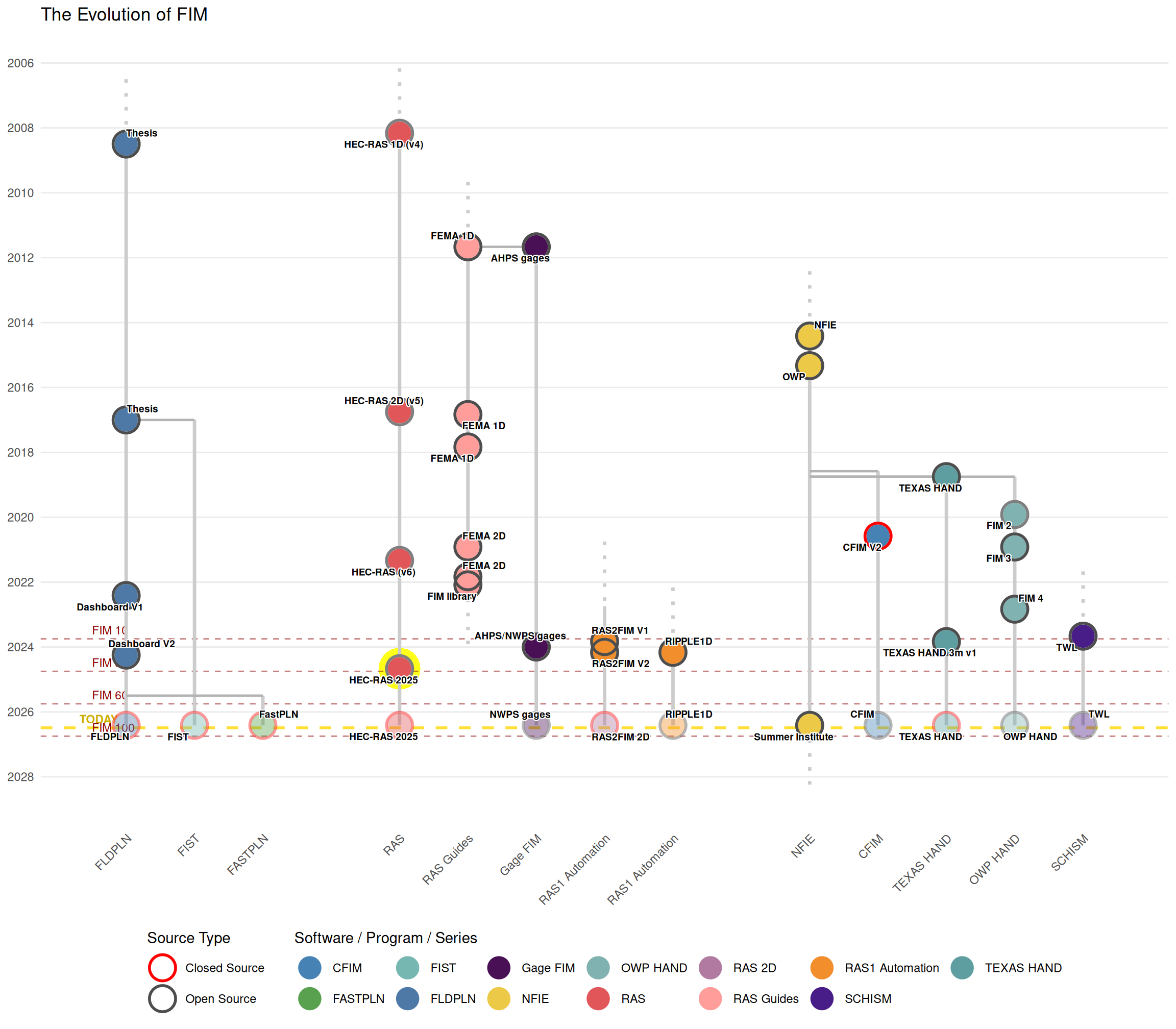
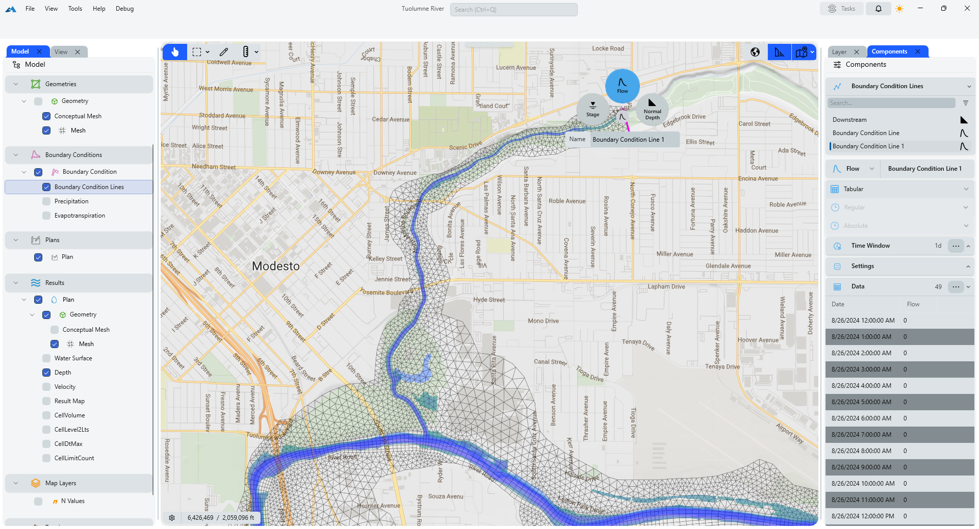
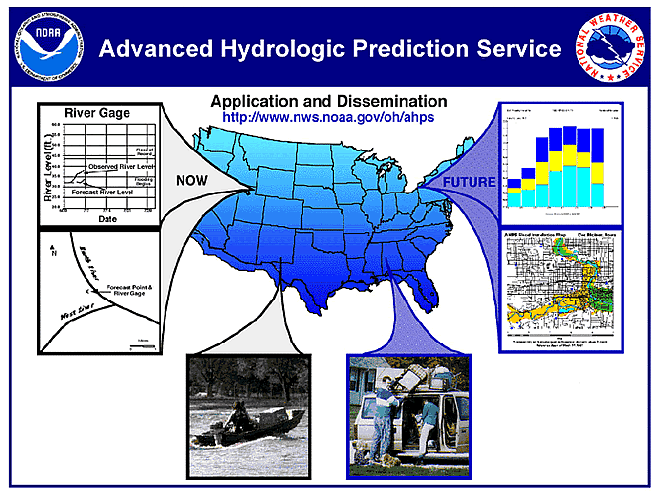
Review: AHPS libraries
Review: Hydraulics: One-Dimensional Analysis
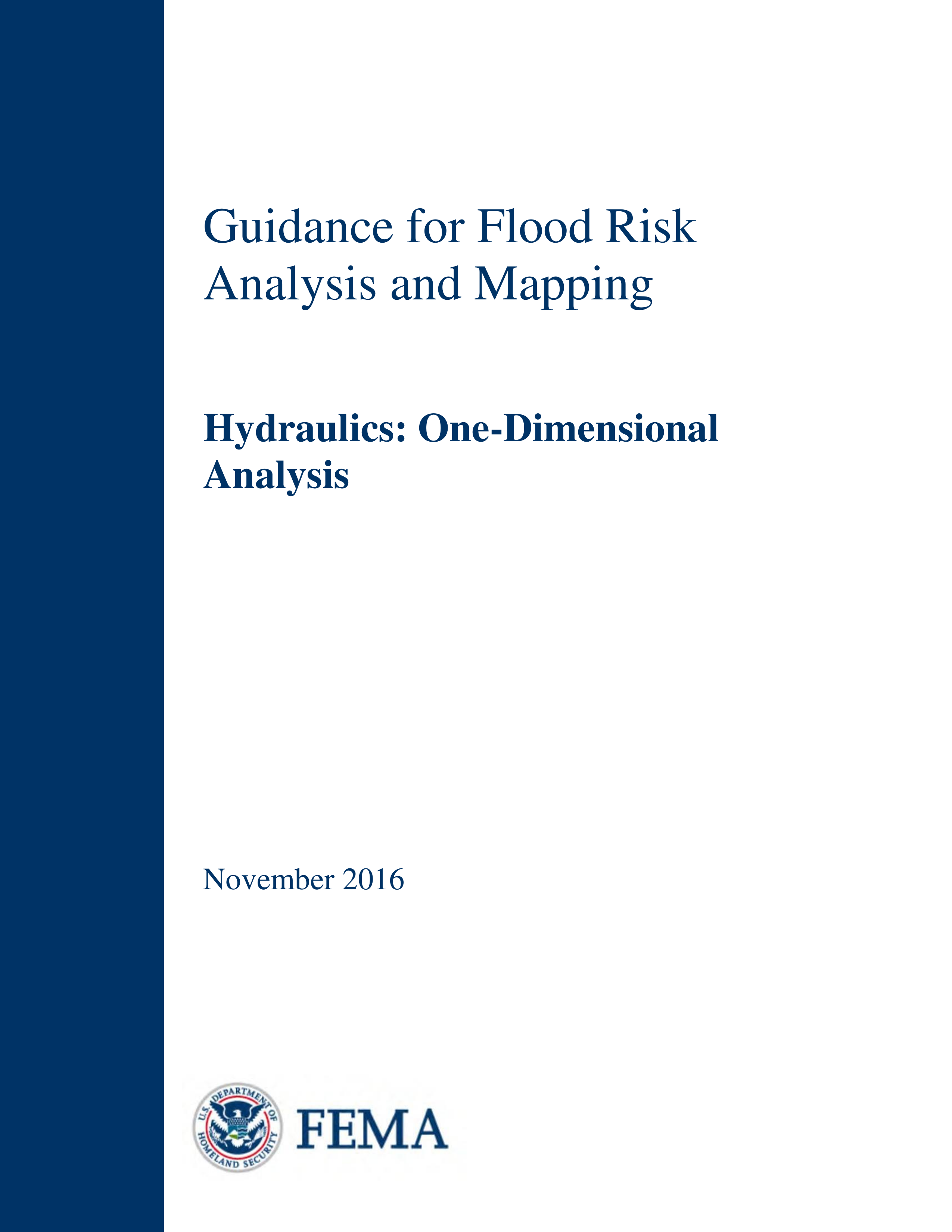
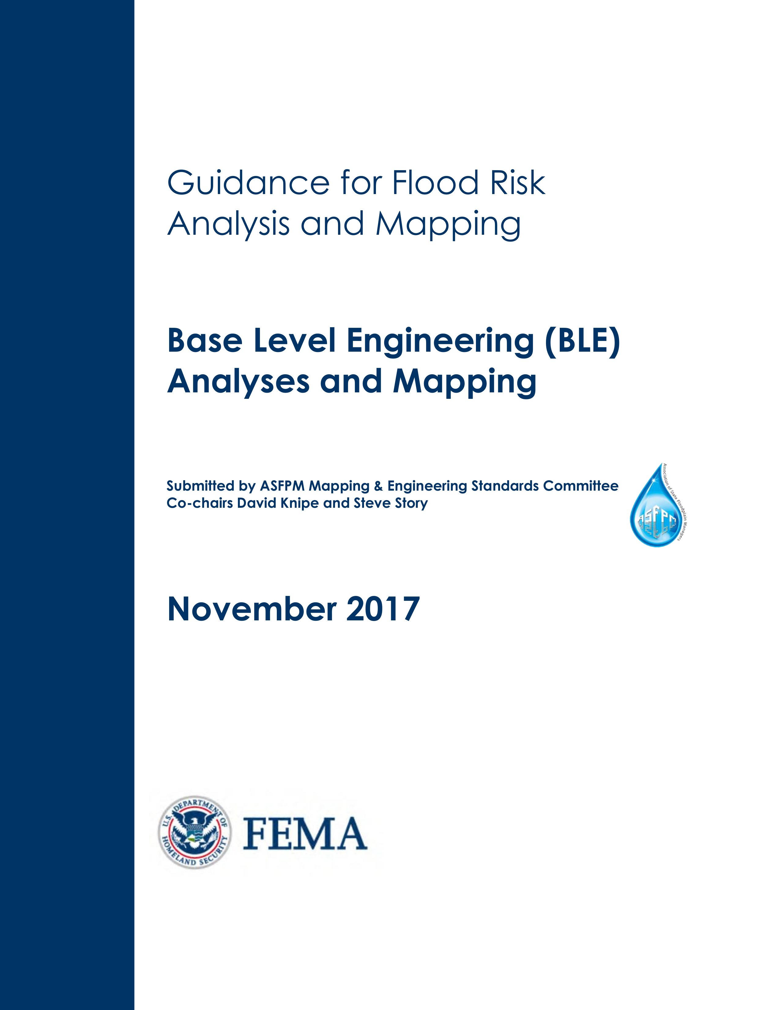
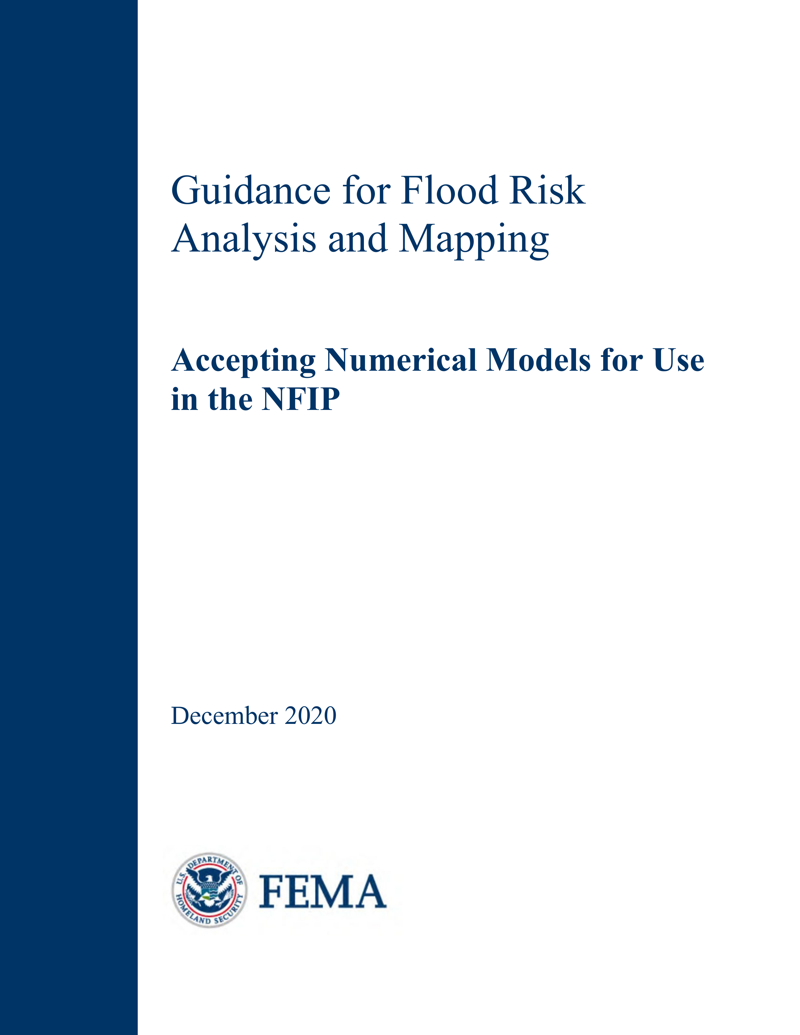
Review: Guidance for Flood Risk Analysis and Mapping
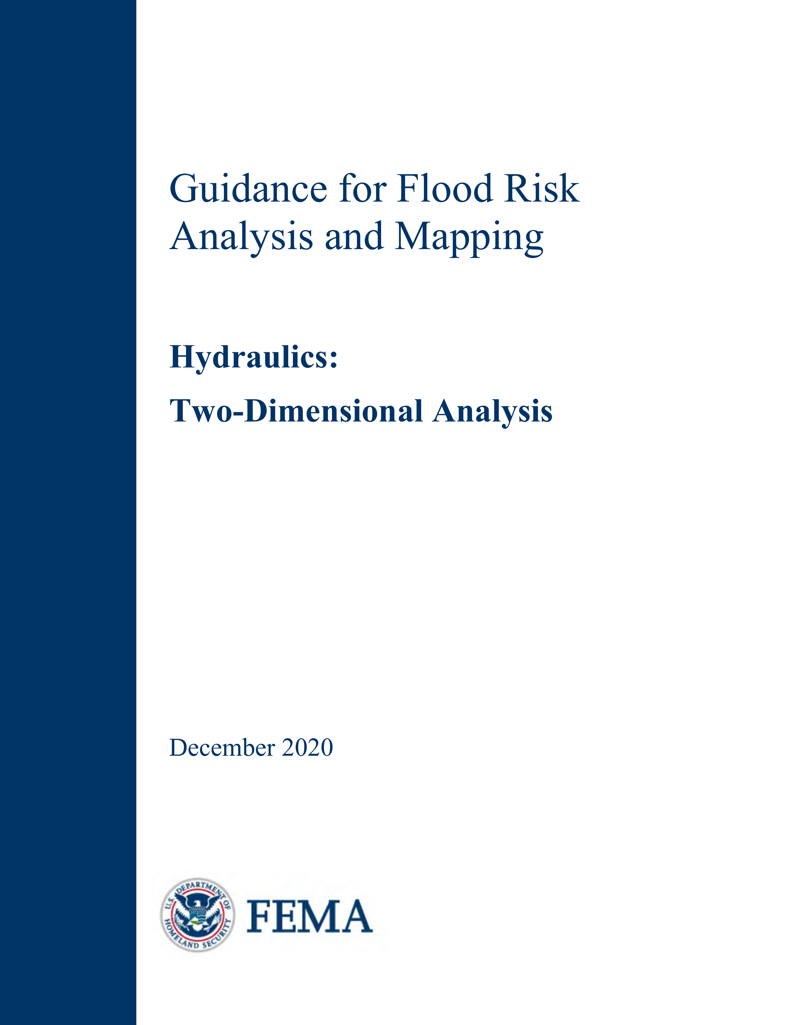
Review: Hydraulics Two-Dimensional Analysis Guidance
Review: Accepting Numerical Models for Use in the NFIP
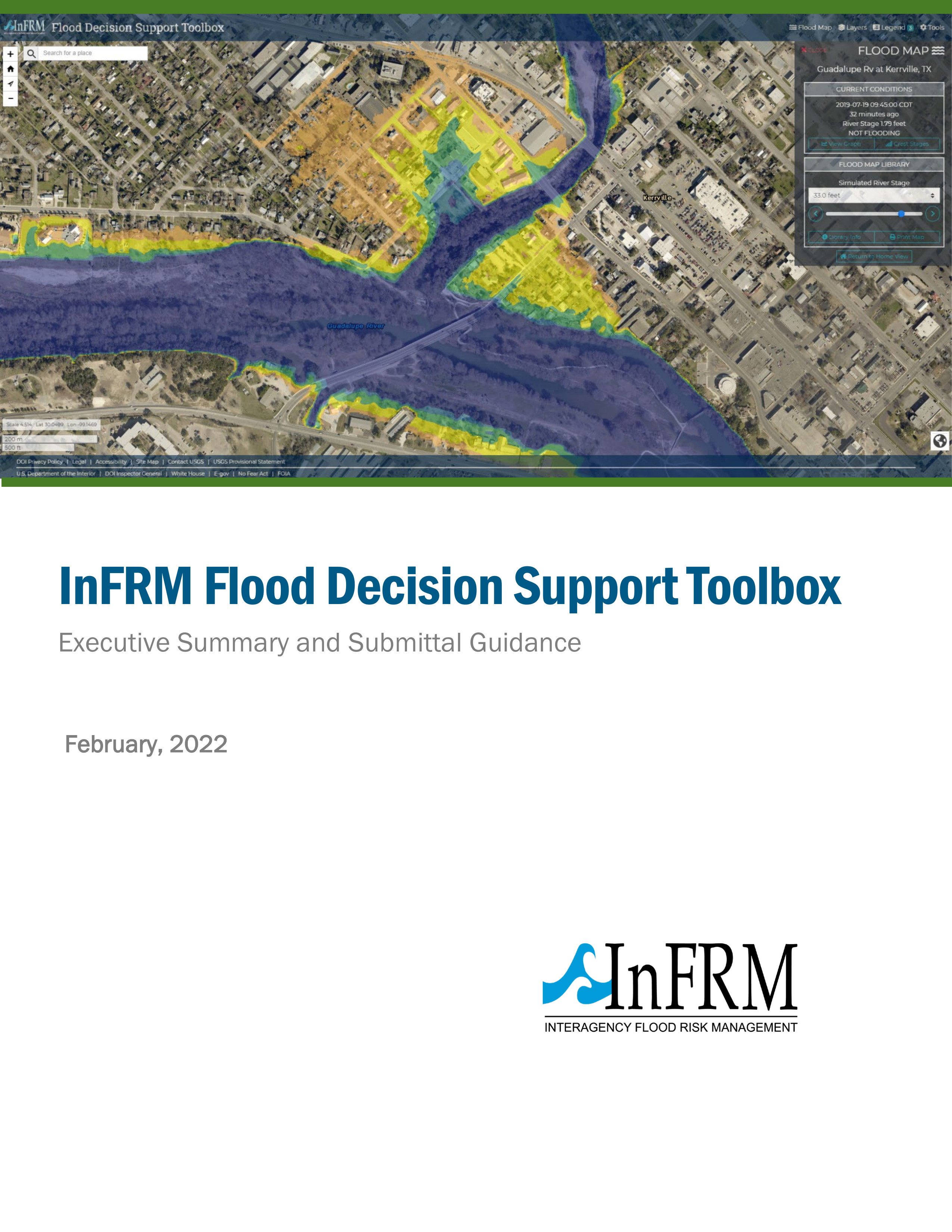
Review: Flood Decision Support Toolbox Executive Summar…
Review: RAS2FIM V1
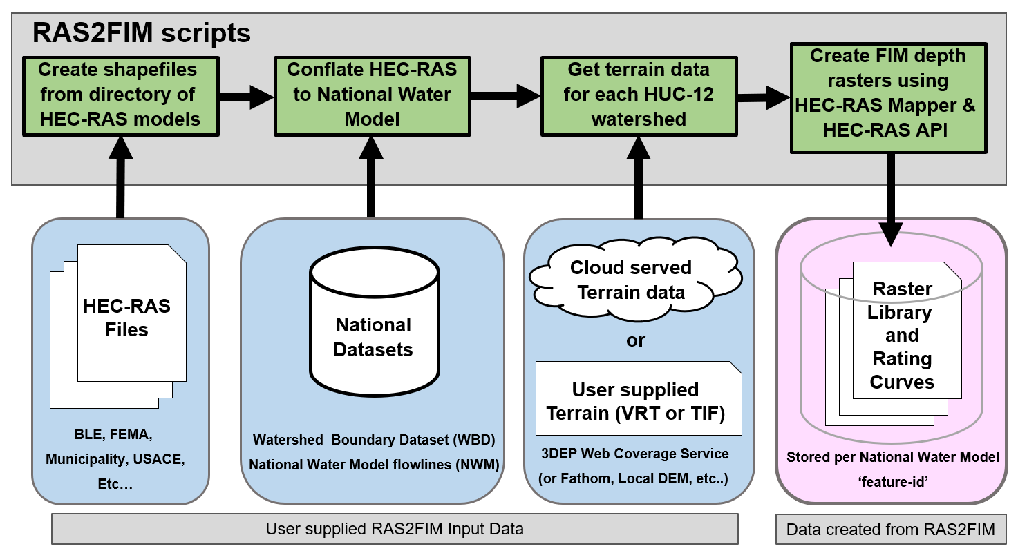
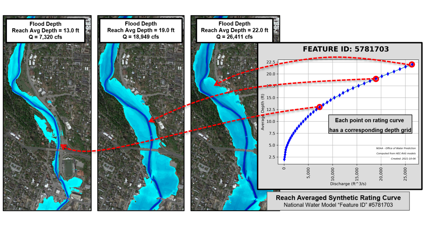
Review: RAS2FIM V2
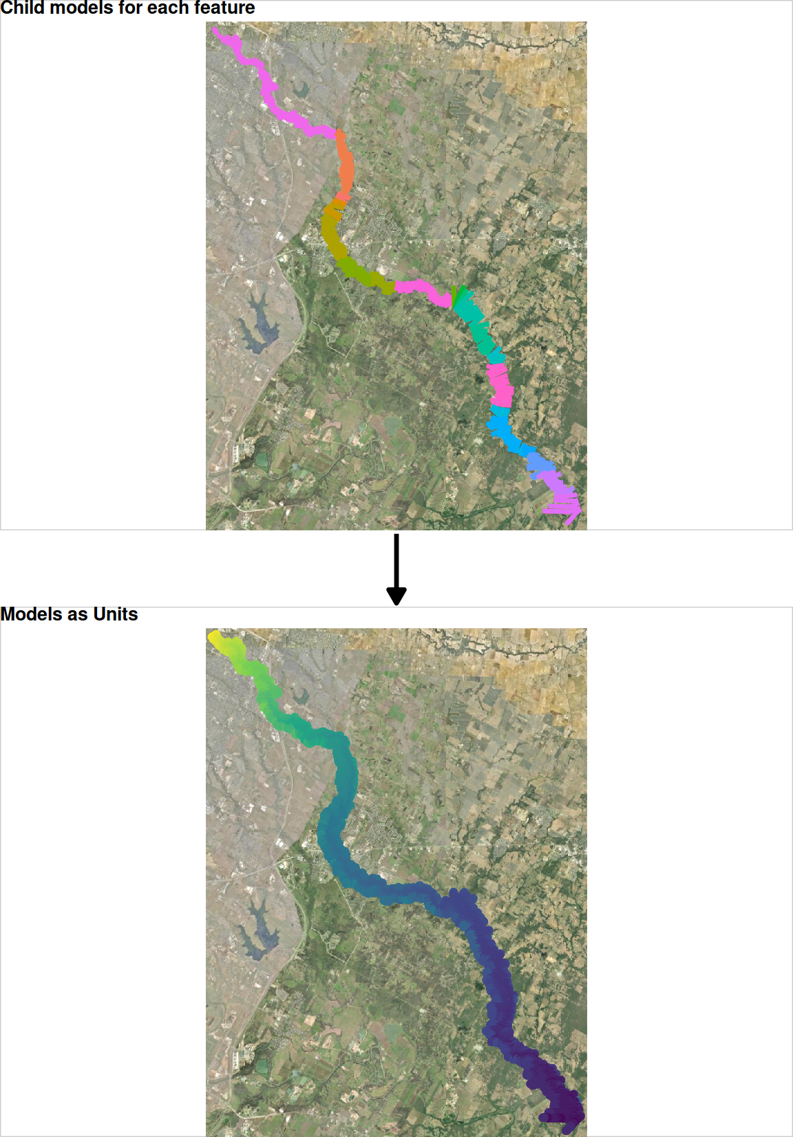
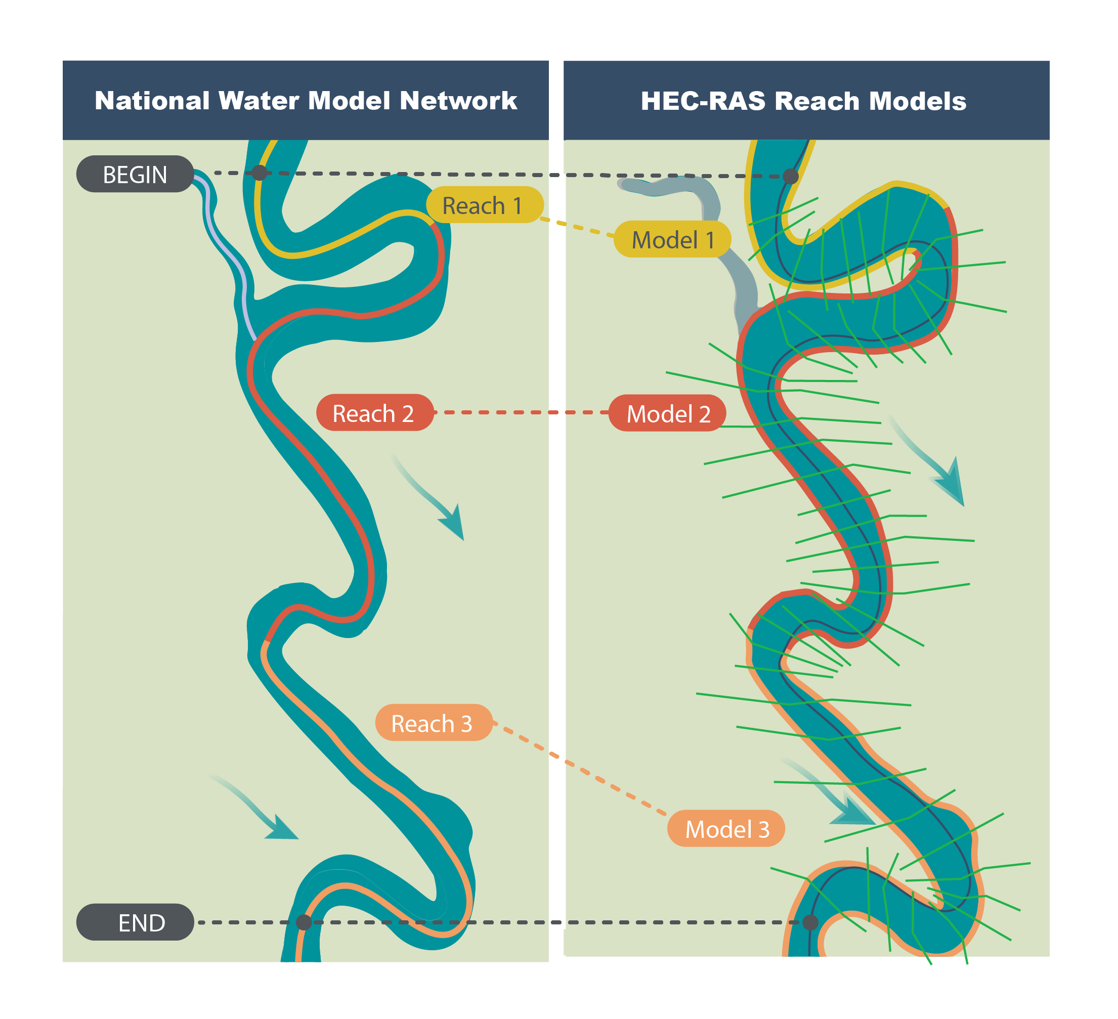
Review: RIPPLE1D
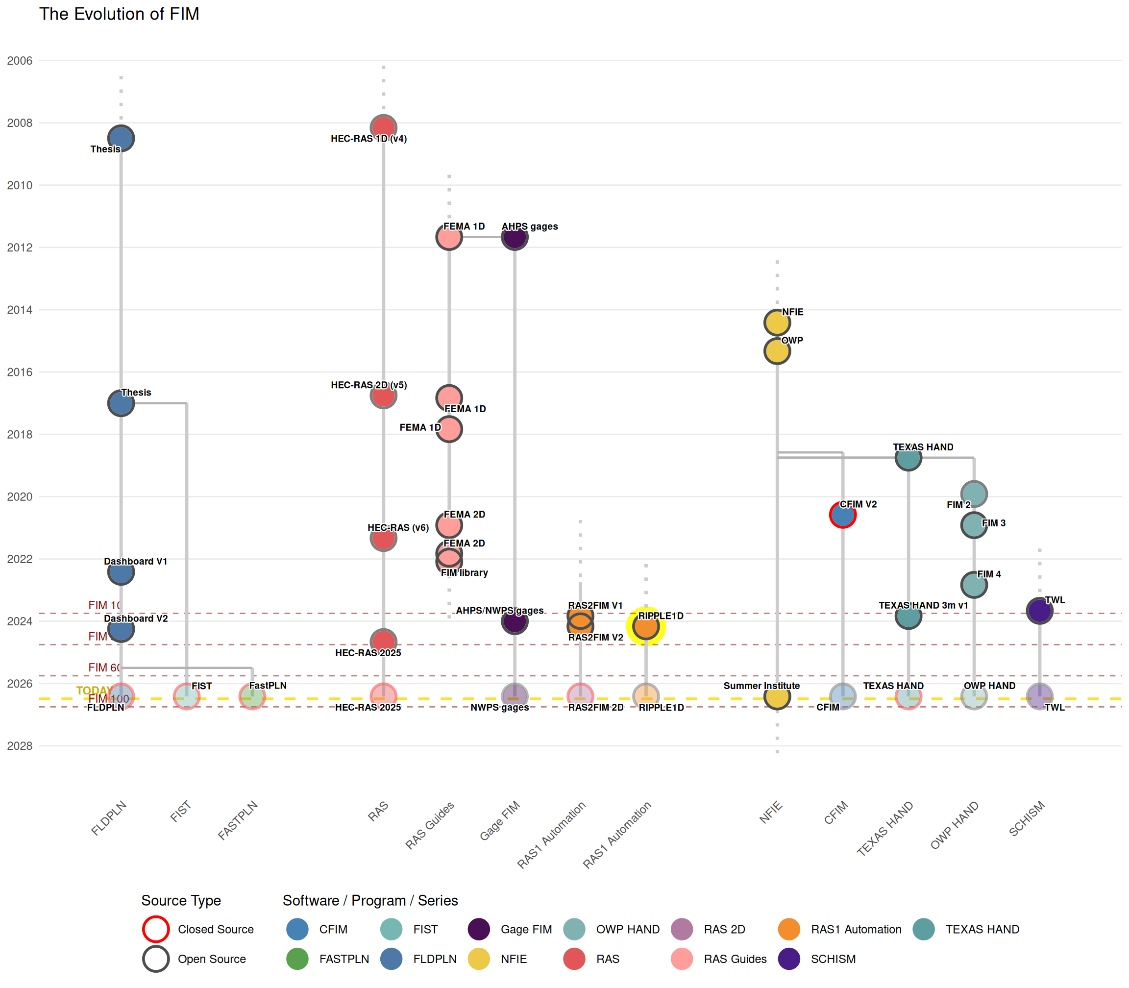
Review: Rebranding to NWPS
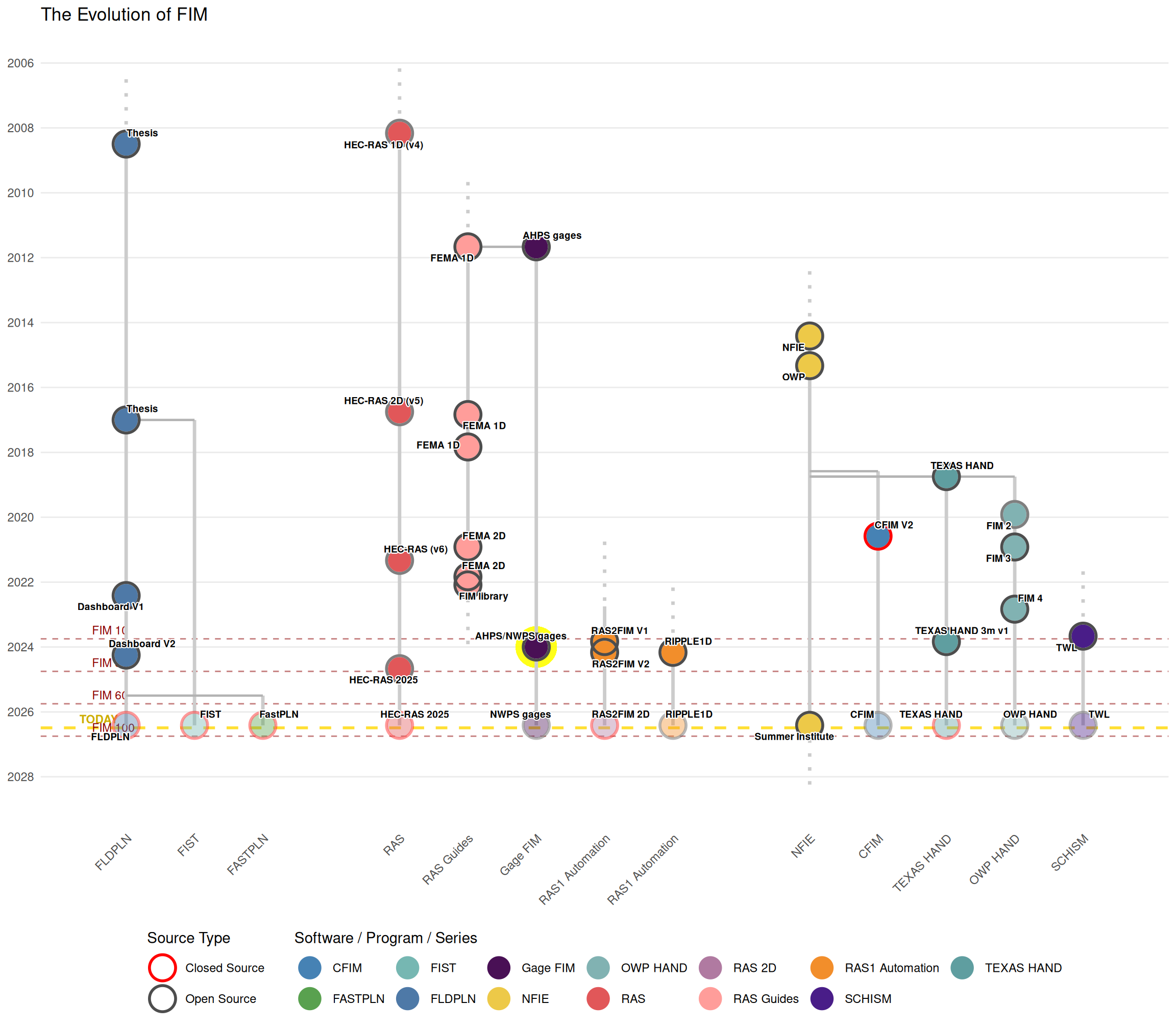
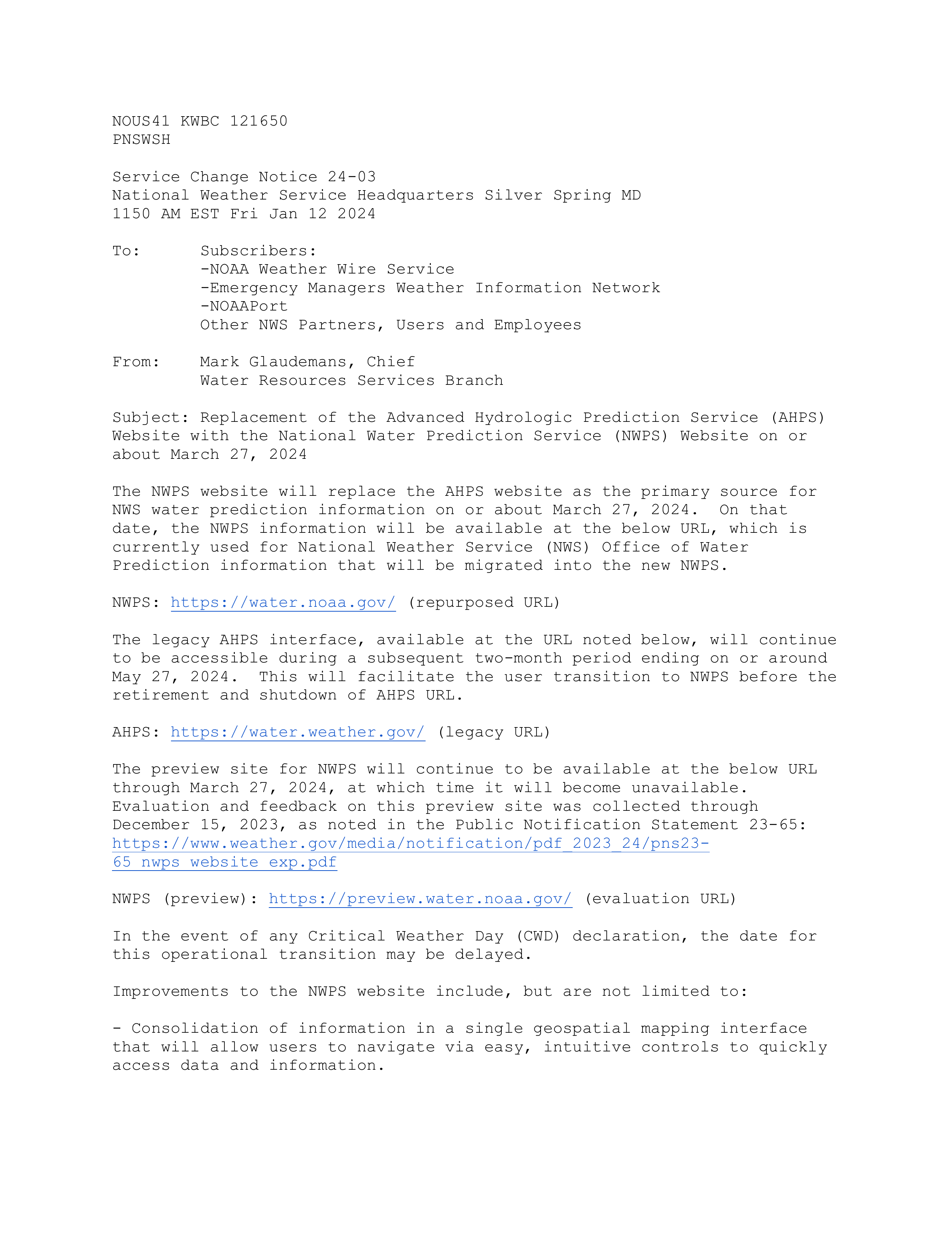
Review: Federated FIM
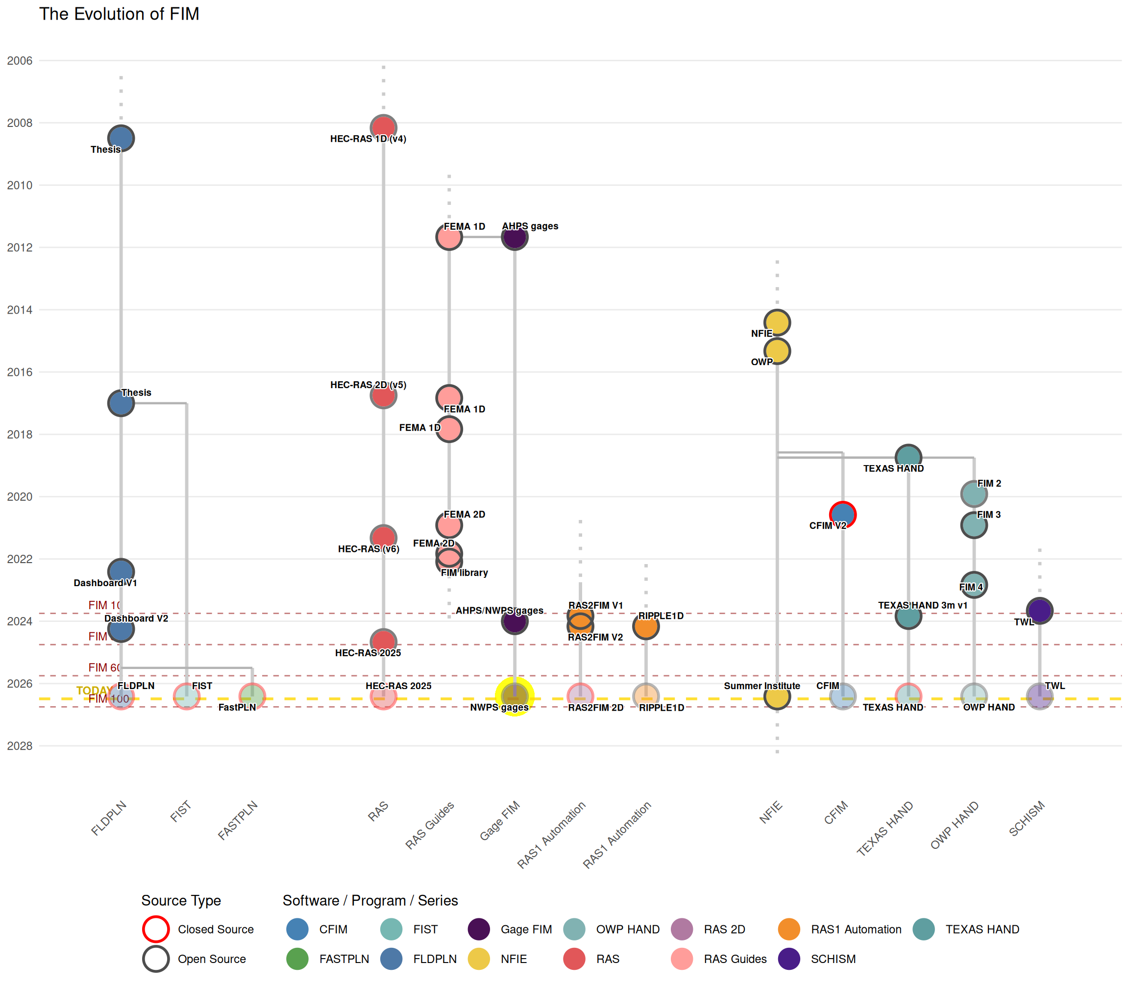
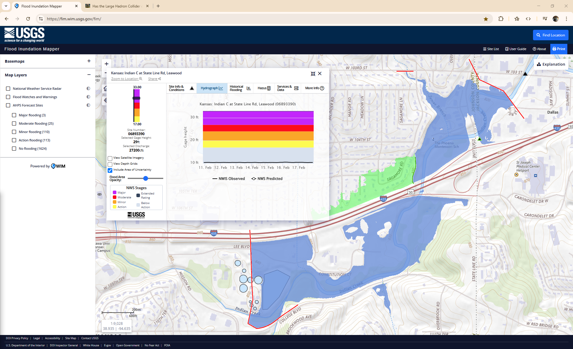
Review: NFIE
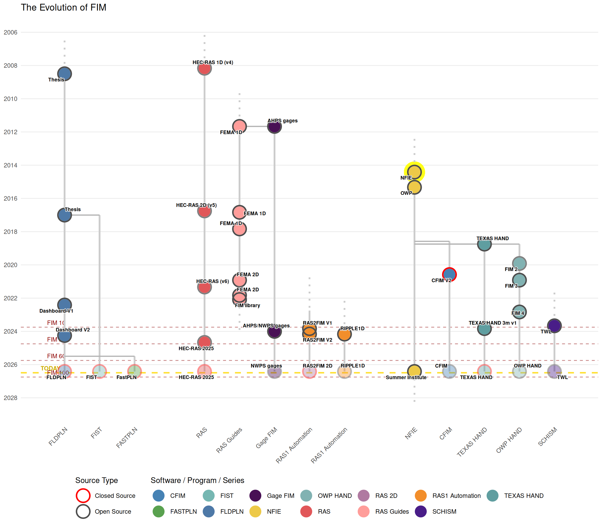
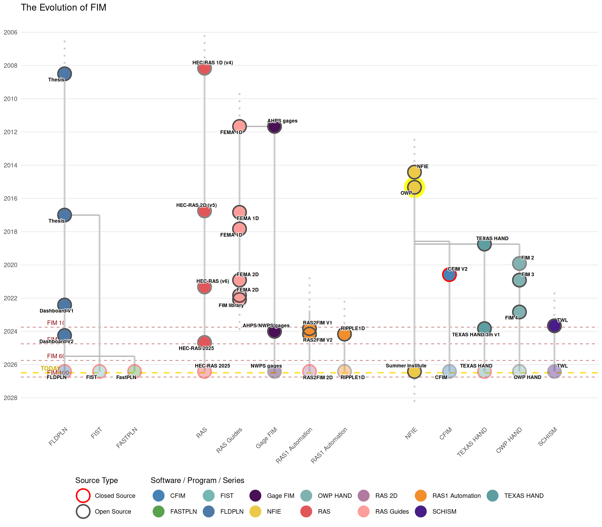
Review: OWP
NWS Vision
A Weather-Ready Nation: Society is prepared for and responds to weather, water, and climate-dependent events.
NWS Mission
Provide weather, water and climate data, forecasts, warnings, and impact-based decision support services for the protection of life and property and enhancement of the national economy. (From: https://www.weather.gov/about)
OWP Mission
The Office of Water Prediction (OWP) collaboratively researches, develops and delivers state-of-the-science national hydrologic analyses, forecast information, data, decision-support services and guidance to support and inform essential emergency services and water management decisions. In partnership with NWS national, regional, and local offices, the OWP coordinates, integrates and supports consistent water prediction activities from global to local levels. (From: https://water.noaa.gov/about/owp)
Review: OWP
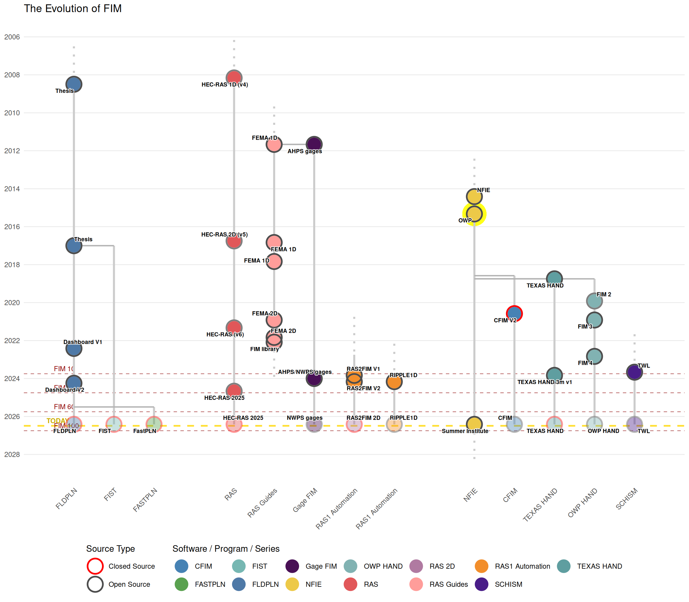
NWS Mission
Provide weather, water and climate data, forecasts, warnings, and impact-based decision support services for the protection of life and property and enhancement of the national economy. (From: https://www.weather.gov/about)
OWP Mission
The Office of Water Prediction (OWP) collaboratively researches, develops and delivers state-of-the-science national hydrologic analyses, forecast information, data, decision-support services and guidance to support and inform essential emergency services and water management decisions. In partnership with NWS national, regional, and local offices, the OWP coordinates, integrates and supports consistent water prediction activities from global to local levels. (From: https://water.noaa.gov/about/owp)
Emphasis mine
A useable prediction of states of the holistic hydrology and hydraulic system that bridges scales from meso-scale to me-scale
- Useable - in both the FAIR and subjective senses
- Everywhere - EVERYWHERE
Review: A CyberGIS Integration and Computation Framewor…
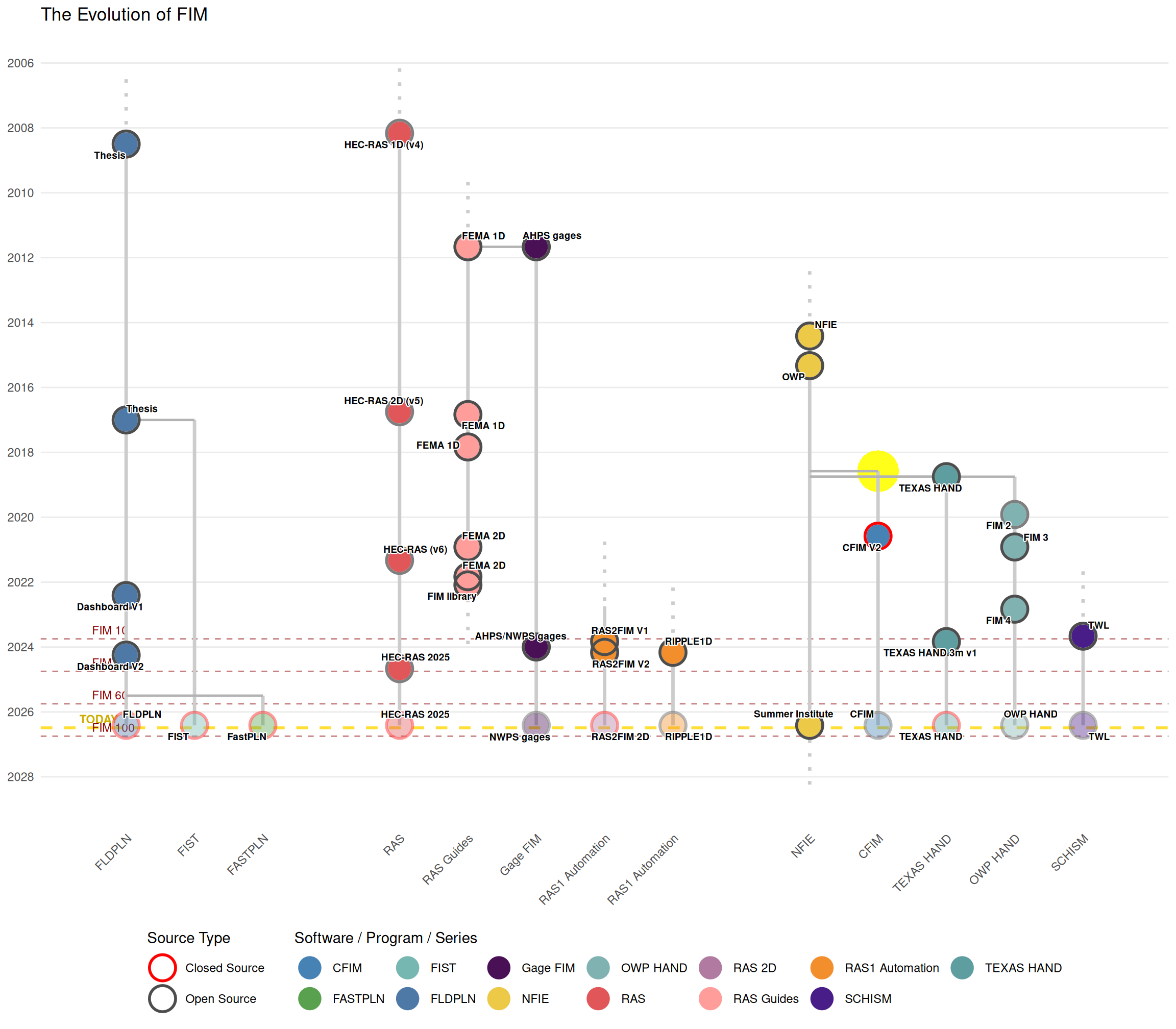
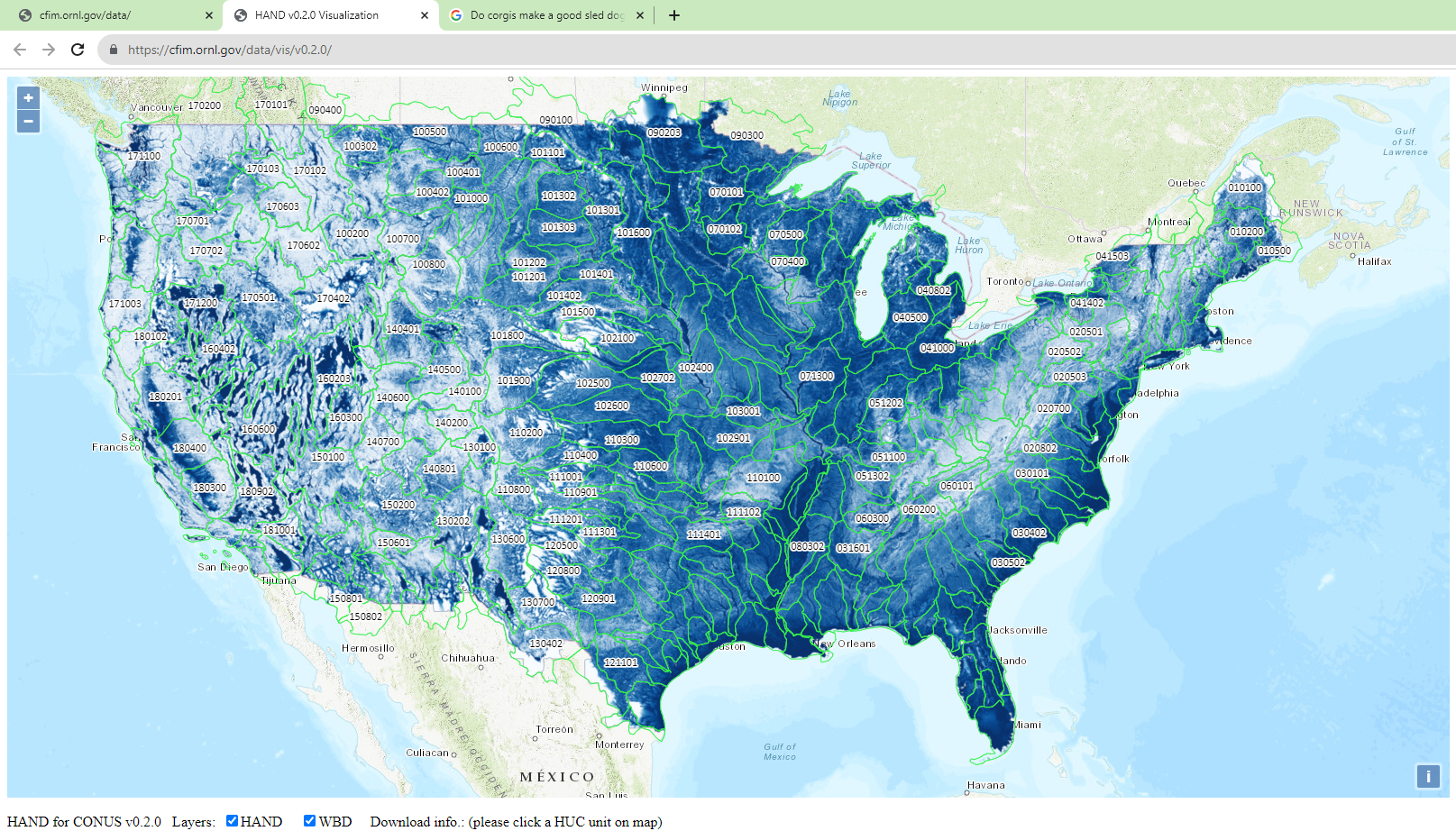
Review: High resolution HAND
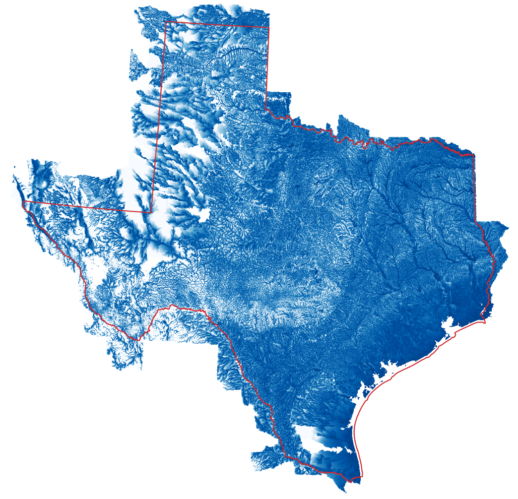
Review: FIM 2
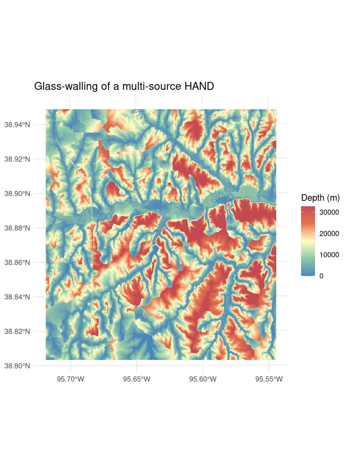
Review: FIM 3
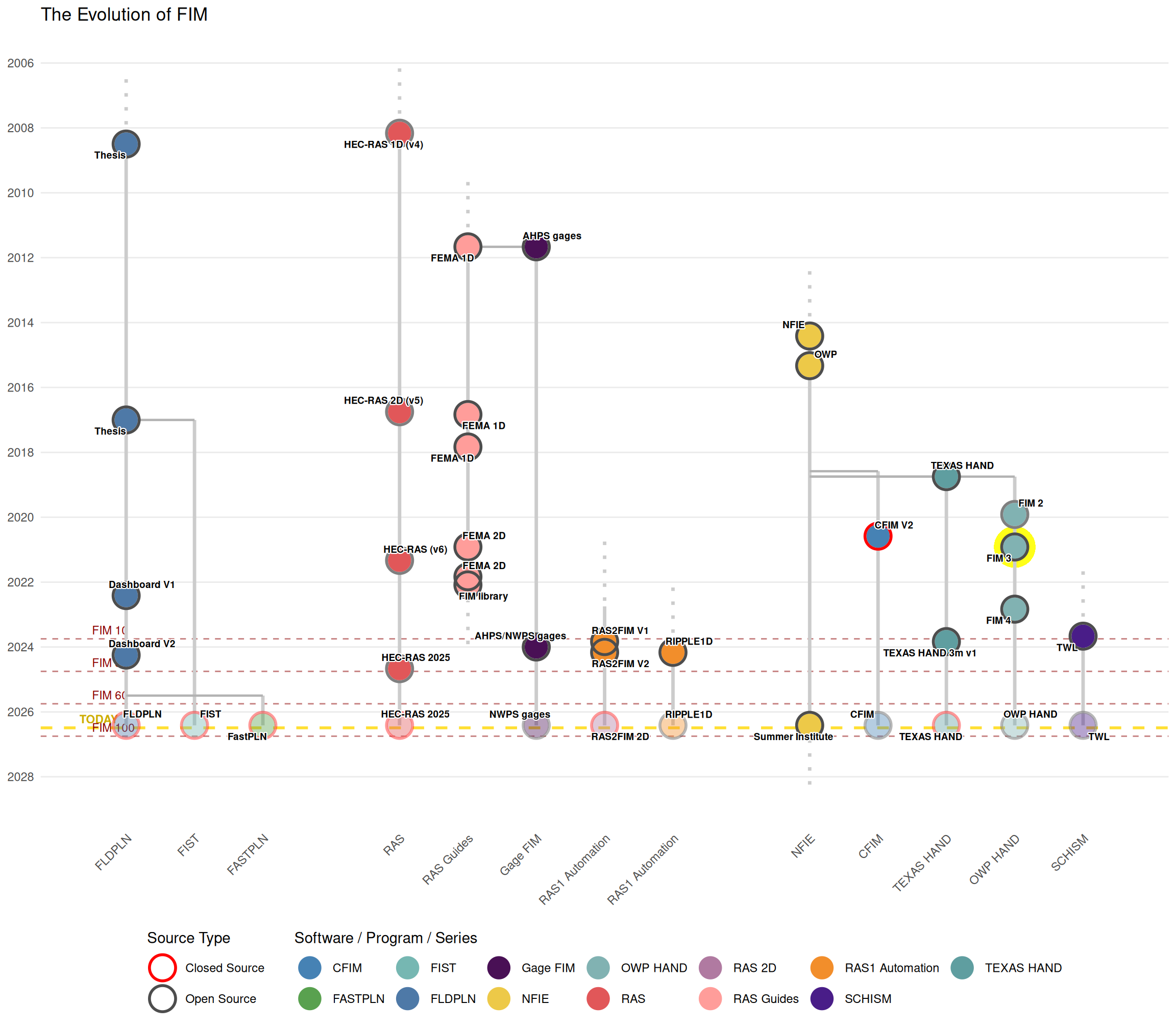
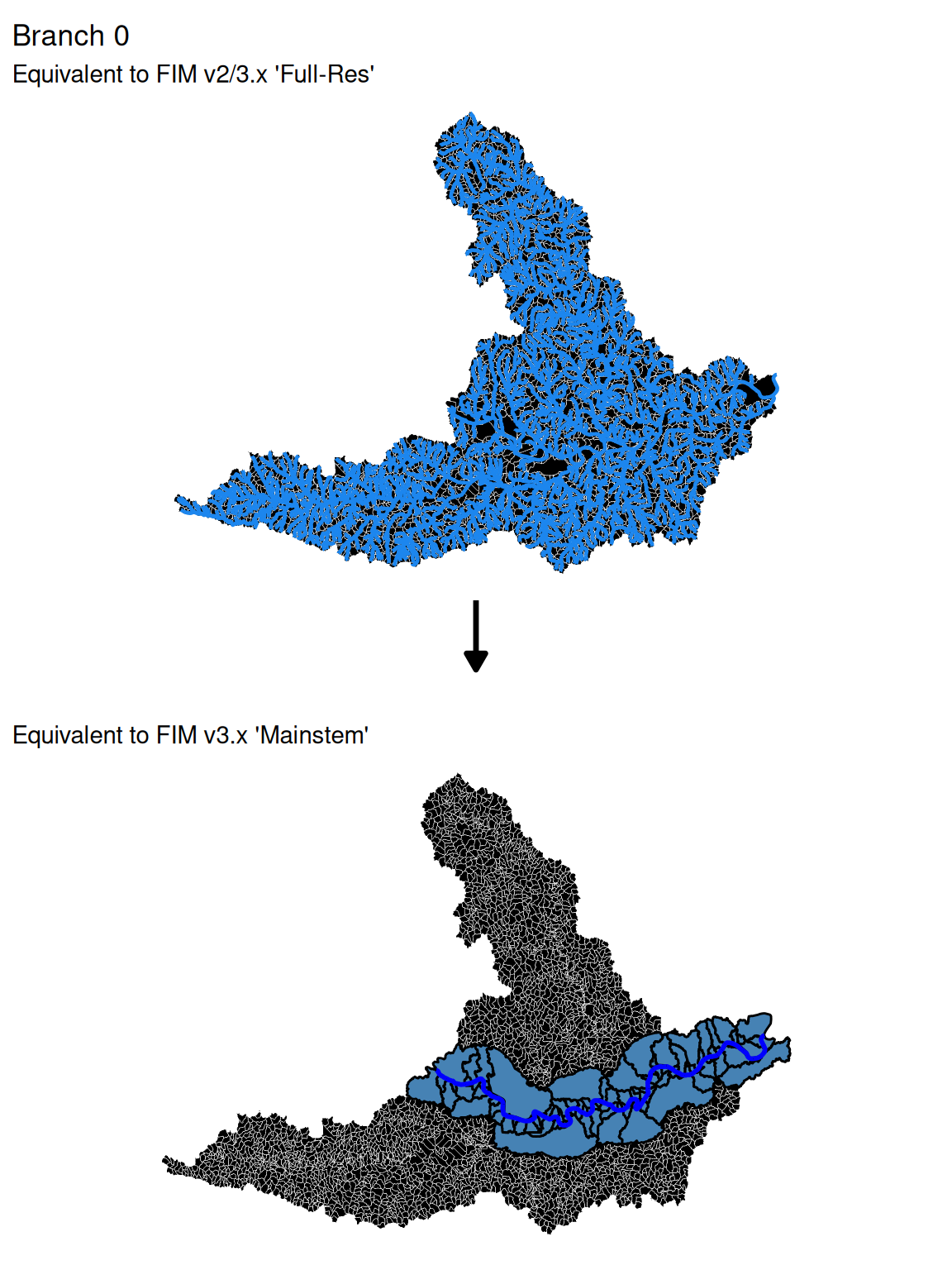
Review: FIM 4
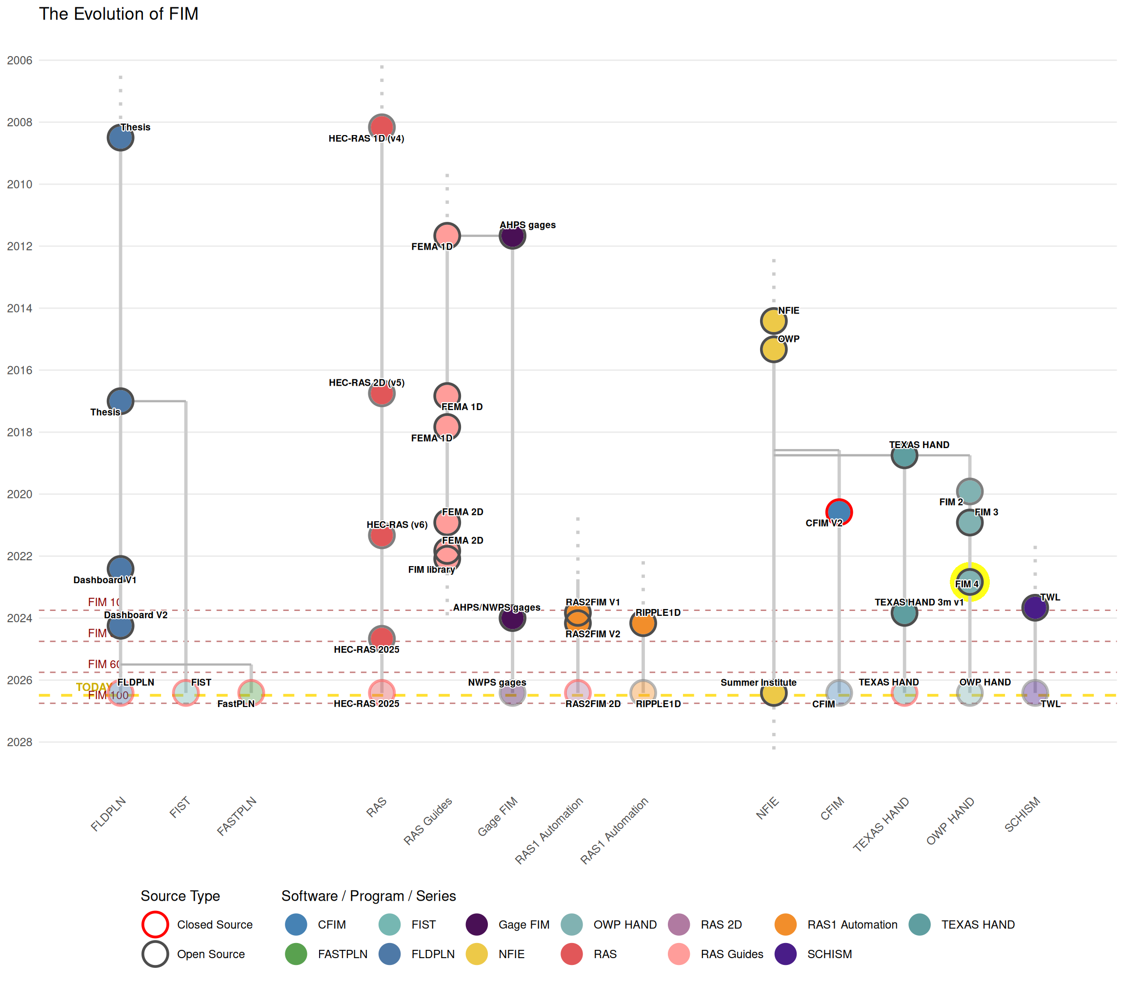
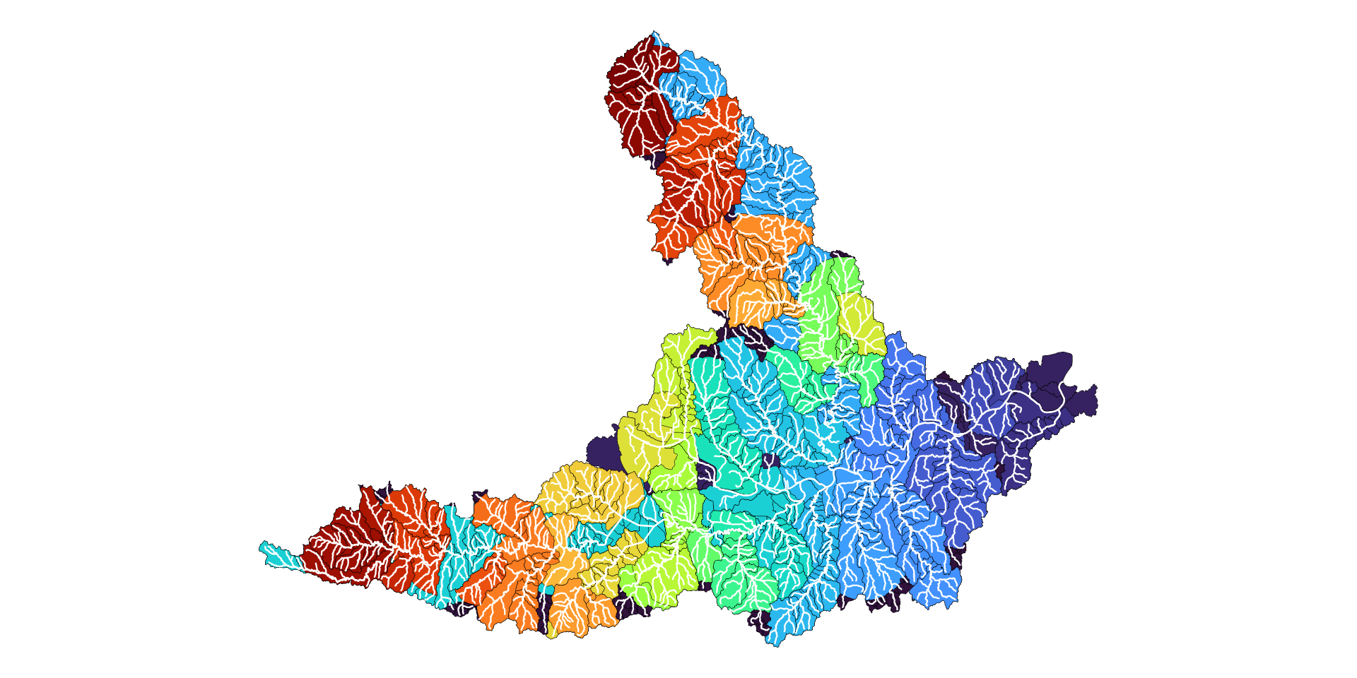
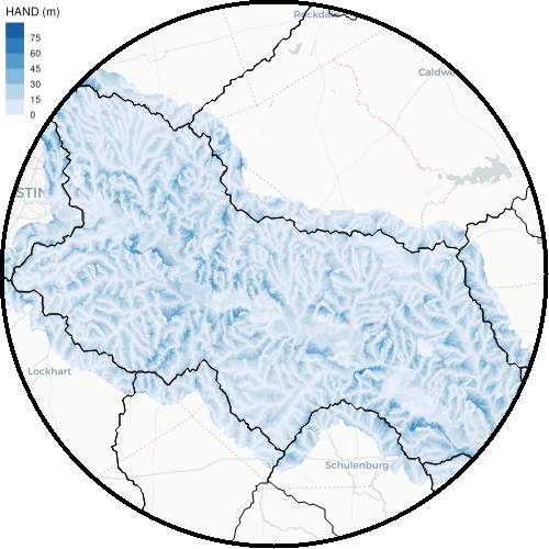
Review: SCHISM Manual at Ccrm-Vims-Edu
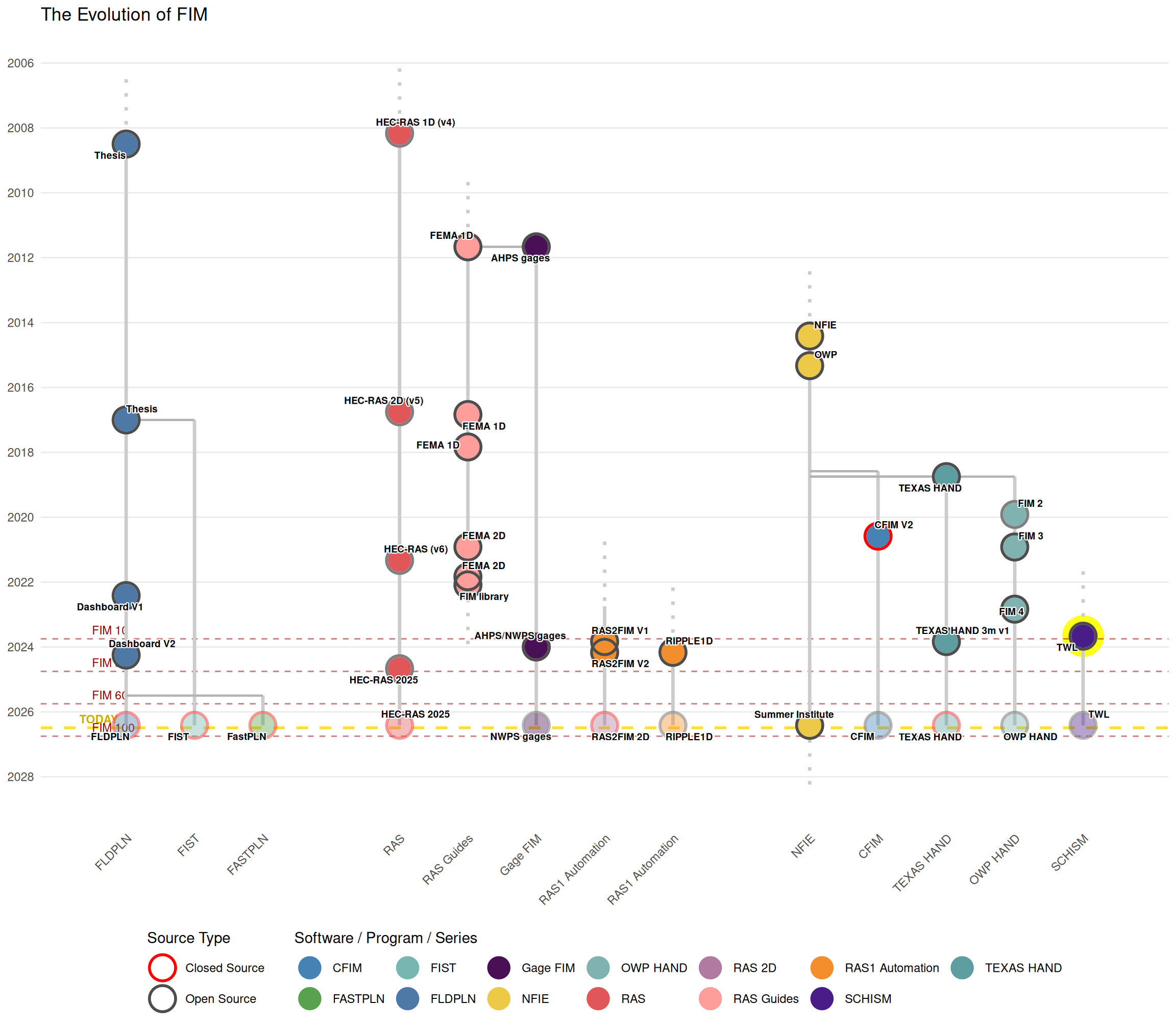
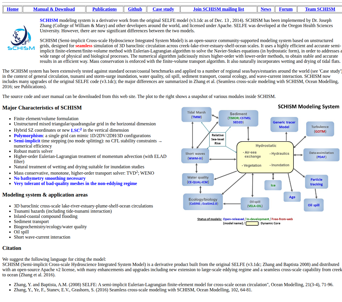
Review: FIM 100 and Beyond
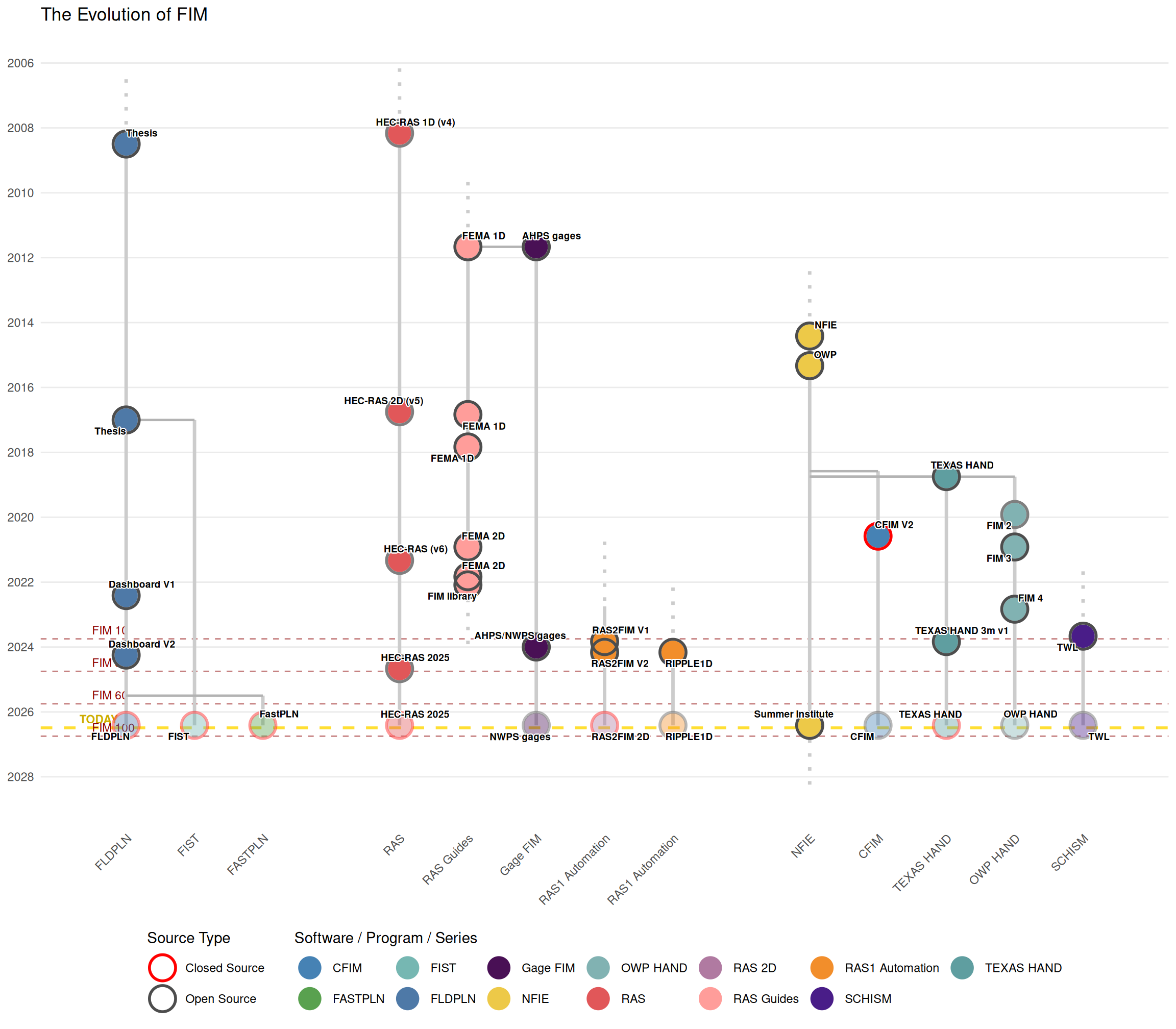
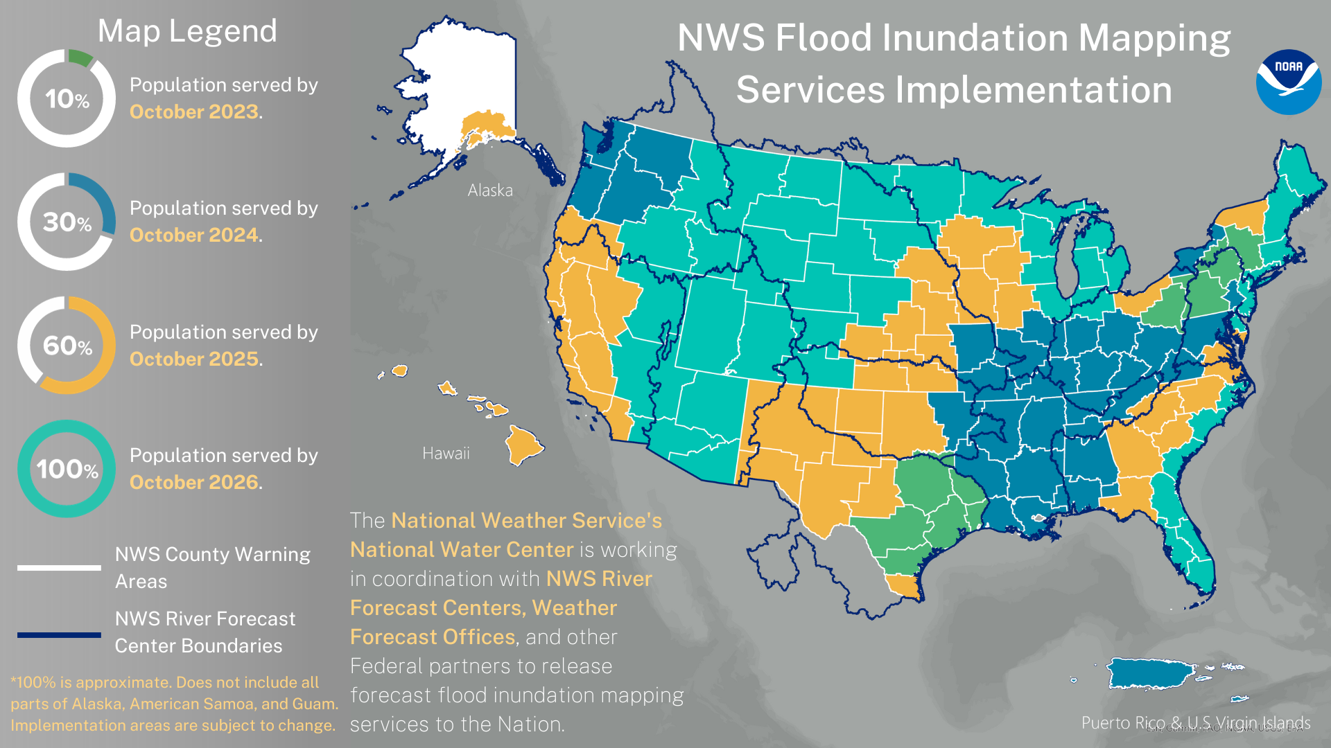
We write the next steps!
Goals:
Outcomes:
- A better understanding of why we use the tools and methods we use.
- More context on the approaches we take to FIM.

See notes (s) and frames for image sources.