Scaling Hydraulic Models for National Flood Inundation Mapping
University of Kansas | Slawson 198 | Zoom Link - 5995eight4
August 10, 2026 at 9:00 AM
Presentation Navigation Tips
Slide layout : This deck has one axis, use any key to advance.
: This deck has interactive elements
Items linked/bordered in green are cited in the tooltip on hover.
Items linked/bordered in blue are hyperlinked to relevant resources.
Photos are Allowed | Questions are Encouraged
: ~35 minutes | Last updated:09/11/2026 21:30:30
! PLEASE !
Interrupt me and ask questions or clarifications.
I’m here to talk with you now, not to these slides.
Control tips
My preferred (FOSS) flavor of slidedecks, revealjs, has intuitive but none the less unconventional PowerPoint presentation controls:
- Slides dynamically resize to use the entirety of the browser window, but you can still fullscreen with
F.- This slide has a red border indicating the content extent.
- Slide navigation is mode dependent. If there are vertical slides, press
space,N, or thedown arrowkey, not theright arrowto advance slides - Press
Mto open to the menu, PressOfor the slide deck overview, PressBto black out the presentation screen, PressSfor a speaker view. - You can use the chalkboard to freemouse/touchpad draw.
- Slides should render as designed1 but you can press
Alt/Opt+ click on the slide to zoom in. Increase text size withAlt/Opt++,Alt/Opt+-to decrease, andAlt/Opt+0reset to the default scale. - Press
Cto declare victory and head home.2


If I have seen further than others, it is by standing upon the shoulders of giants.
- Sir Isaac Newton

Scaling Hydraulic Models for National Flood Inundation Mapping
Outline
- Defining My Question: Elaborating on my Jargon
- How We Stage & Scale: RRASSLER & Reusing Legacy Data
- How We Automate: RAS2FIM and Inundation Libraries
- How We Compare: Model Bakeoff
- What We Learned: Results & Insights
- Where We Go: Healing & National FIM
Takeaways
- A better understanding of the tools and techniques used to create FIM
- A better grasp on the impact different modeling choices have across our scales
- A better appreciation for how YOUR efforts can integrate into a shared national flood map
- A picture of something worth your attention.


Terminology levelset
- FIM: Flood Inundation Modeling/Mapping — Delineating water extents/depths.
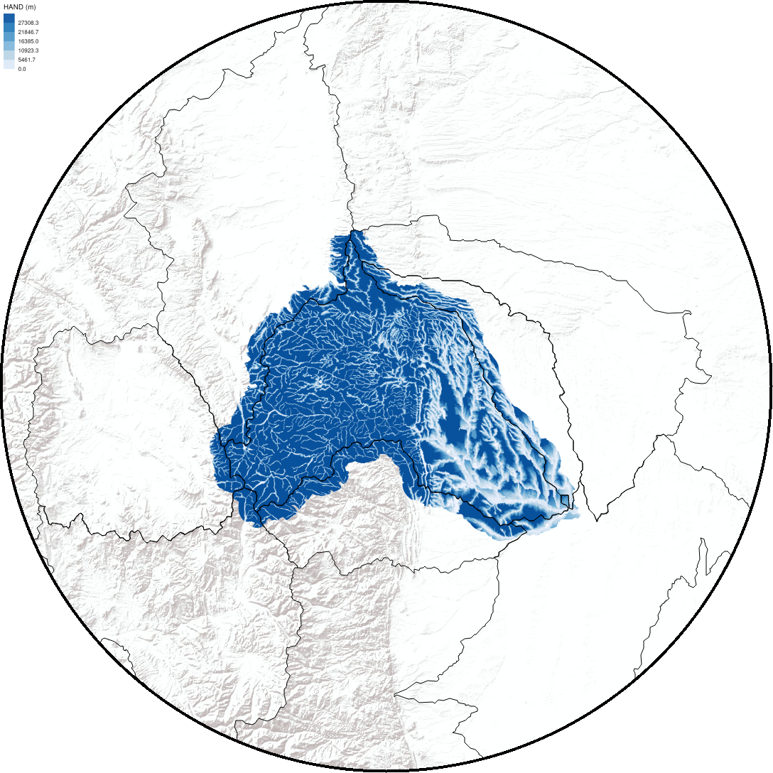
- HAND / REM: Height Above Nearest Drainage / Relative Elevation Model — Topographic normalized elevation surfaces used in geospatial FIM.
- Inundation Library: A structured database of pre-computed depth rasters, rating curves, or hydraulic predictions.
- Volume: Parsed, modular database subsets categorized by reach resolution, flow step, or spatial boundary.
- “Operational” Library: Constructed at a resolution sufficient for operational decision-making—encompassing multi-resolution ensembles rather than a handful of static point predictions.
- FAIR: guidelines to improve the Findability, Accessibility, Interoperability, and Reuse of digital assets
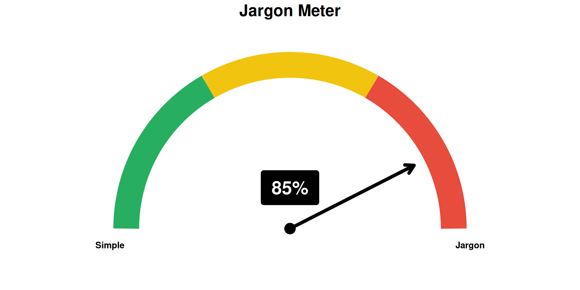
AI Overview: Jargon is the specialized, technical language or vocabulary used by a particular profession, group, or activity…
Why FIM?
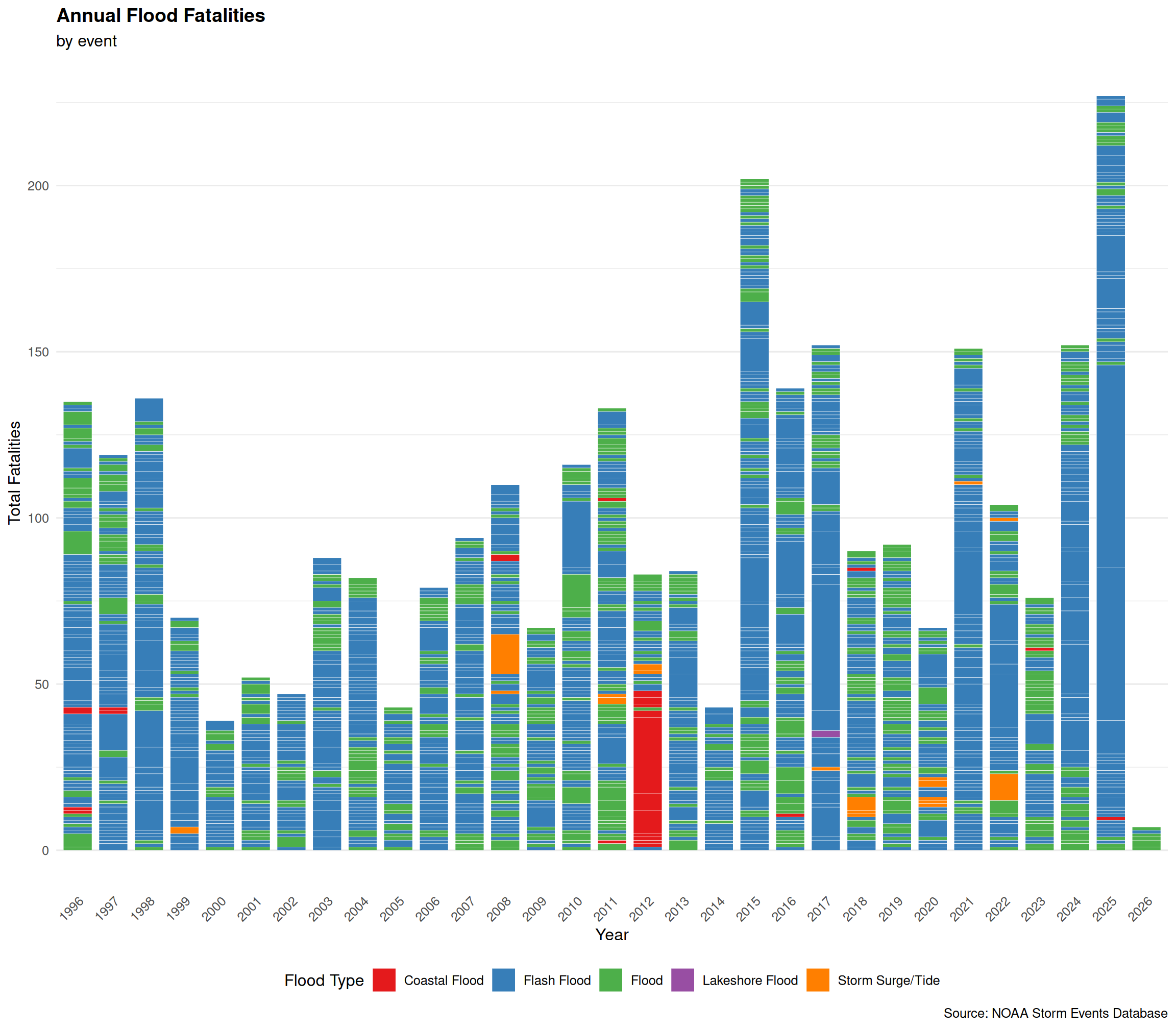
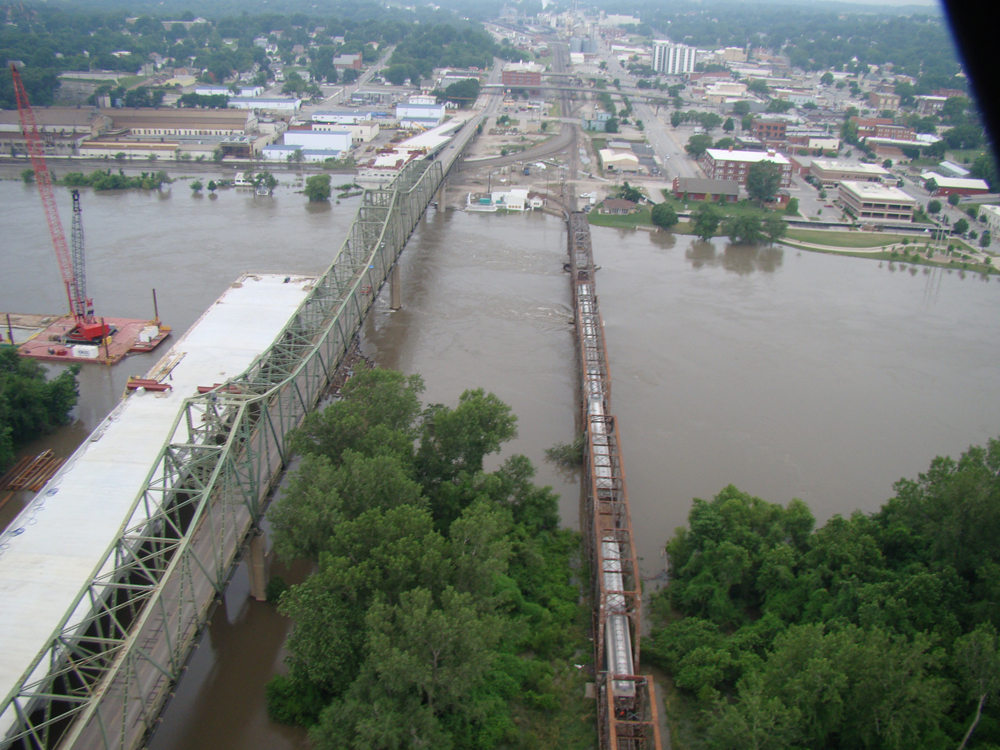

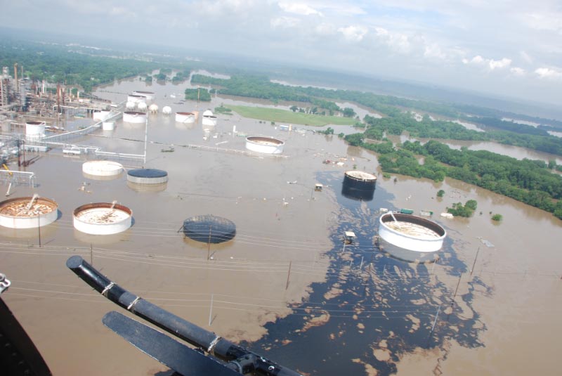

Why Now?
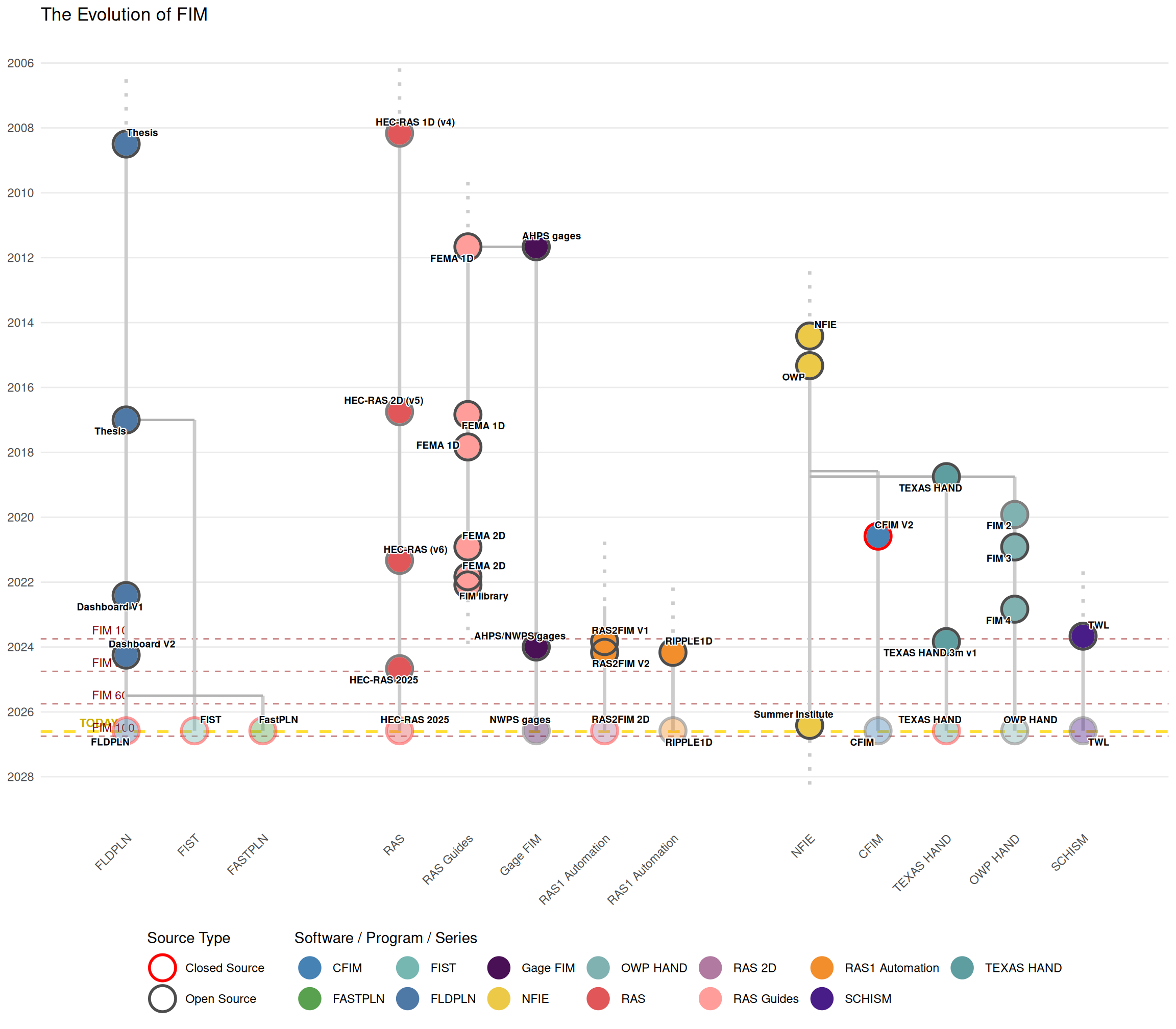
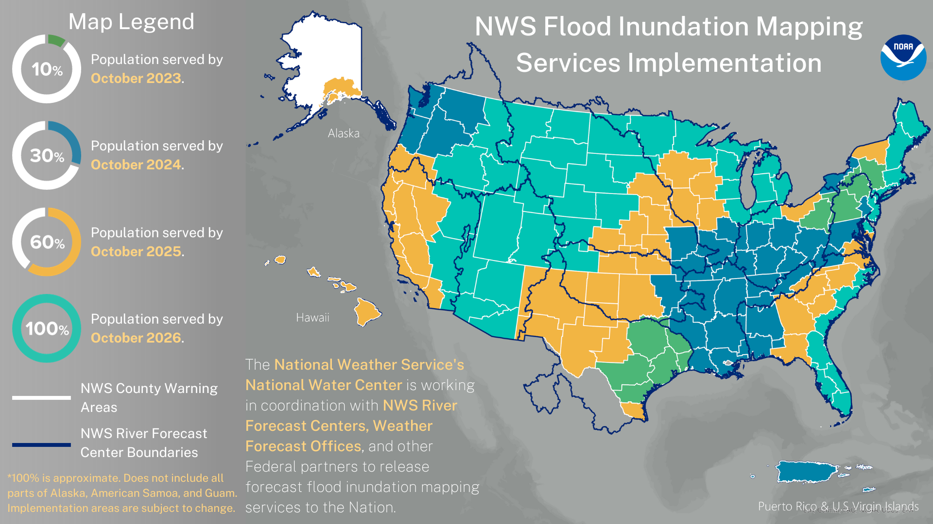
How?
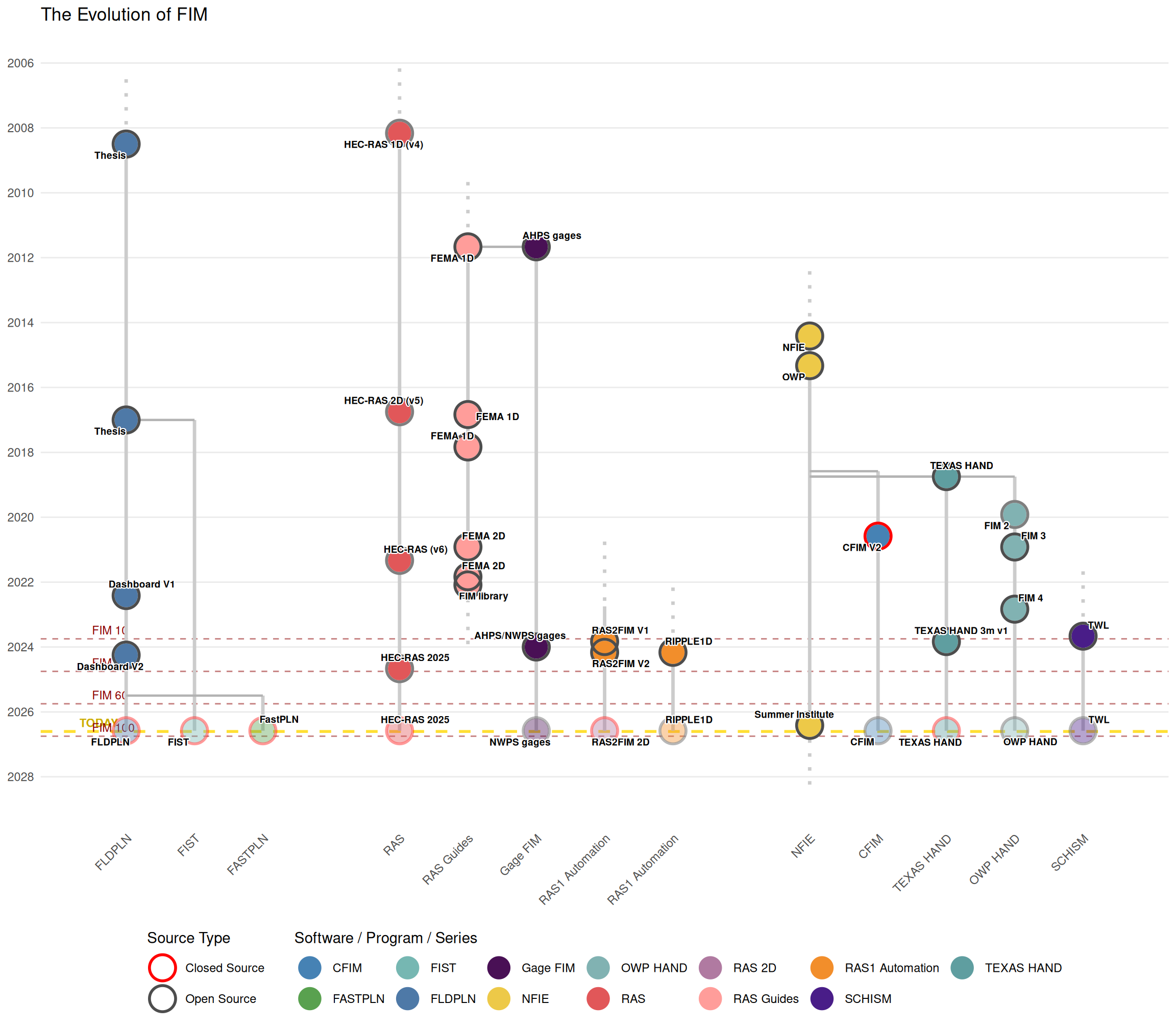
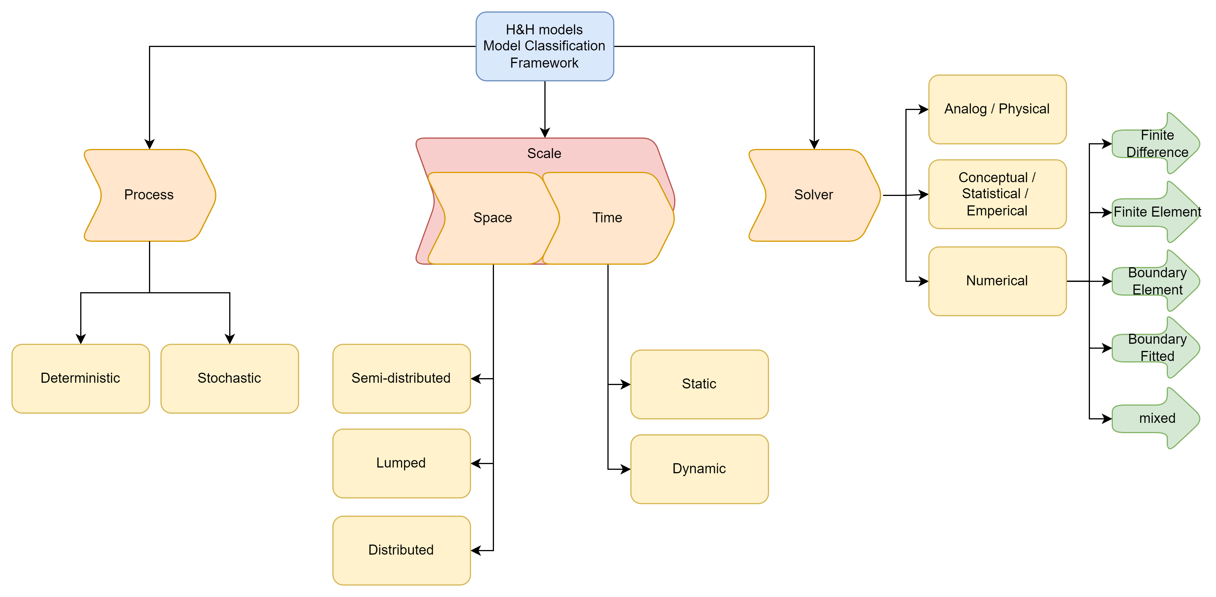
FIModeling: Flood Inundation Modeling, or the act of representing the spatial extent, depth, and movement of floodwaters across a landscape. This can be accomplished using either geospatial or hydrodynamic methods.
Geospatial: utilizes spatial relationships (local, focal, and zonal operations) and more simplistic calculations to approximate floodwaters across a landscape.
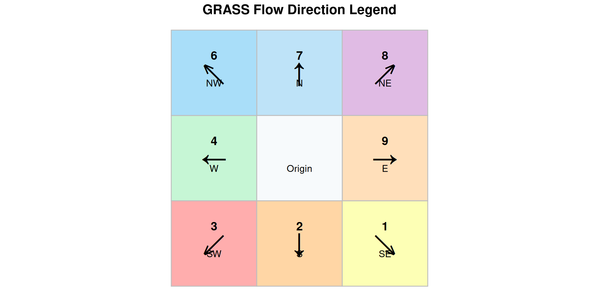
How?
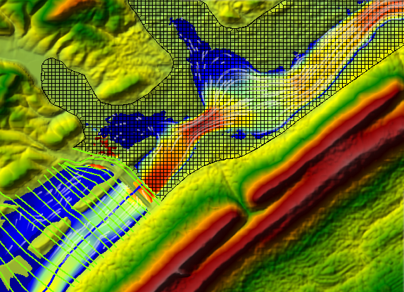
FIModeling: Flood Inundation Modeling, or the act of representing the spatial extent, depth, and movement of floodwaters across a landscape. This can be accomplished using either geospatial or hydrodynamic methods.
Hydrodynamic: Solves variations of the shallow water equations to more exhaustively simulate the flow dynamics of floodwaters across a landscape.
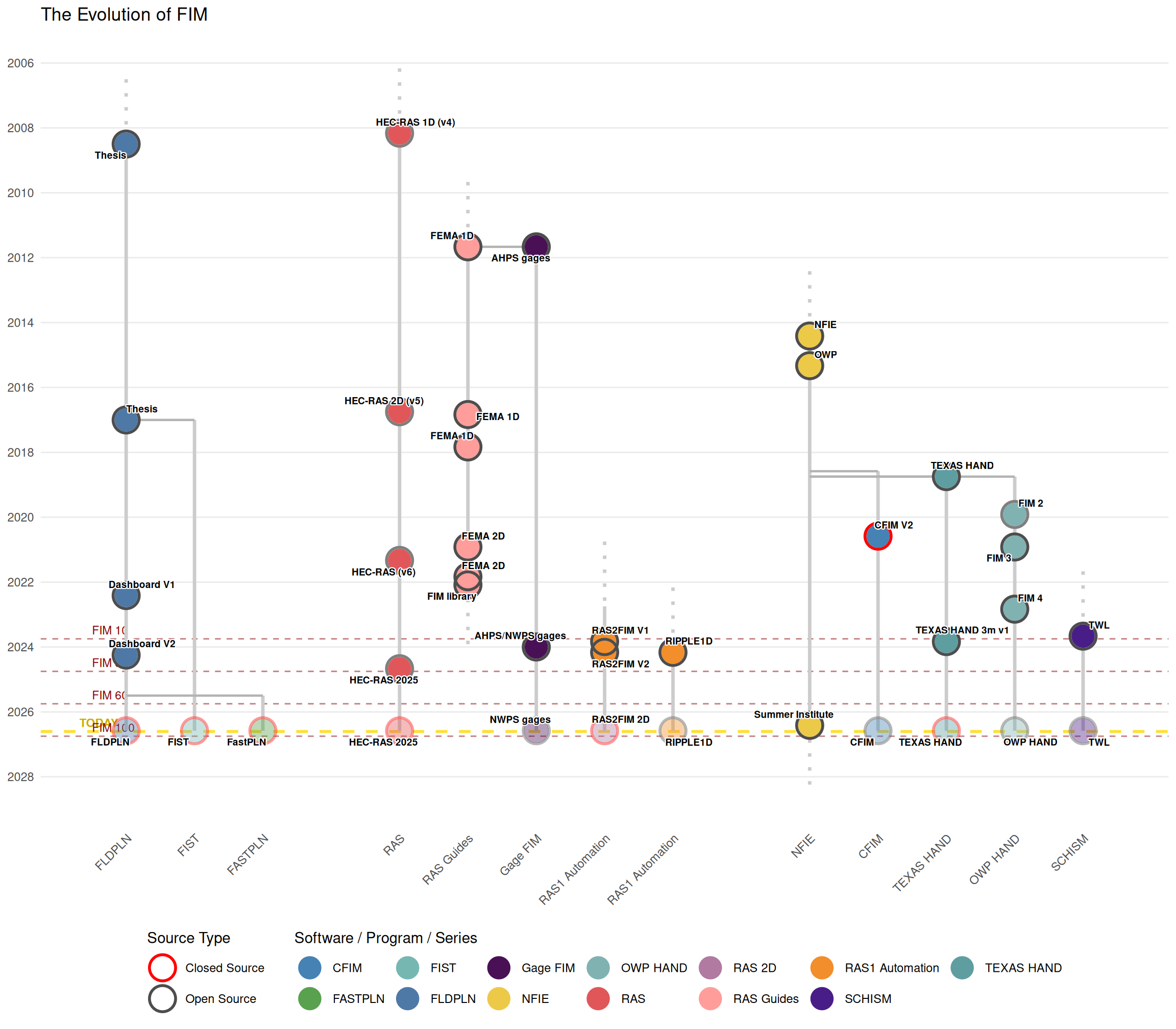
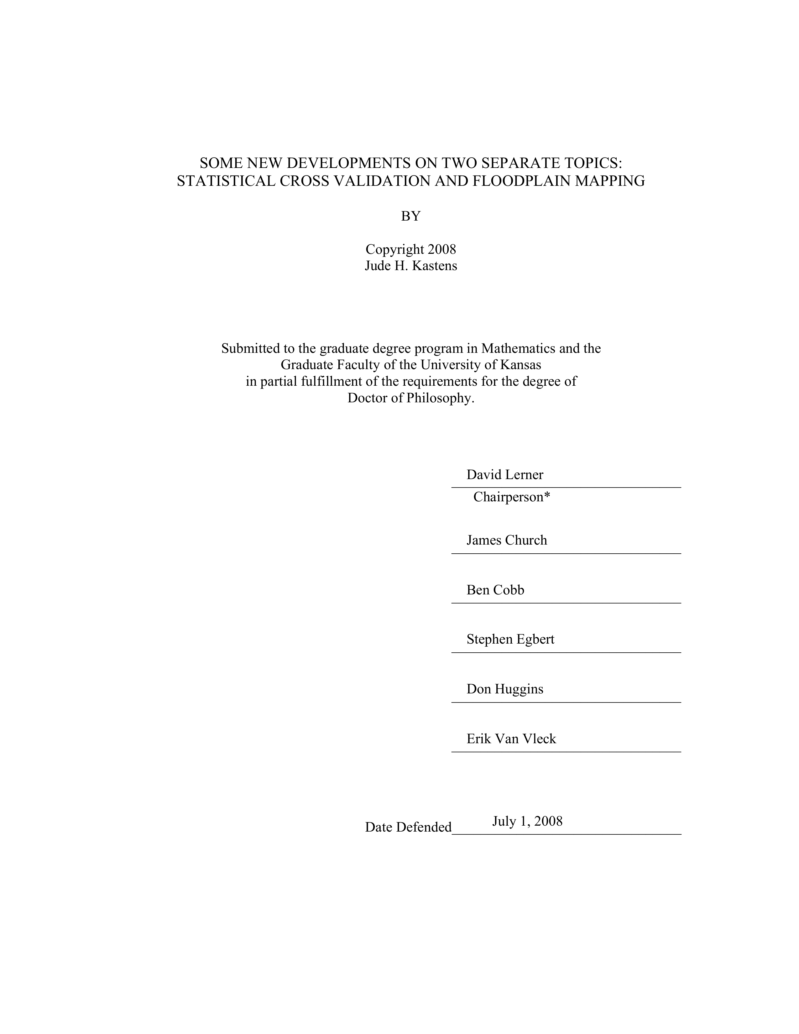
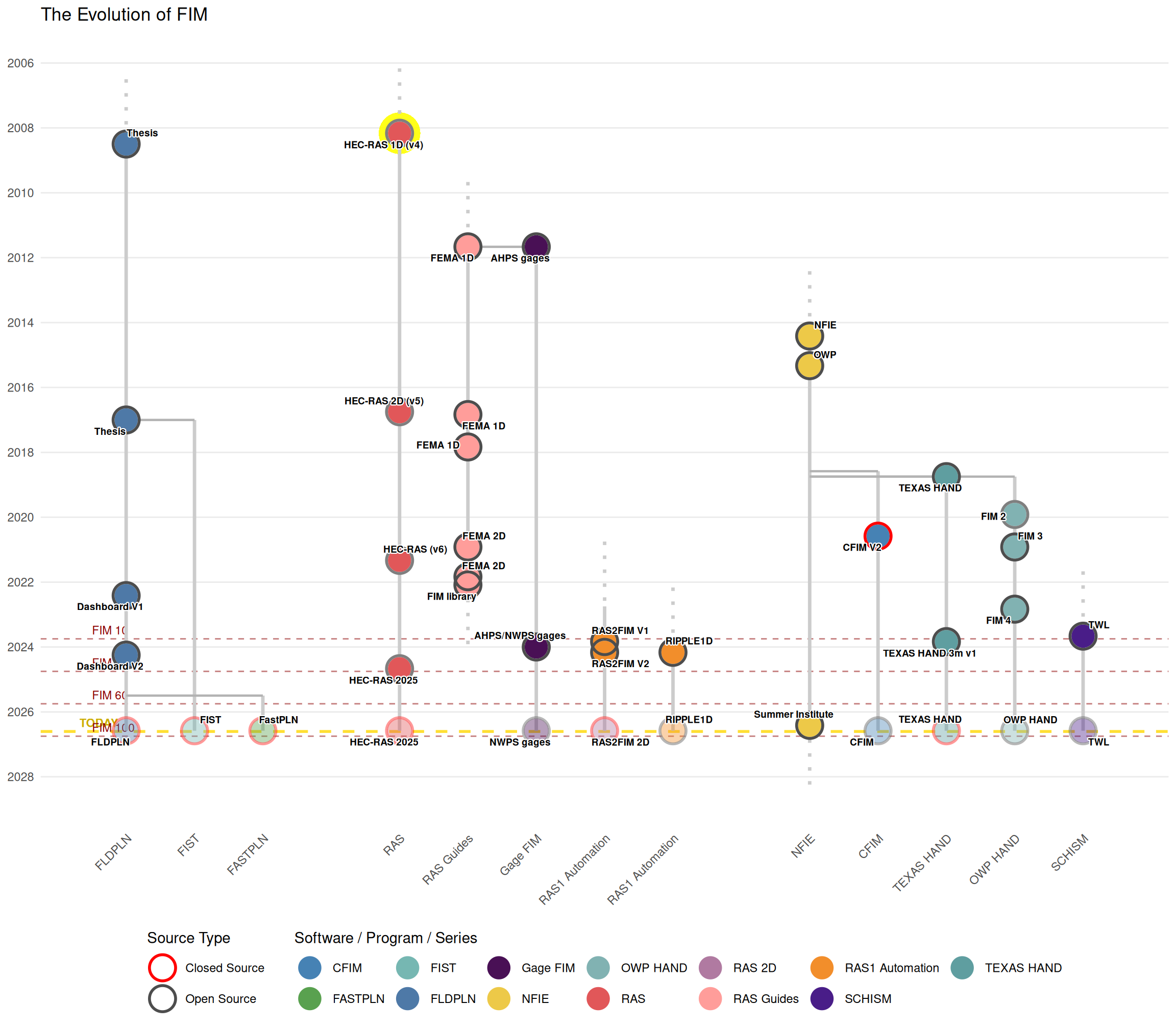
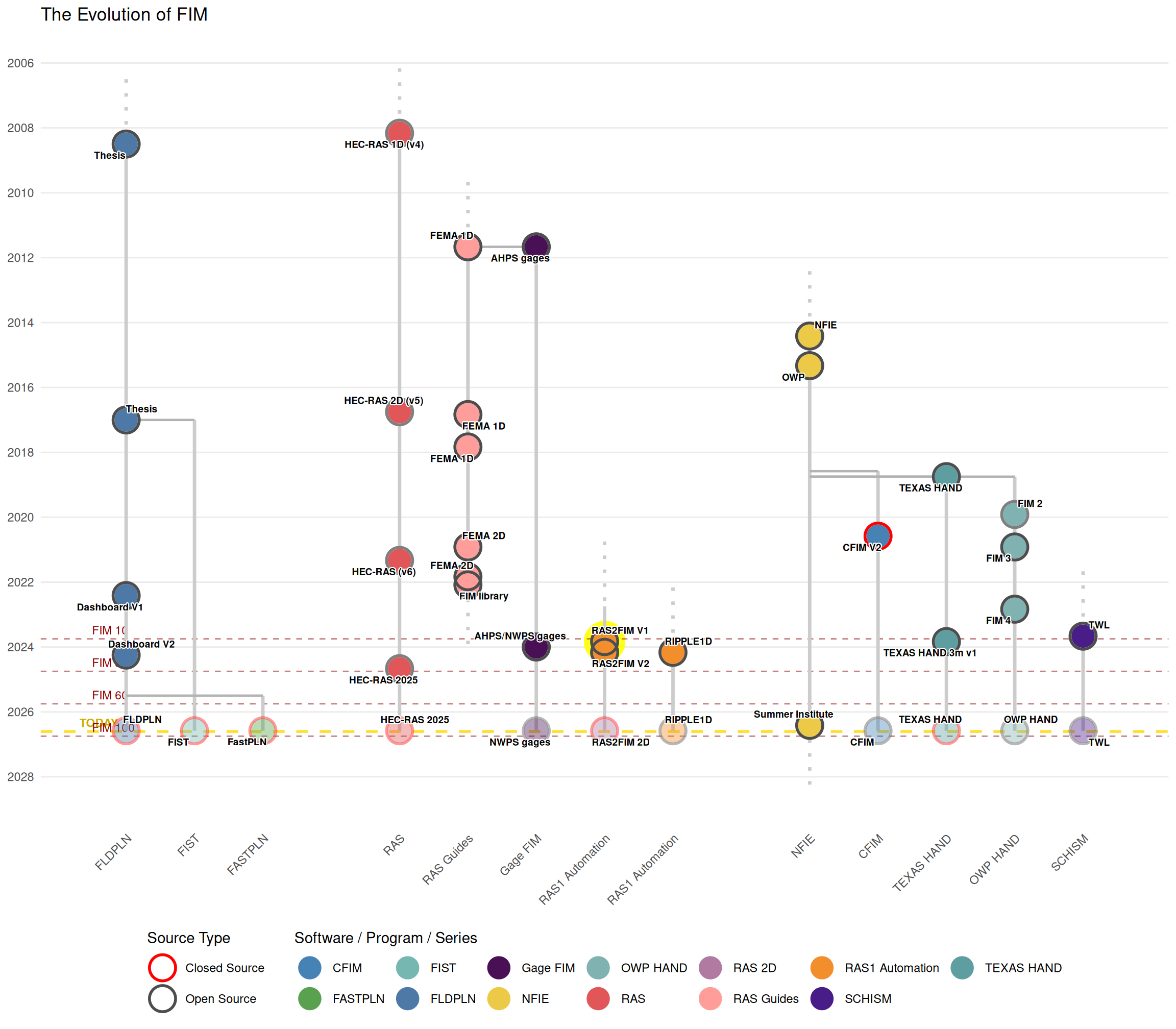
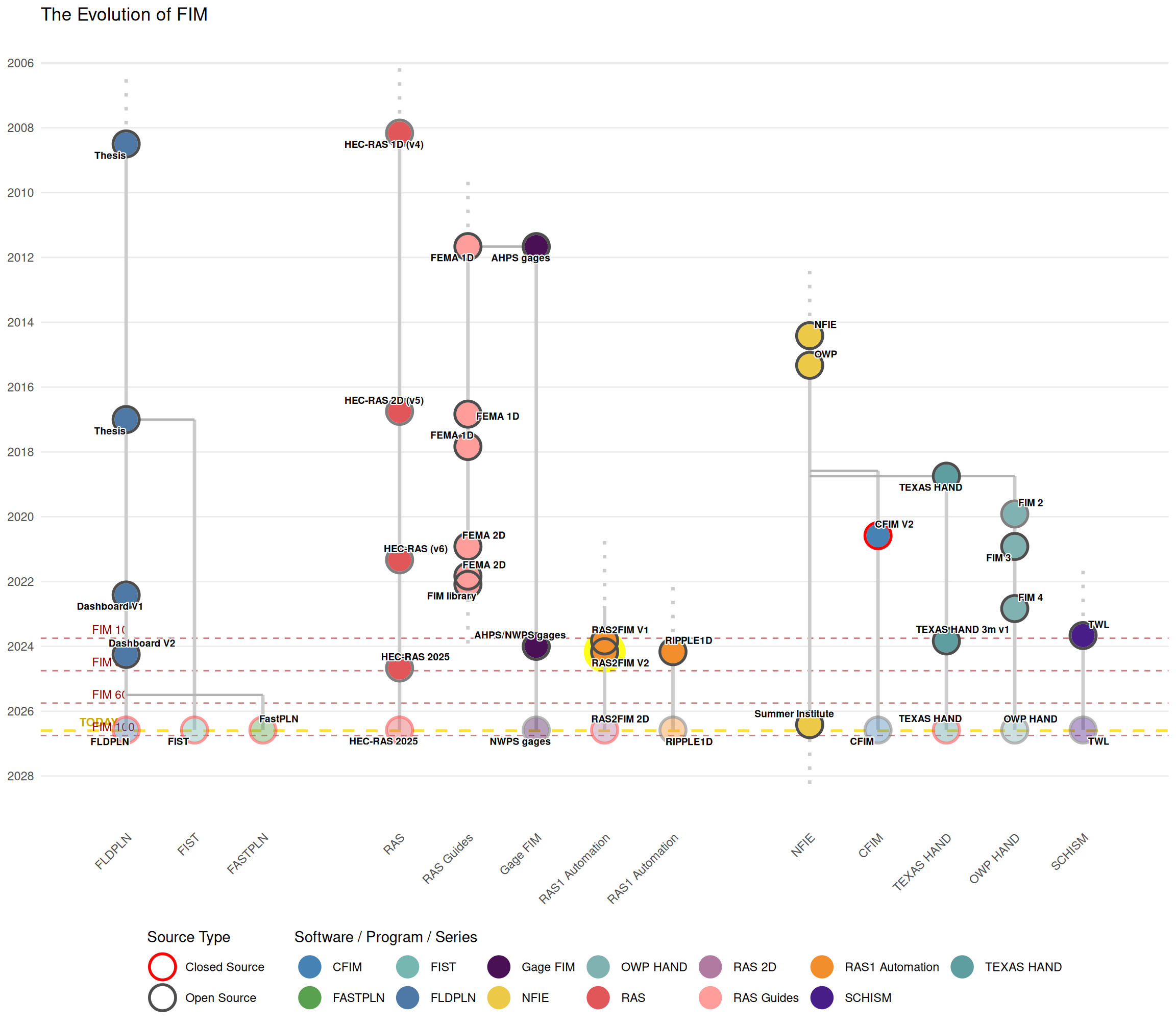
Some New Developments on Two Separate Topics: S…
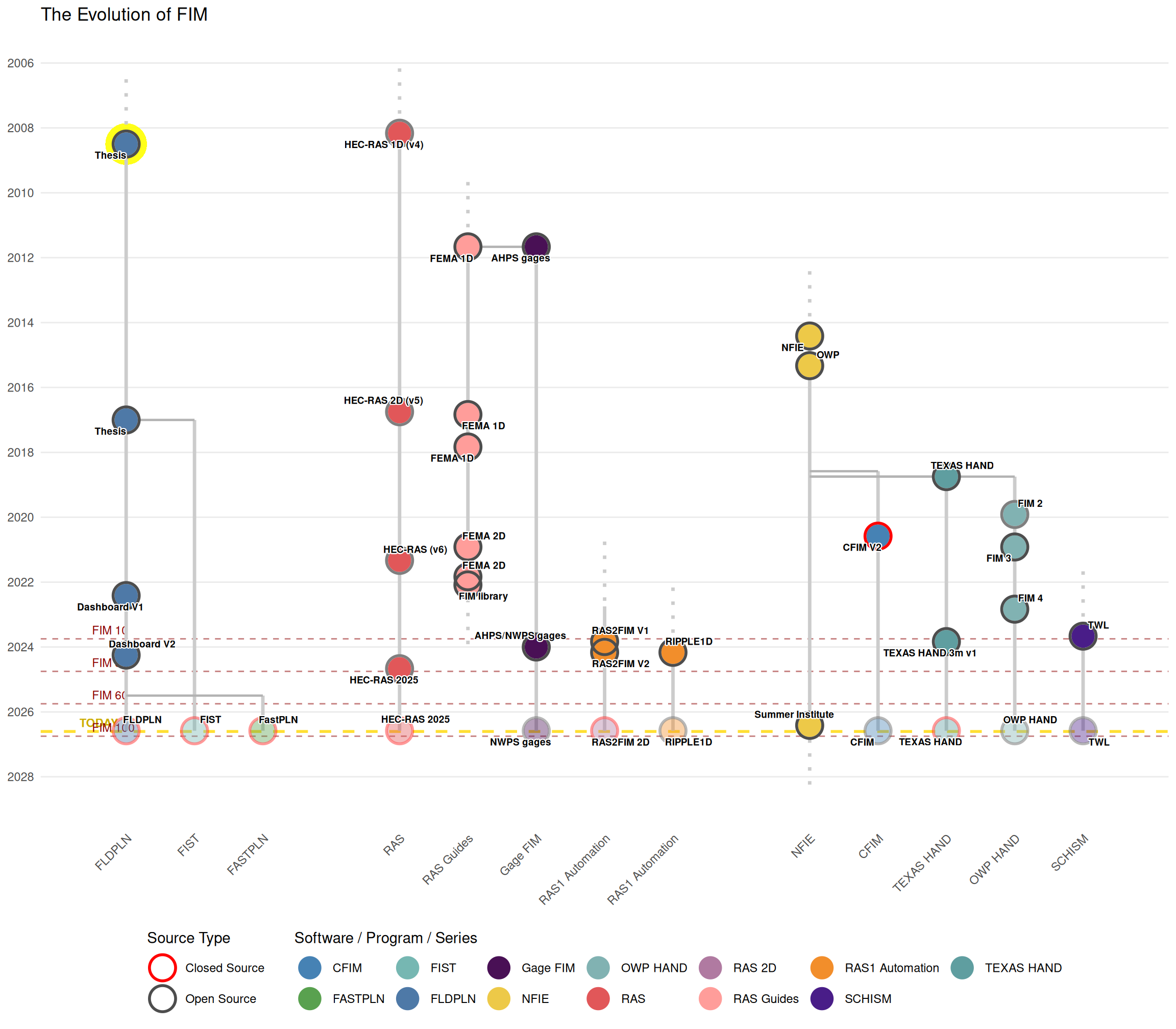
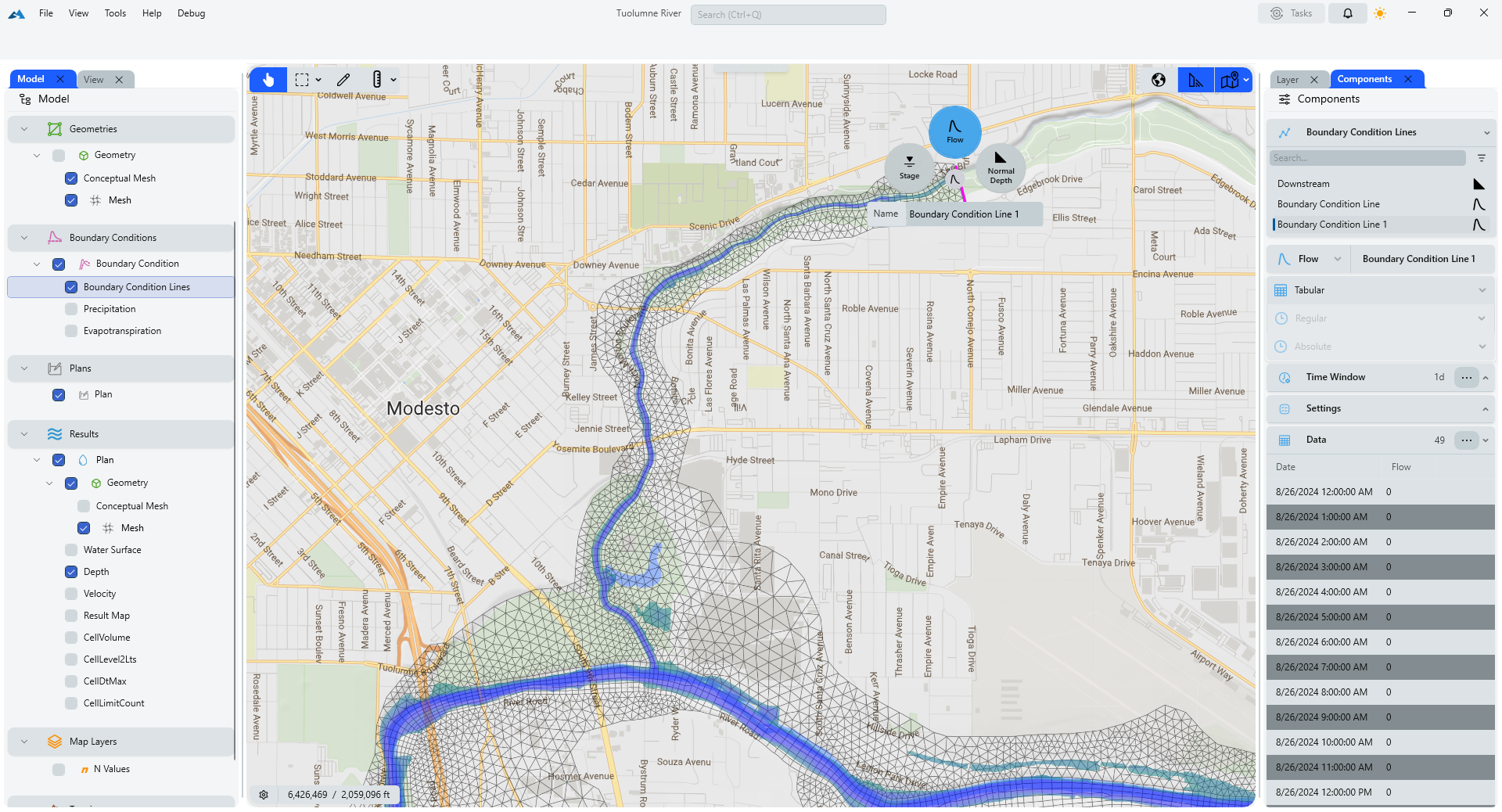
A Modern HEC-RAS
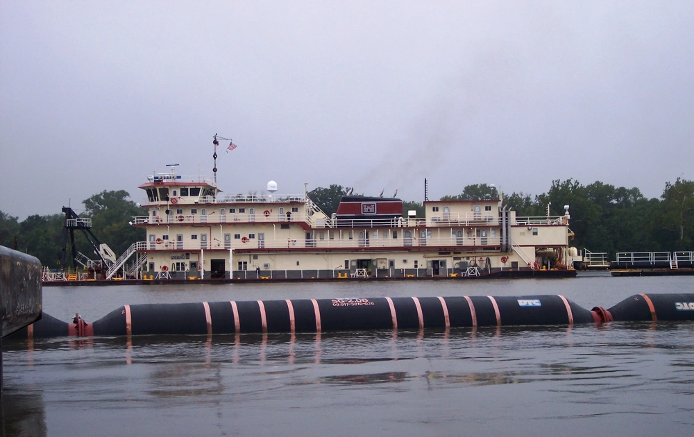
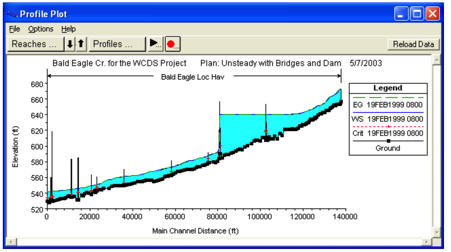
The First 2D HEC-RAS
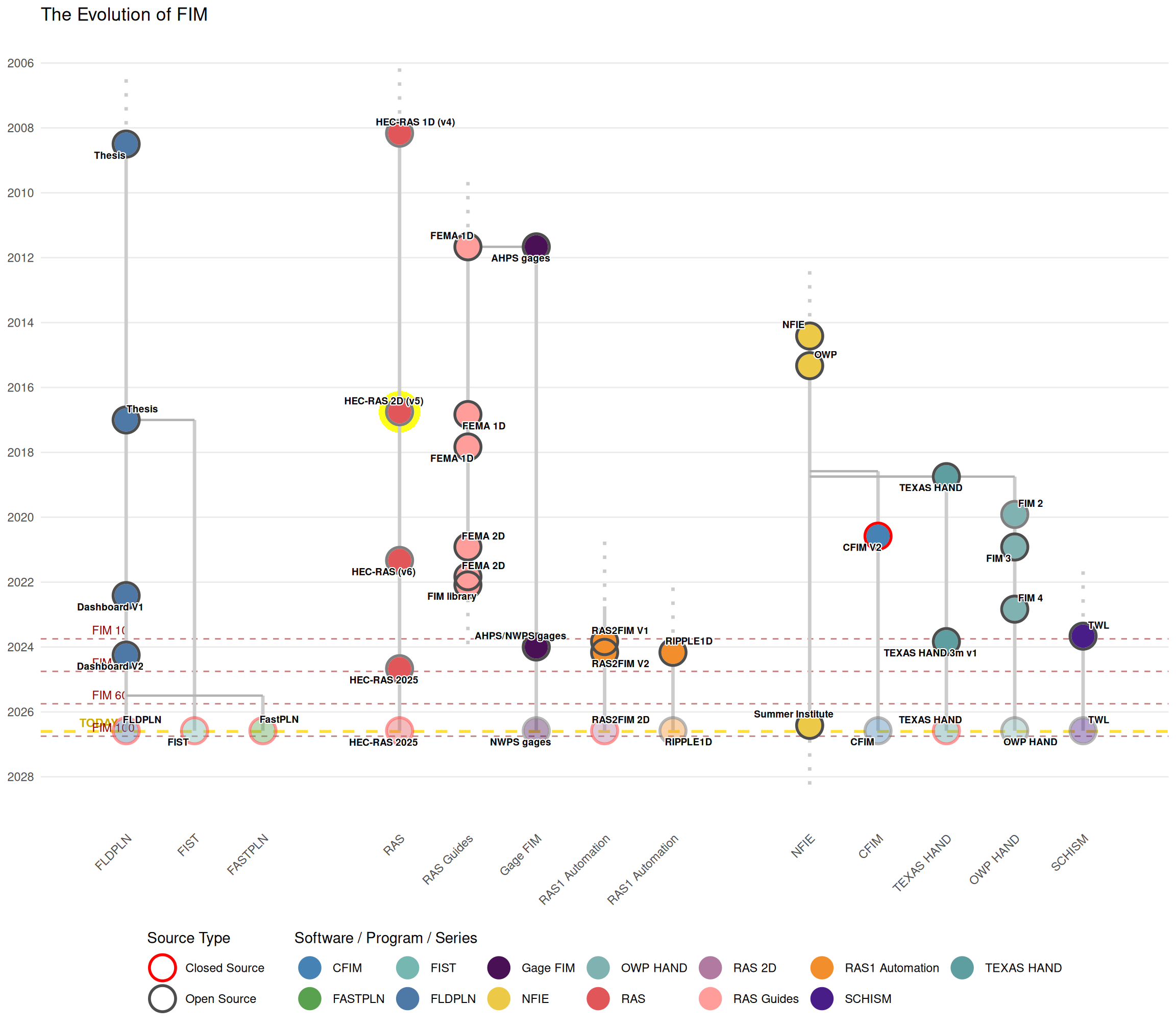
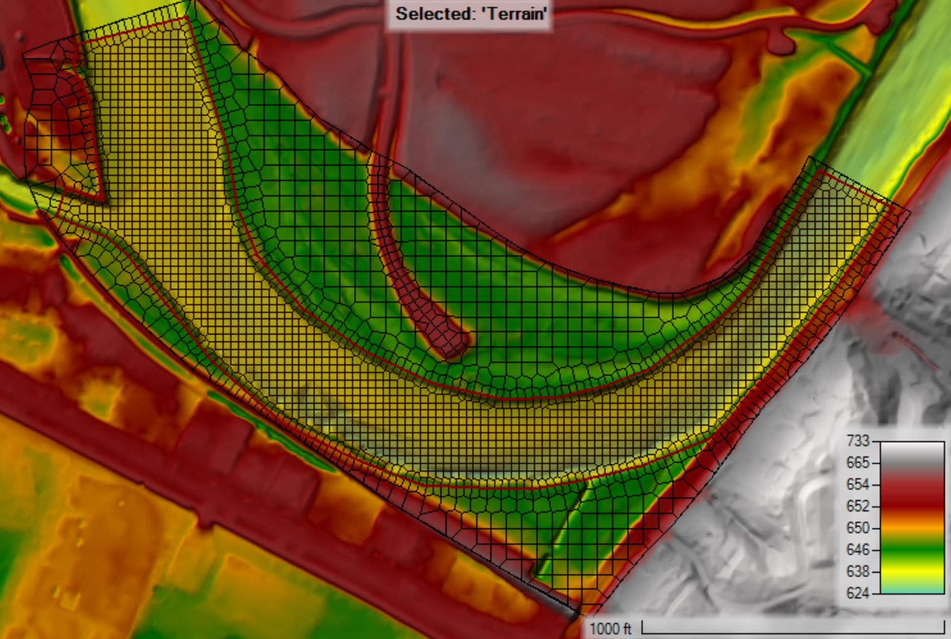
HEC-RAS 2025
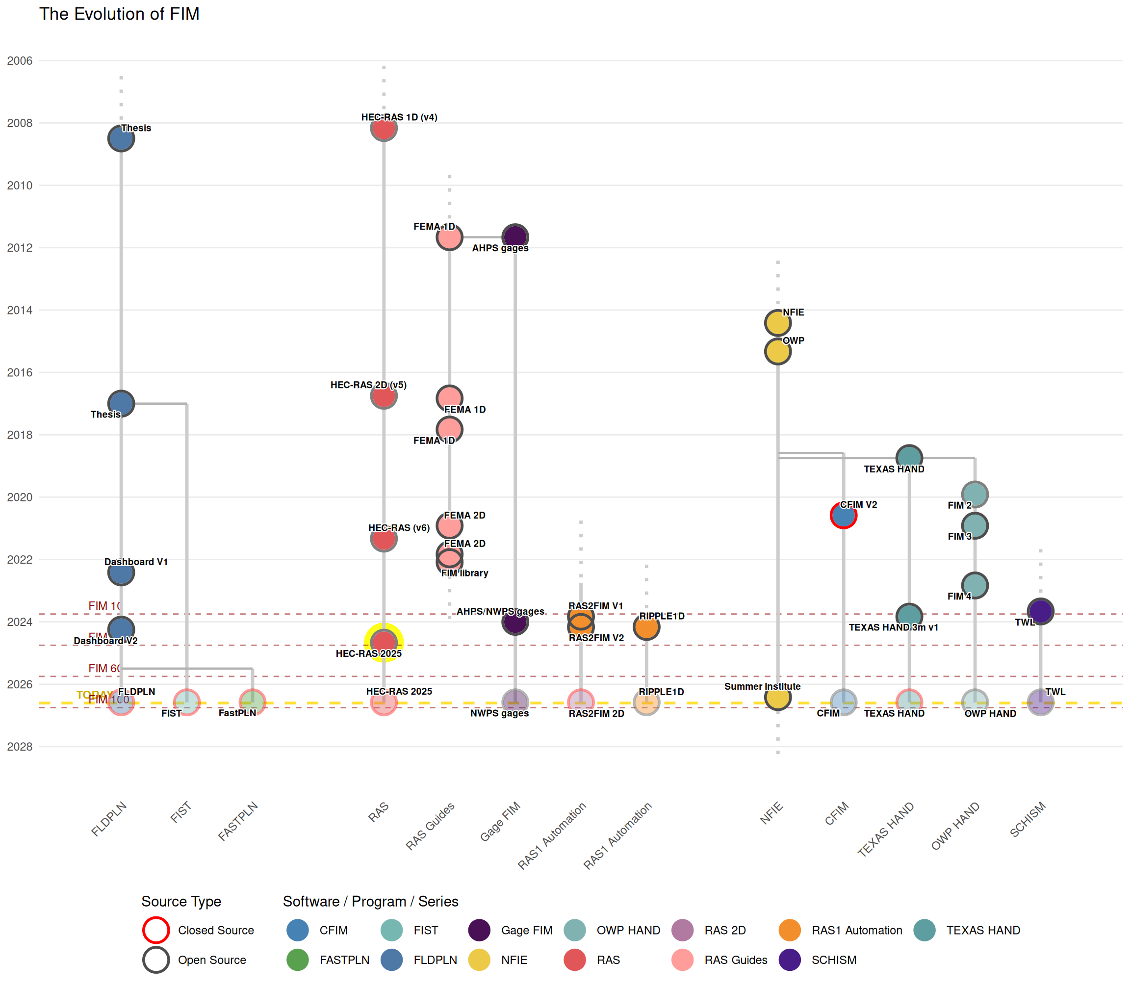
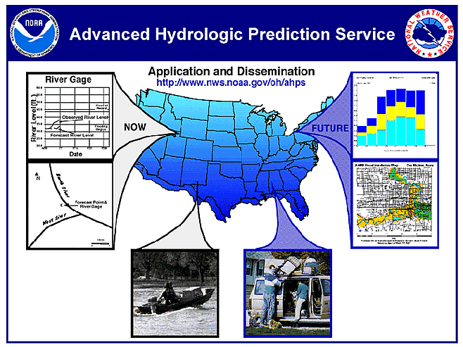
AHPS libraries
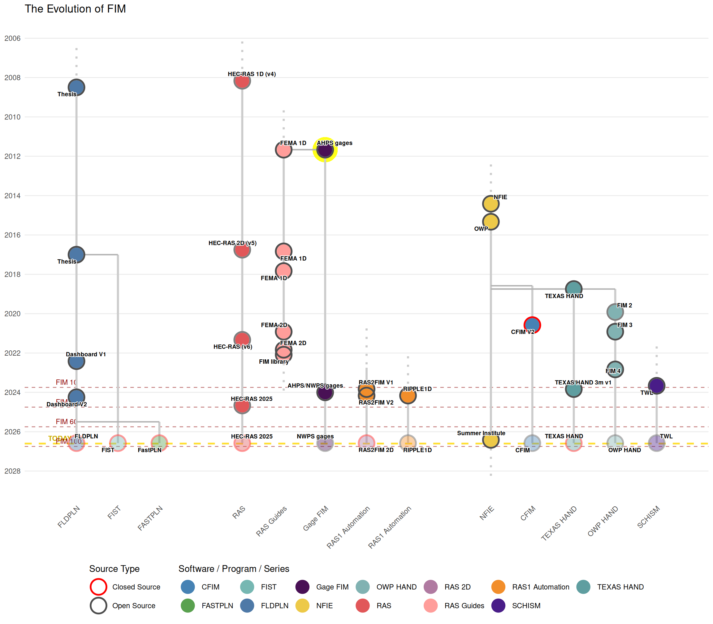
The Problem: Friction at Scale
Flood Modeling’s Fragmentation Problem
While FIM methodologies and datasets have rapidly expanded, these efforts remain isolated and rarely communicated clearly or combined effectively.
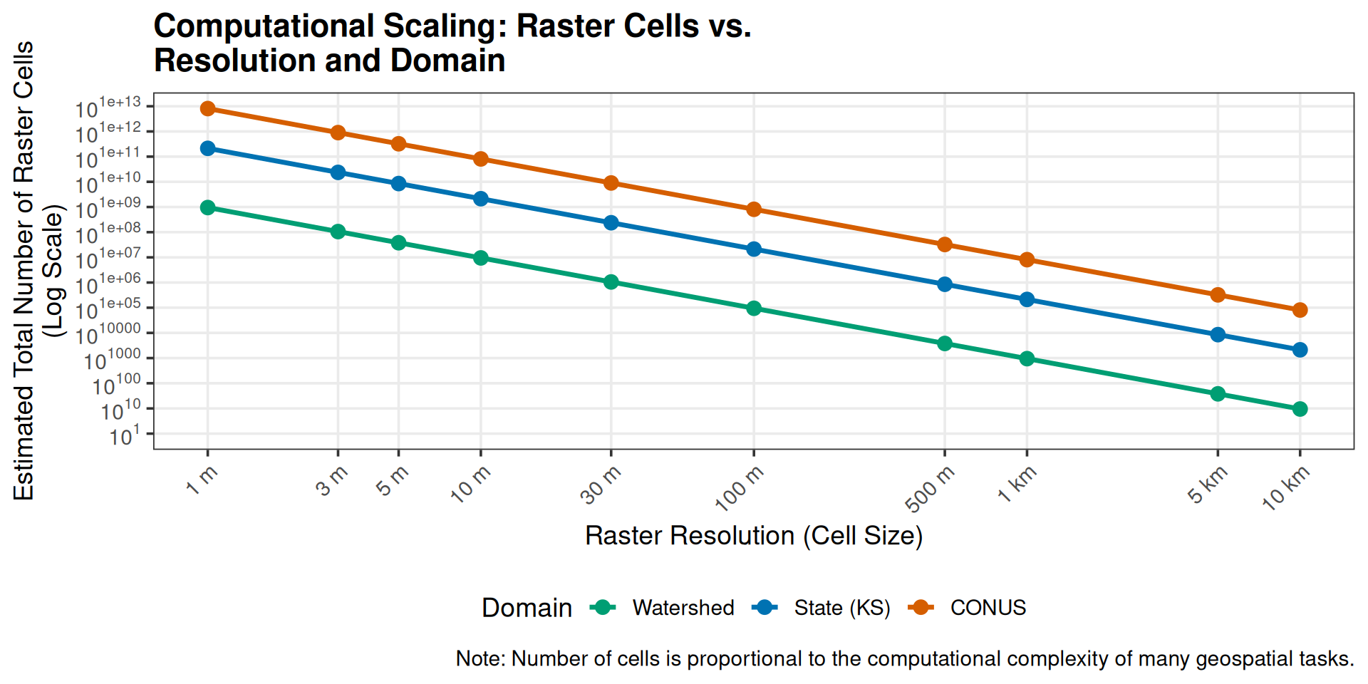
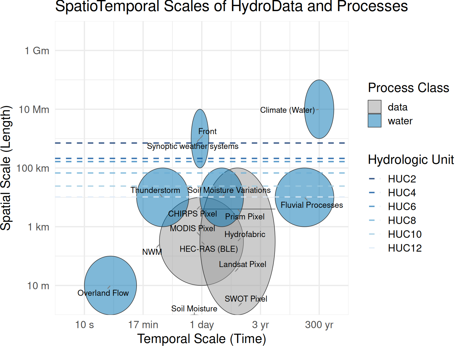
- The Scale Disconnect: Transitioning from reach-scale hydraulic precision to national-scale mapping creates massive technical friction.
The Problem: Friction at Scale
Flood Modeling’s Fragmentation Problem
While FIM methodologies and datasets have rapidly expanded, these efforts remain isolated and rarely communicated clearly or combined effectively.
- The Scale Disconnect: Transitioning from reach-scale hydraulic precision to national-scale mapping creates massive technical friction.
The Problem: Interoperating modeling frameworks
Flood Modeling’s Fragmentation Problem
While FIM methodologies and datasets have rapidly expanded, these efforts remain isolated and rarely communicated clearly or combined effectively.
- The Scale Disconnect: Transitioning from reach-scale hydraulic precision to national-scale mapping creates massive technical friction.
- Data & Language Barriers: Specialized formats, less-than FAIR data, and model-specific jargon trap insights in silos.
The Result: We spend our time fighting the mechanics of modeling rather than communicating actionable emergency response maps.
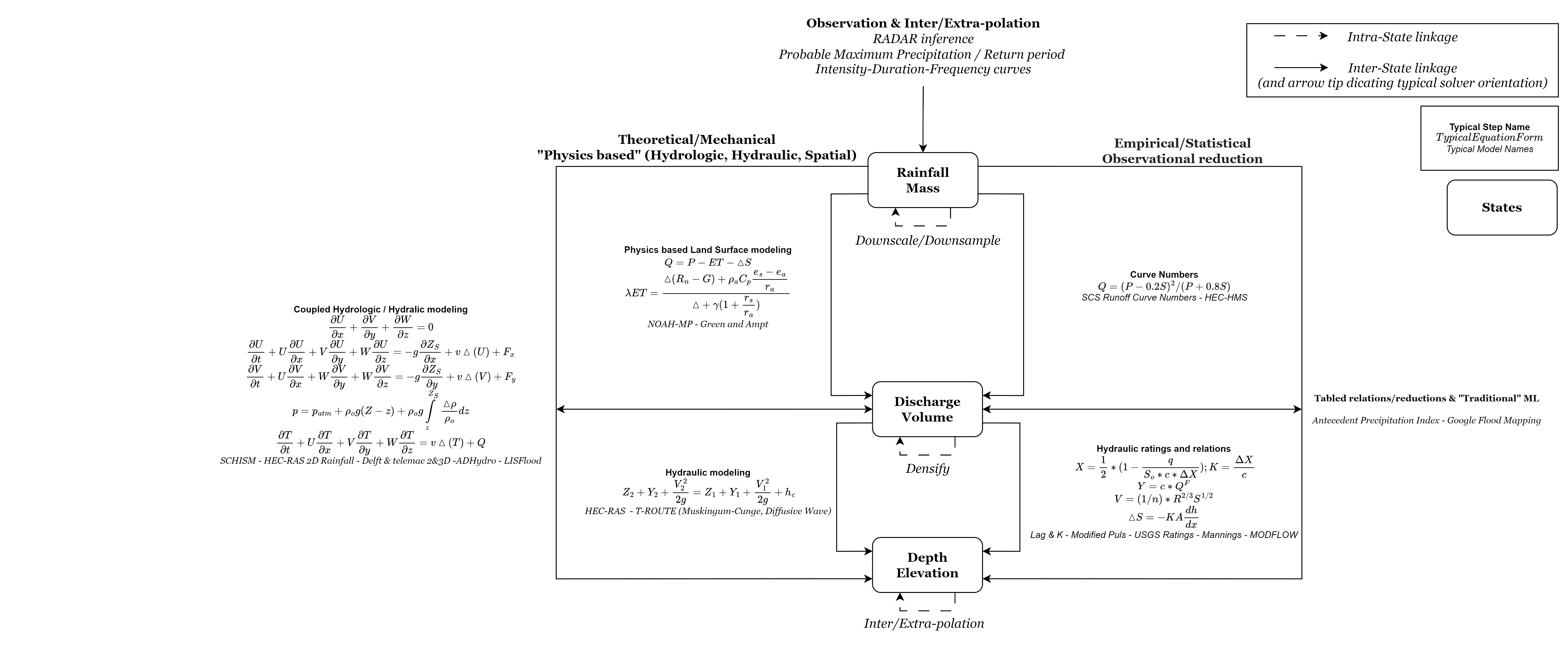
How do we bridge the orders of magnitude that separate FIM? How can we more cleanly link otherwise independent libraries?
The HEC-RAS model format
The Theoretical Standard
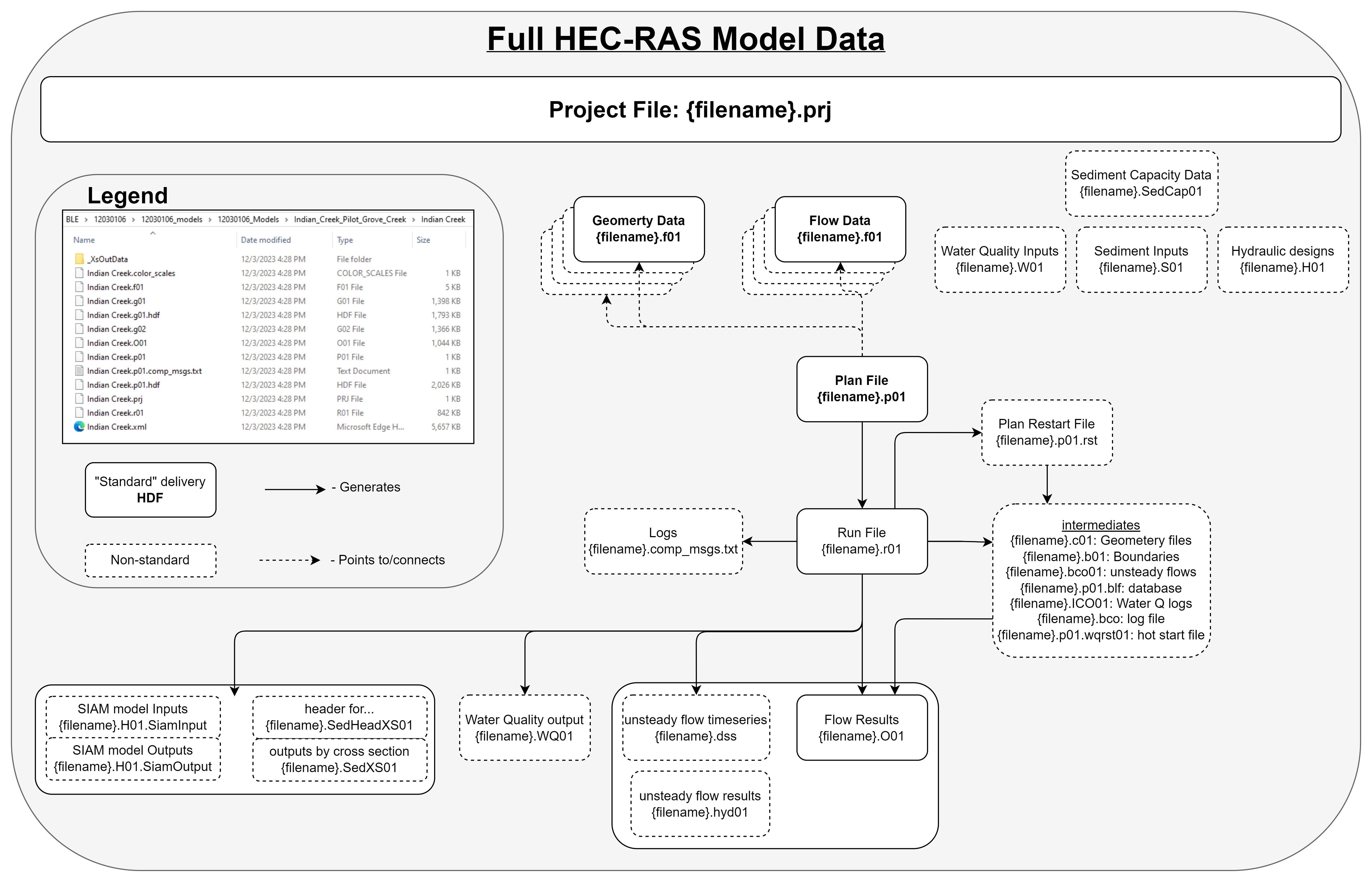
Files to Track
| File grep Pattern (# denotes single numeric wildcard) | HEC-RAS Model Use |
|---|---|
| .g## | Geometry definitions |
| .prj | Projection (can be non-standard proj4 string defined file) |
| .prj | Project (same extension, defines how RAS models are wired) |
| .p## | Plan file, used to drive the model |
| .f## | Steady Flow file. Profile information, flow data and boundary conditions |
| .h## | Hydraulic Design data file |
| .v## | Velocity file |
| .o## | Output file |
| .r## | Run file for steady flow |
| .u## | unsteady Flow file. Profile information, flow data and boundary conditions |
| .x## | Run file for unsteady flow |
| .dss | Data files |
| .rasmap | Output plan |
These files, followed by a .hdf, are transformations of their counterparts needed for newer versions of HEC-RAS and are automatically created as needed.
The HEC-RAS model format
Model Standards
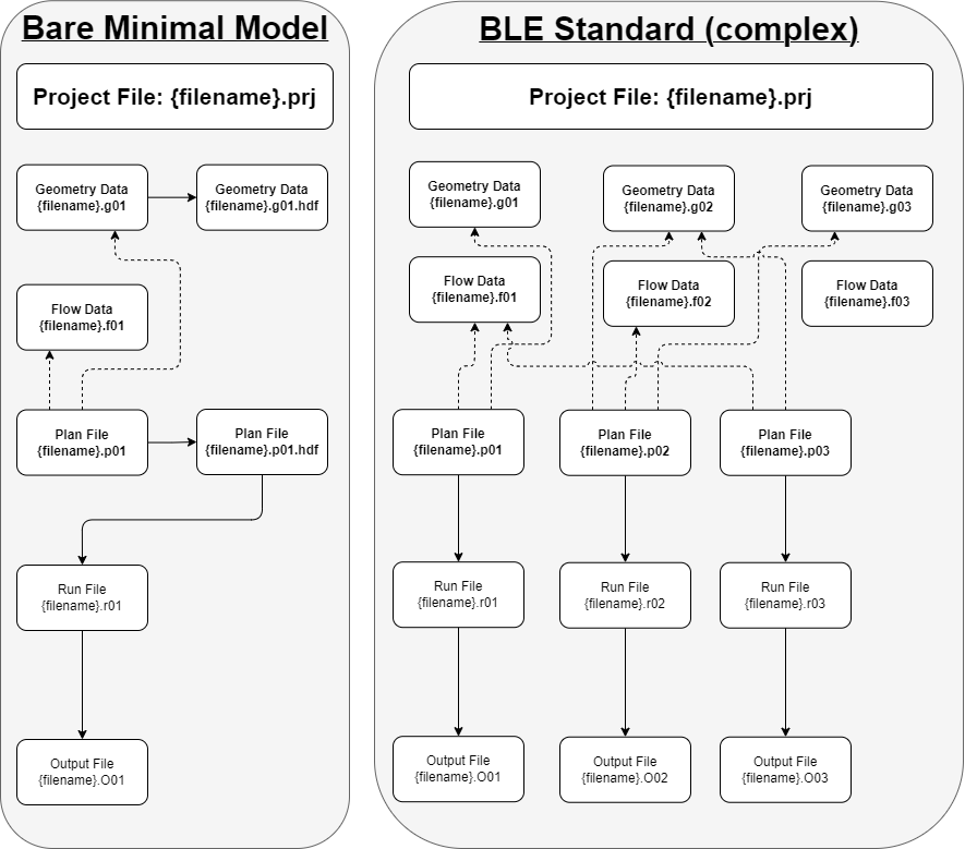
Files to Track
| File grep Pattern (# denotes single numeric wildcard) | HEC-RAS Model Use |
|---|---|
| .g## | Geometry definitions |
| .prj | Projection (can be non-standard proj4 string defined file) |
| .prj | Project (same extension, defines how RAS models are wired) |
| .p## | Plan file, used to drive the model |
| .f## | Steady Flow file. Profile information, flow data and boundary conditions |
| .h## | Hydraulic Design data file |
| .v## | Velocity file |
| .o## | Output file |
| .r## | Run file for steady flow |
| .u## | unsteady Flow file. Profile information, flow data and boundary conditions |
| .x## | Run file for unsteady flow |
| .dss | Data files |
| .rasmap | Output plan |
These files, followed by a .hdf, are transformations of their counterparts needed for newer versions of HEC-RAS and are automatically created as needed.
The HEC-RAS model format
A “real-world” example
Files to Track
| File grep Pattern (# denotes single numeric wildcard) | HEC-RAS Model Use |
|---|---|
| .g## | Geometry definitions |
| .prj | Projection (can be non-standard proj4 string defined file) |
| .prj | Project (same extension, defines how RAS models are wired) |
| .p## | Plan file, used to drive the model |
| .f## | Steady Flow file. Profile information, flow data and boundary conditions |
| .h## | Hydraulic Design data file |
| .v## | Velocity file |
| .o## | Output file |
| .r## | Run file for steady flow |
| .u## | unsteady Flow file. Profile information, flow data and boundary conditions |
| .x## | Run file for unsteady flow |
| .dss | Data files |
| .rasmap | Output plan |
These files, followed by a .hdf, are transformations of their counterparts needed for newer versions of HEC-RAS and are automatically created as needed.

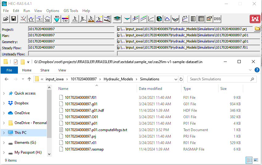
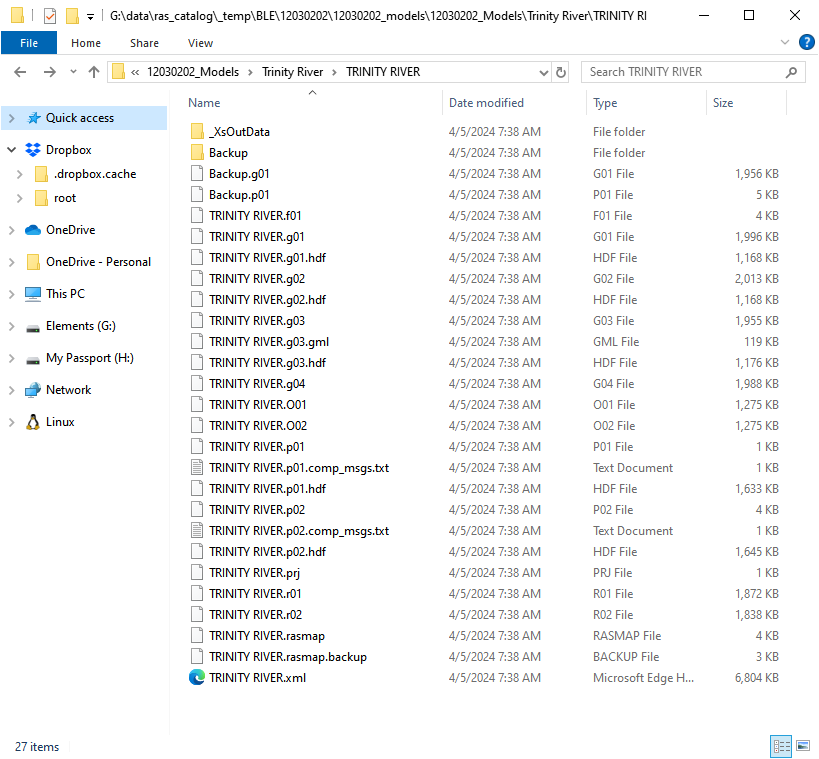
Even After Overcoming the Pain of Reading in a HEC-RAS model…
Other Potential Readers
- Point and click through the HEC-RAS interface to export
- Con: Unaccountable and unsustainable
-
Pro: I can do it

-
MCAT-RAS
- I am unfamiliar with go, it’s implemented language.
- pyHMT2D is primarily oriented towards 2D.
Can you answer these questions?
- Where are models?
- What cross sections do I have for my network?
- Is this the same model?
Models from Different Providers?
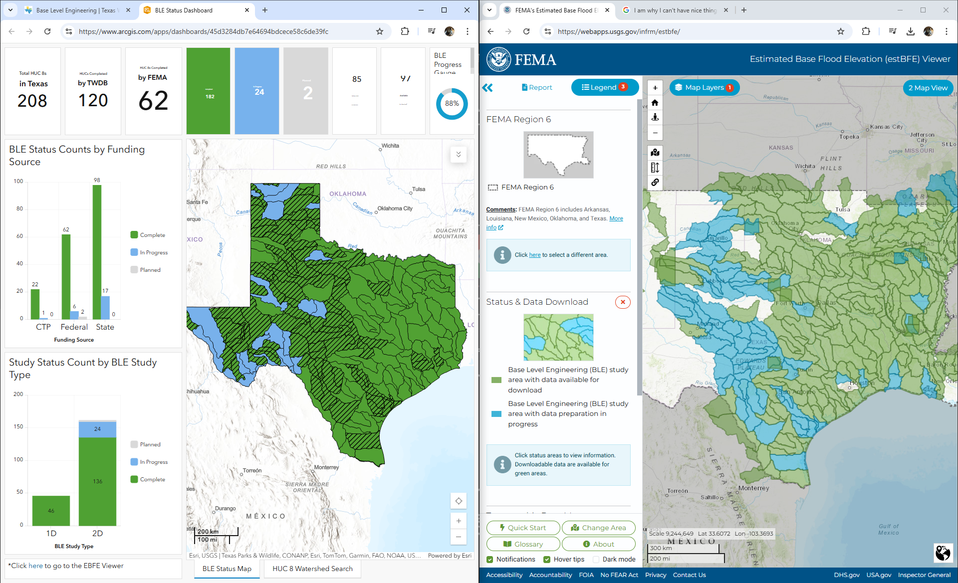
asynchronous update cycles
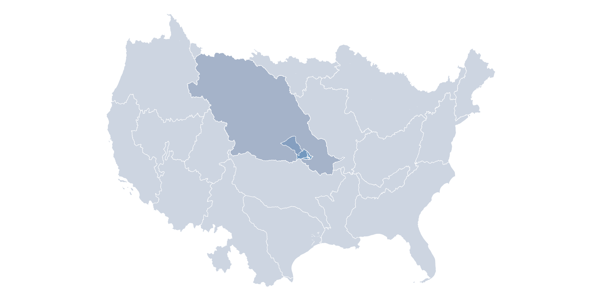
Models from Broad Geographies
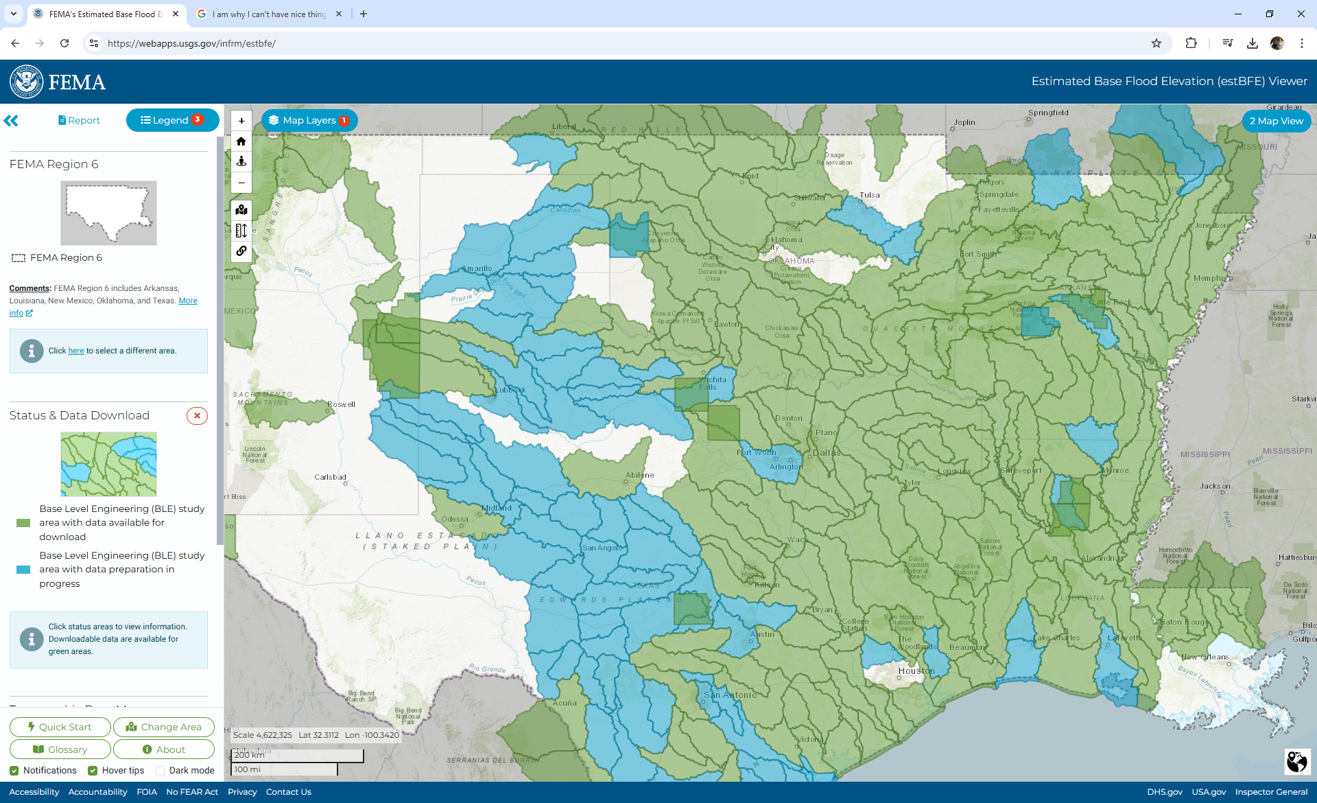
Clashing spatial units
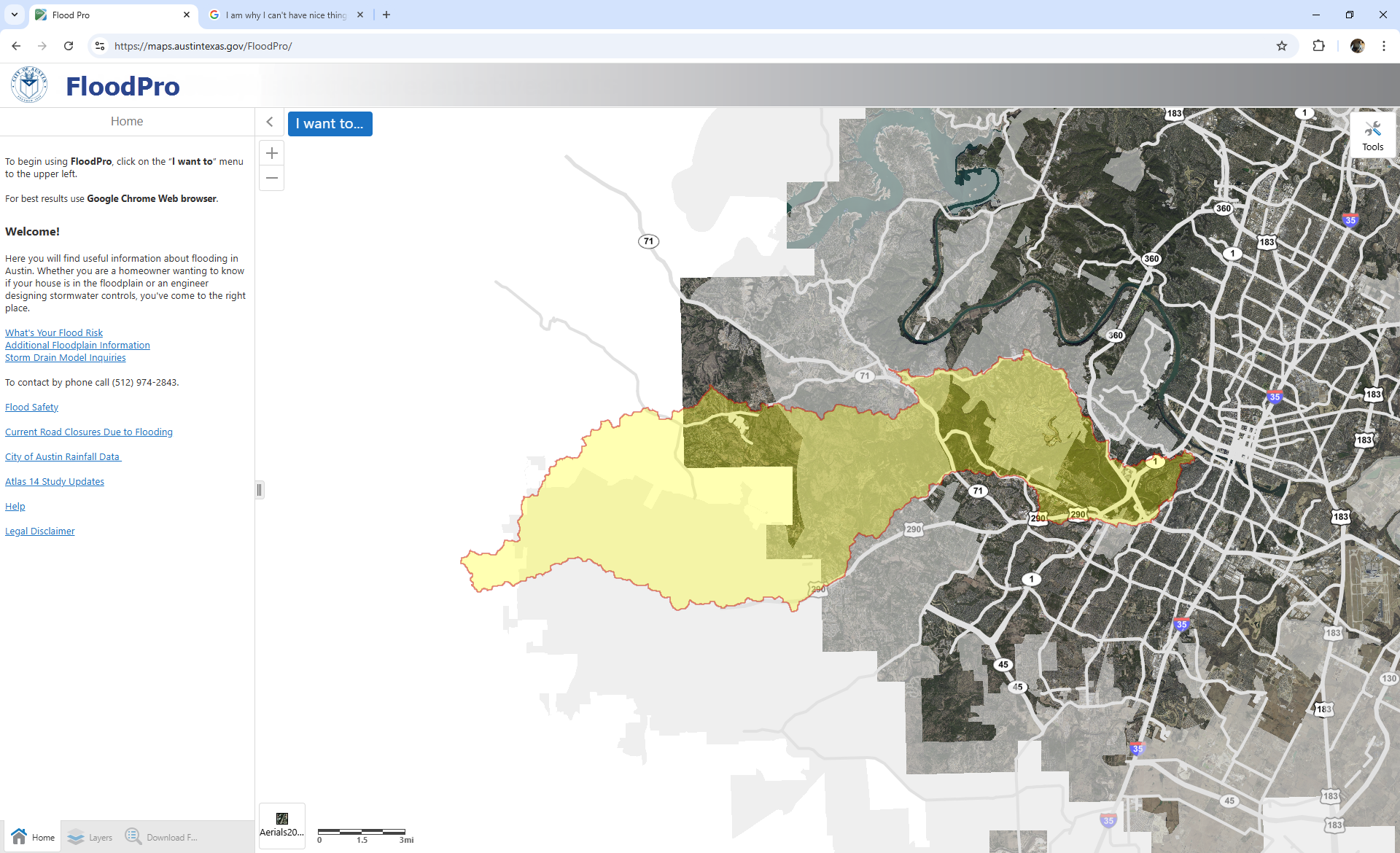
Models at street scale: Example Austin FloodPro
Manual subsetting
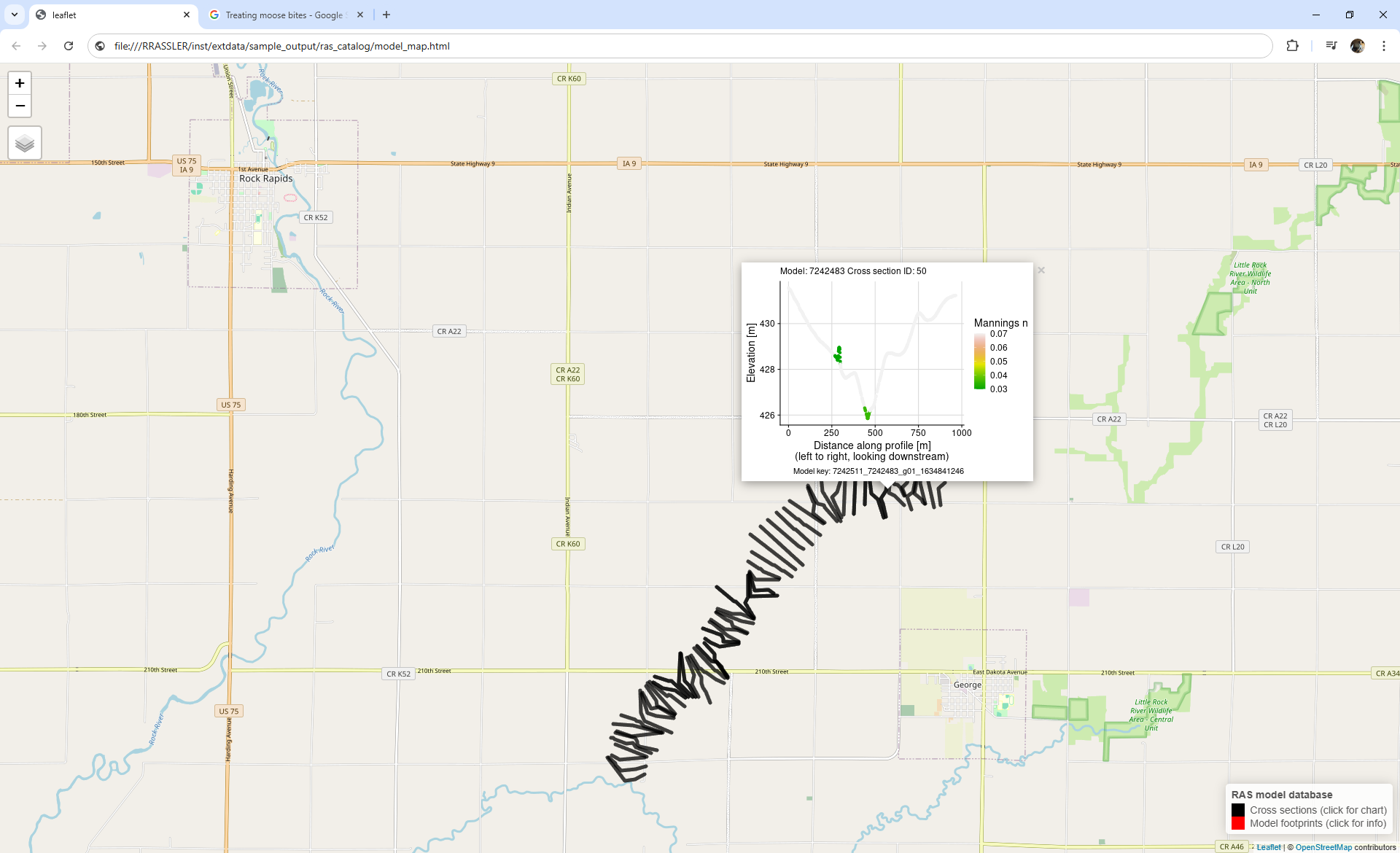
RRASSLER Can!
“Where are models?” – See the mapping vignette!
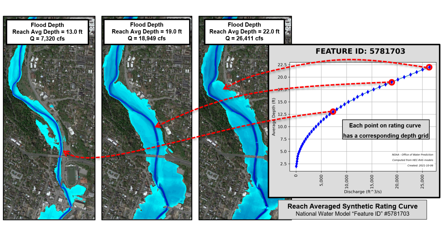
Review: RAS2FIM V1
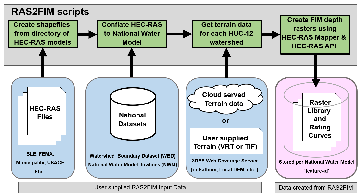
Review: RAS2FIM V2
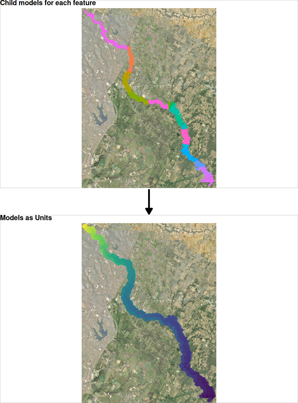
Model chopping impacts
Version 1
Version 2
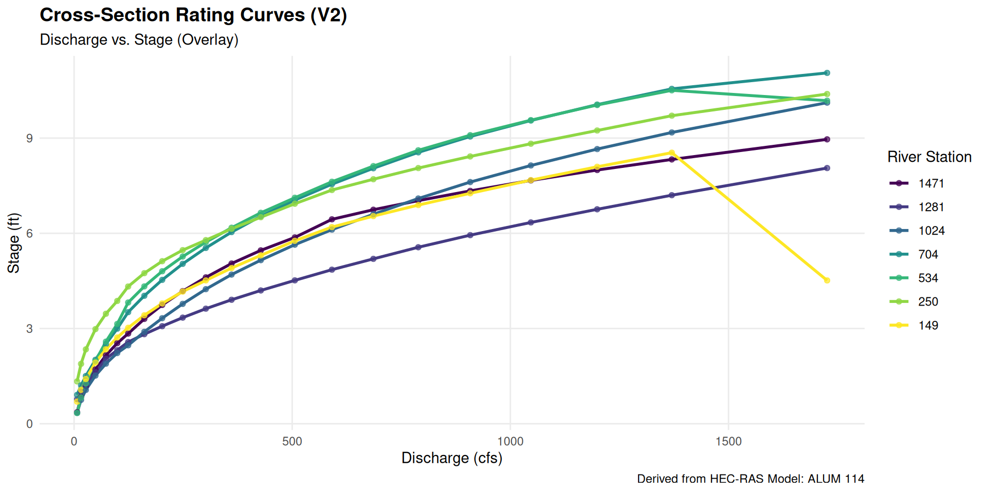
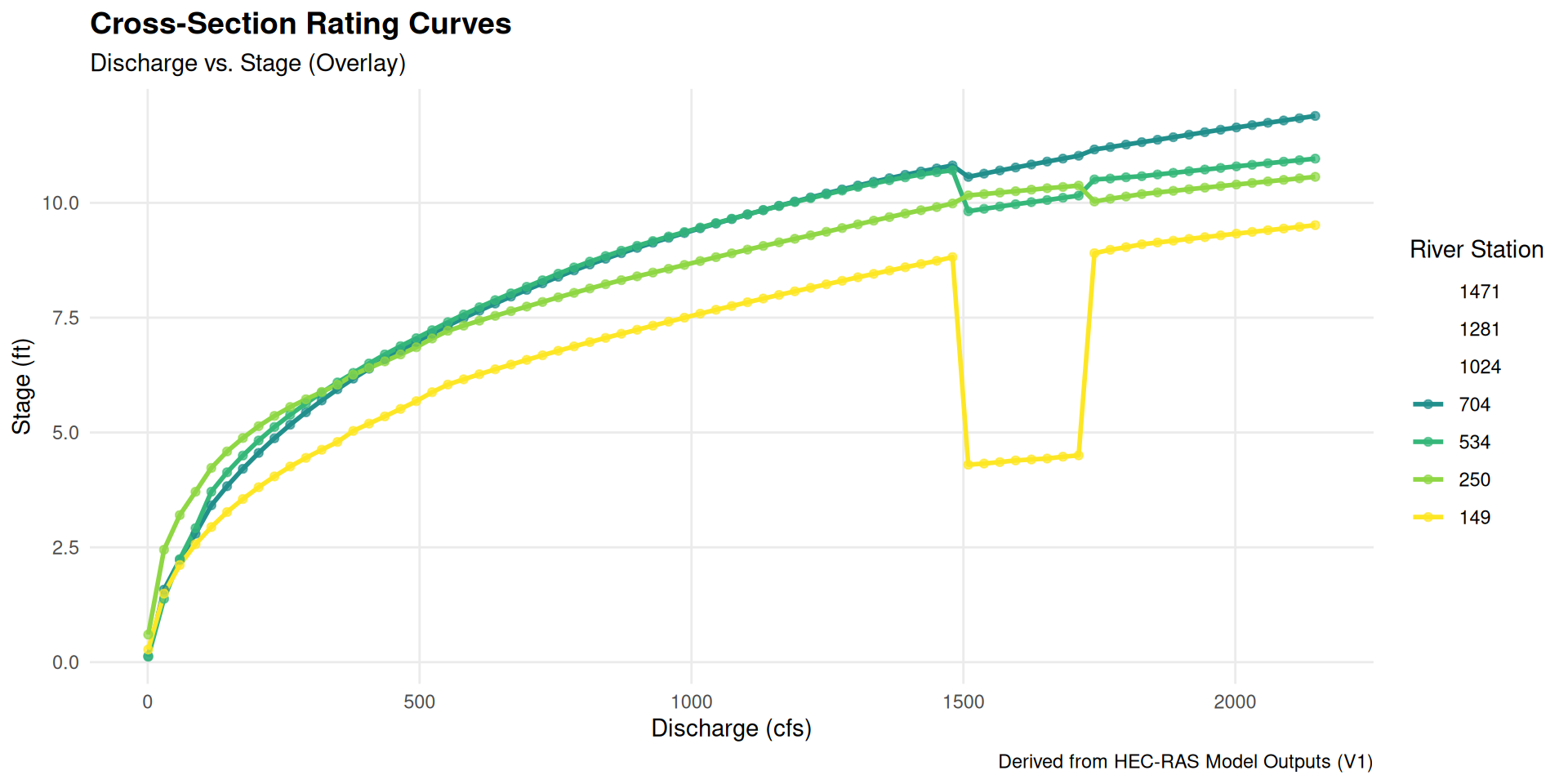
Differences in automation
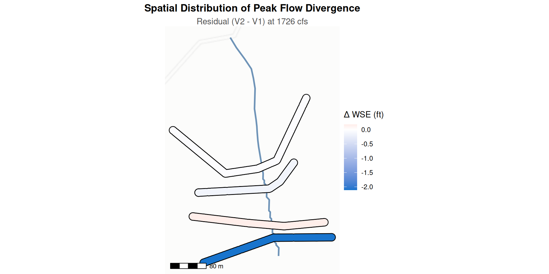
| Model Comparison Metrics | ||||
| Analysis of WSE Residuals (V2 - V1) across interpolated flow range | ||||
| River Stationing | MAE (ft) | RMSE (ft) | Mean Bias (ft) | Max Absolute Diff (ft) |
|---|---|---|---|---|
| 704 | 0.024 | 0.057 | 0.008 | 0.478 |
| 534 | 0.055 | 0.129 | 0.022 | 0.549 |
| 250 | 0.026 | 0.057 | −0.014 | 0.351 |
| 149 | 0.252 | 0.631 | 0.117 | 2.618 |
| Metrics calculated over the shared discharge domain. | ||||
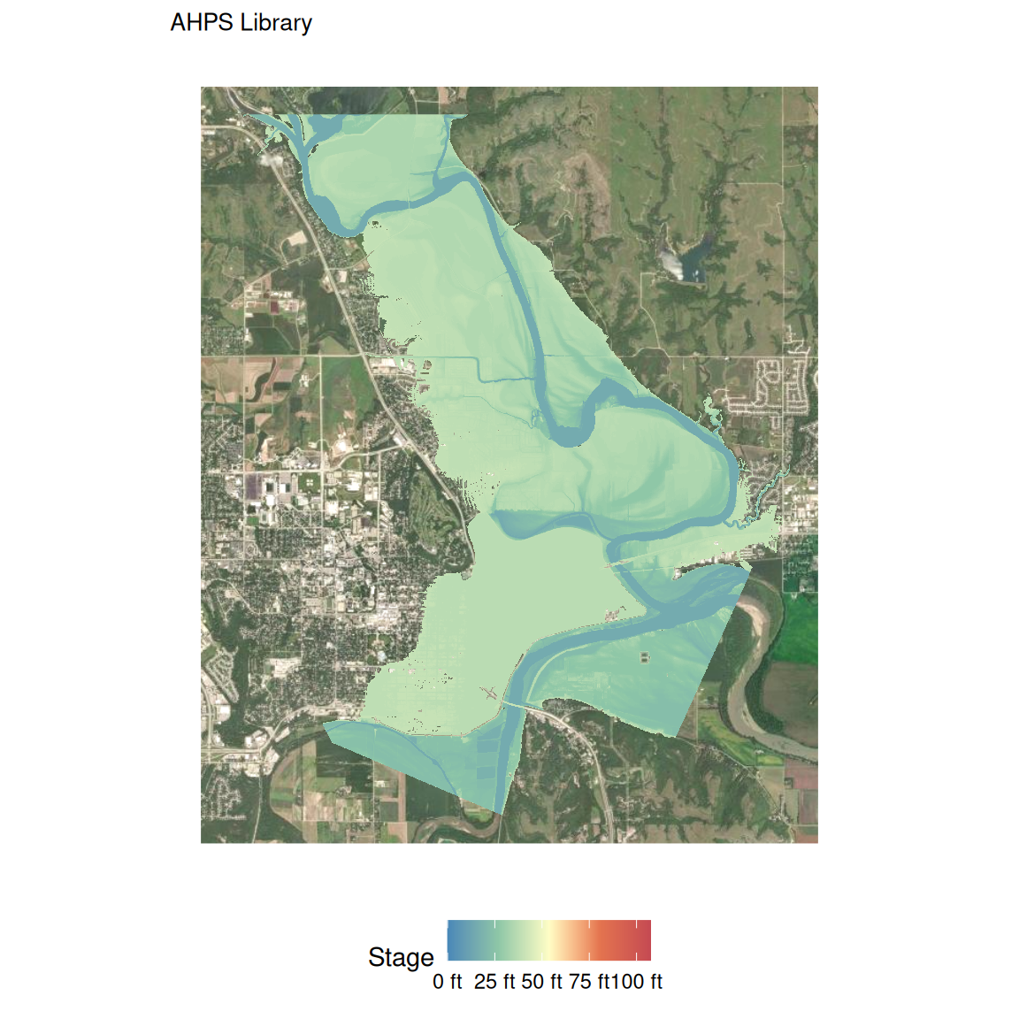
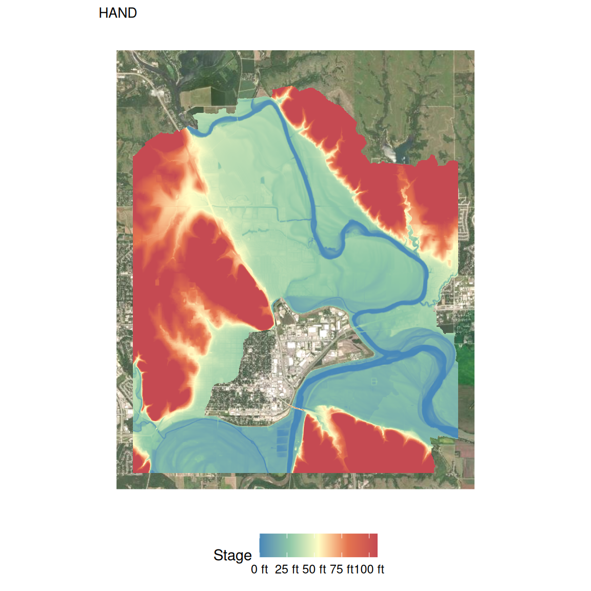
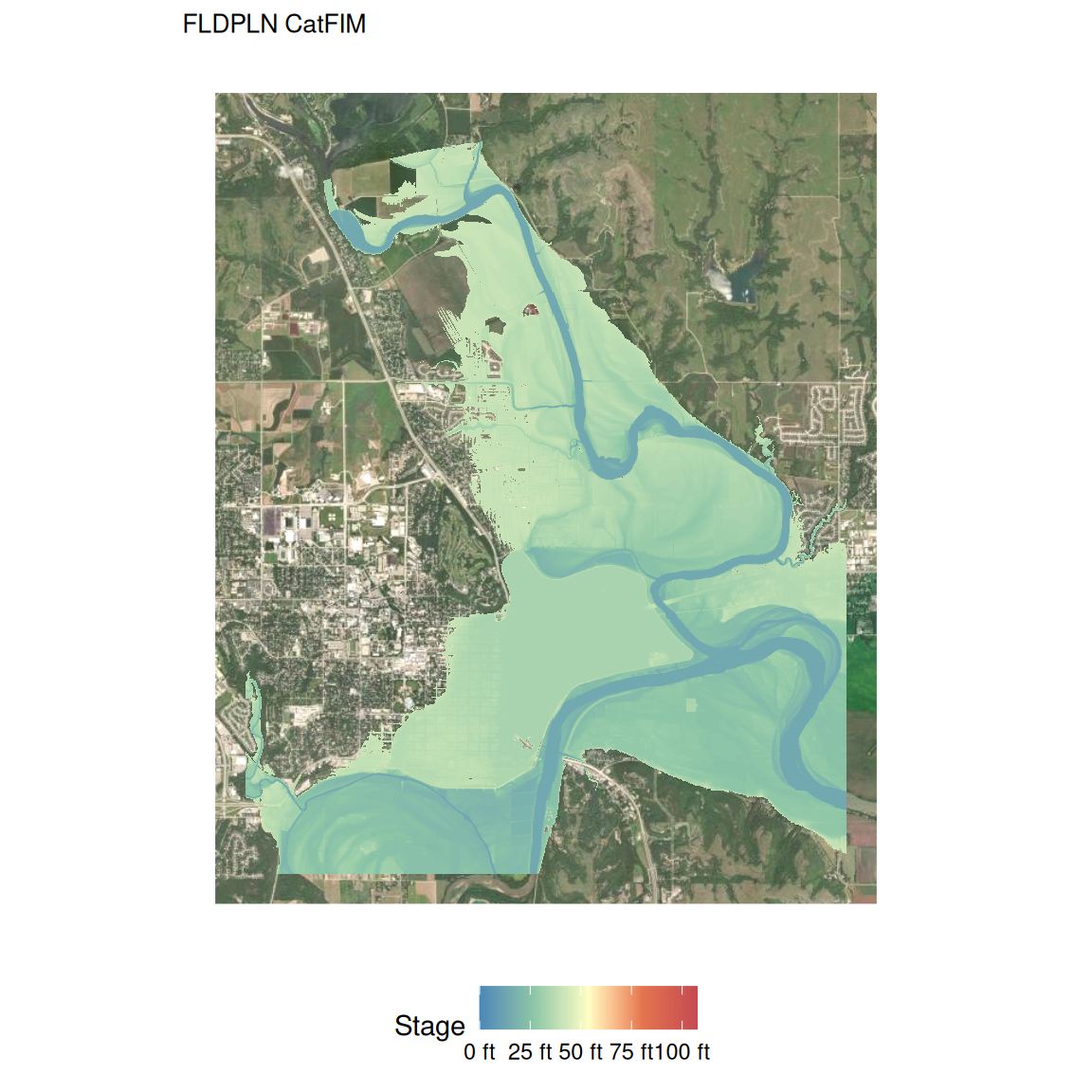
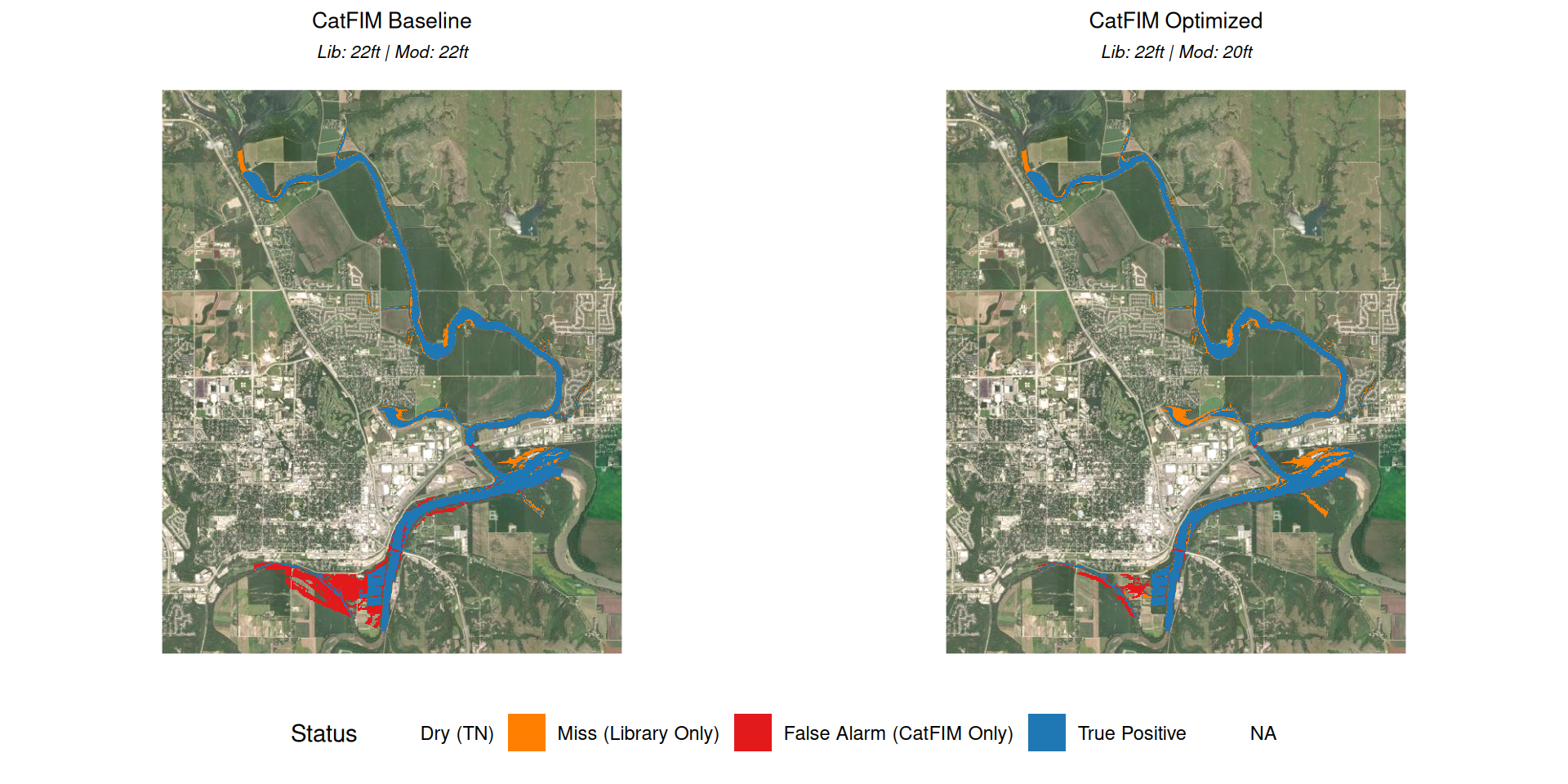
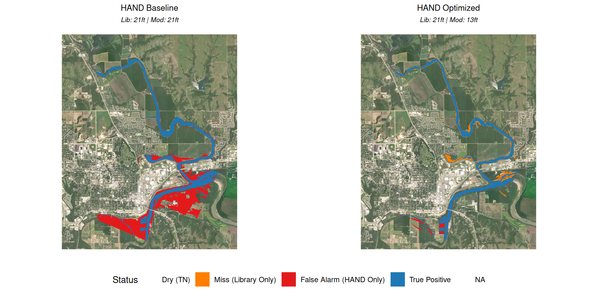
The FIM Bake-off: Mosaics of CatFIM
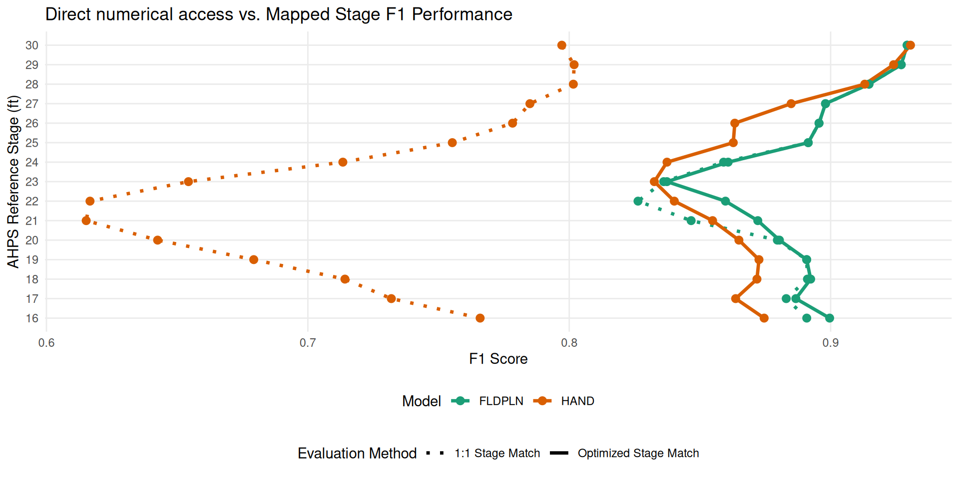
Optimizing Access Patterns
Conclusions and Contributions
Conclusions
- FAIR principles unlock scale: Data transformations are required to facilitate complex process integration across domains.
- Legacy models have a second life: Existing models contain highly usable information when properly spatialized and harmonized.
- Monolithic > Segmented: Processing large hydraulic models as units significantly transforms hydraulic predictions, physical subsetting improves computational speed.
- Decoupling is necessary: Separating hydrologic, hydraulic, and geospatial drivers from map creation allows disparate libraries to form a clearer operating picture.
Contributions
- RRASSLER: Developed a novel utility to spatialize legacy HEC-RAS models, aligning them with FAIR data principles.
- RAS2FIM: Created an automated framework to generate inundation libraries that integrate directly with National Water Model (NWM) forecasts.
- Architectural Clarity: Oriented towards the separation of concerns between Modeling (the underlying mechanics) and Mapping (the communication of those results).
- Towards Operational implementation: Moved the conceptual bottleneck from mundging towards the communication of actionable maps.
Thank you
Outcomes:
Next Steps:
- Scale and extension: Both RRASSLER archives and RAS2FIM methodologies have room for enhancements and extensions.
- Mapping and Modeling surface adaptation - healing and impacts.
- Optimization: Accessibility across user base and compute environment.
- Write: One of these day’s I’ll figure that out.
See notes (s) and frames for image sources.