Gage FIM
Executive Summary
The United States Geologic Survey and the National Water Prediction Service Flood Inundation Maps are a series of stage relative depth maps for each river gage that has a survey. These depth grids are model outputs from contractors who developed hydraulic models and standardized the output. There are two main sources of inundation maps at a federal level. The first is the USGS Flood Inundation Mapping Program (Flood Inundation Mapping (FIM) Program U.S. Geological Survey, n.d.). The second, The National Water Prediction Service Flood Inundation Mapping services through the National Weather Service (NOAA - National Weather Service - Water, n.d.). These two separate databases both reference the same standards document (Dewberry 2011), and are often blended together.
From USGS
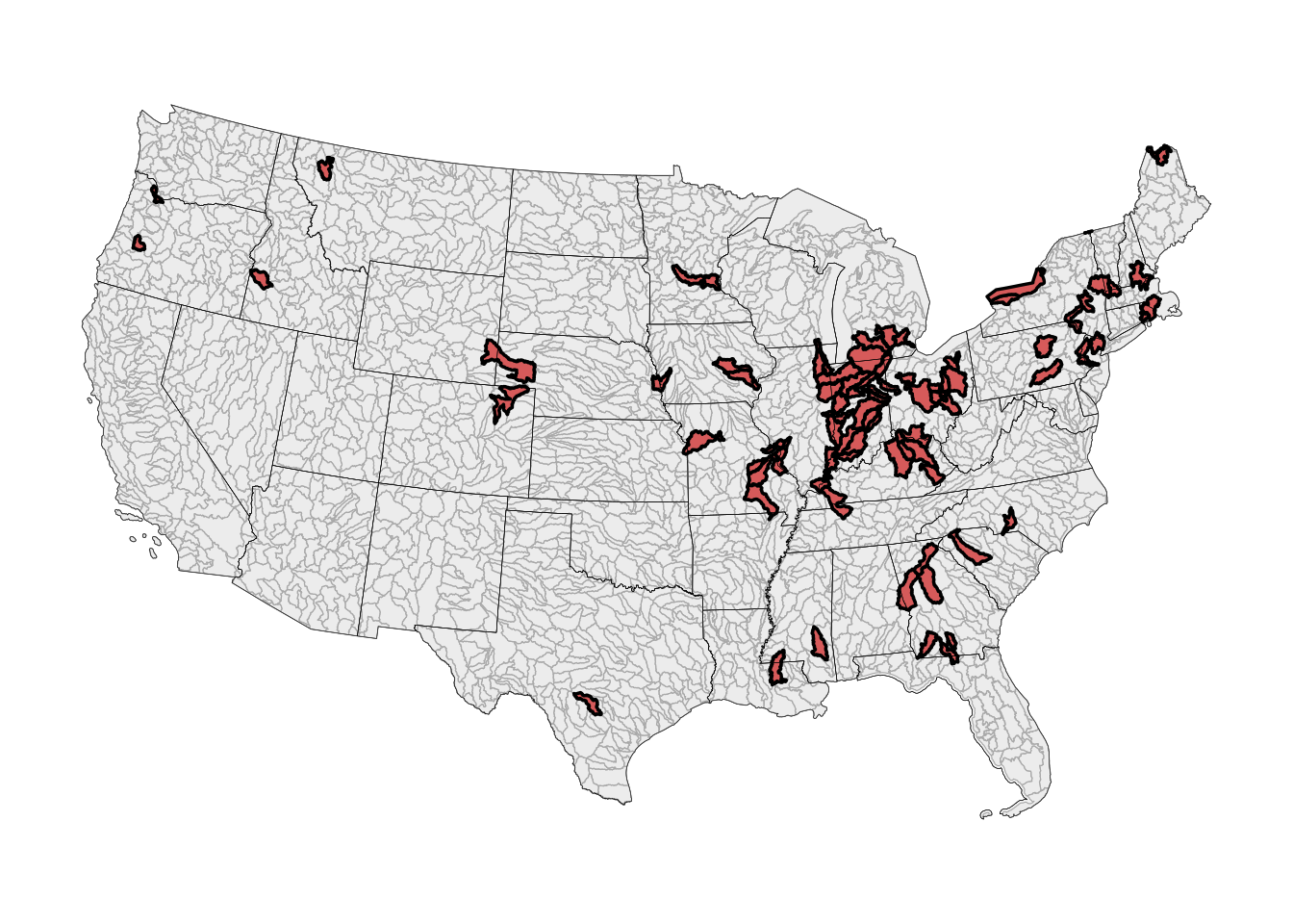
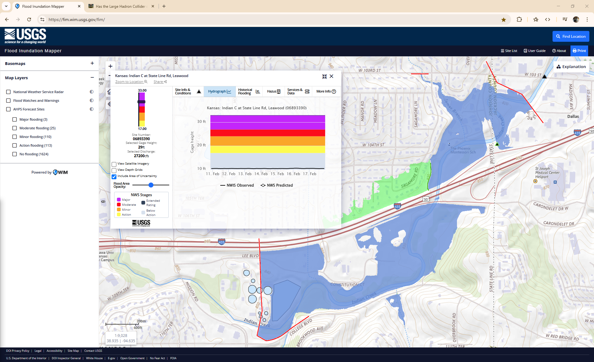
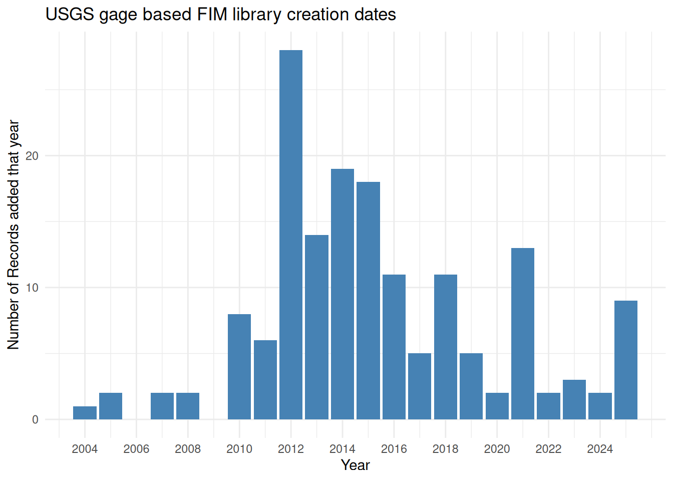
FIM libraries proffered by the USGS can be accessed at https://fim.wim.usgs.gov/fim/. These high-impact areas receive the highest base confidence level, take months/years to develop, and have operational attention turned towards them on a nearly daily basis. These libraries have accumulated over many years and are currently comprised of 163 libraries.
From NOAA
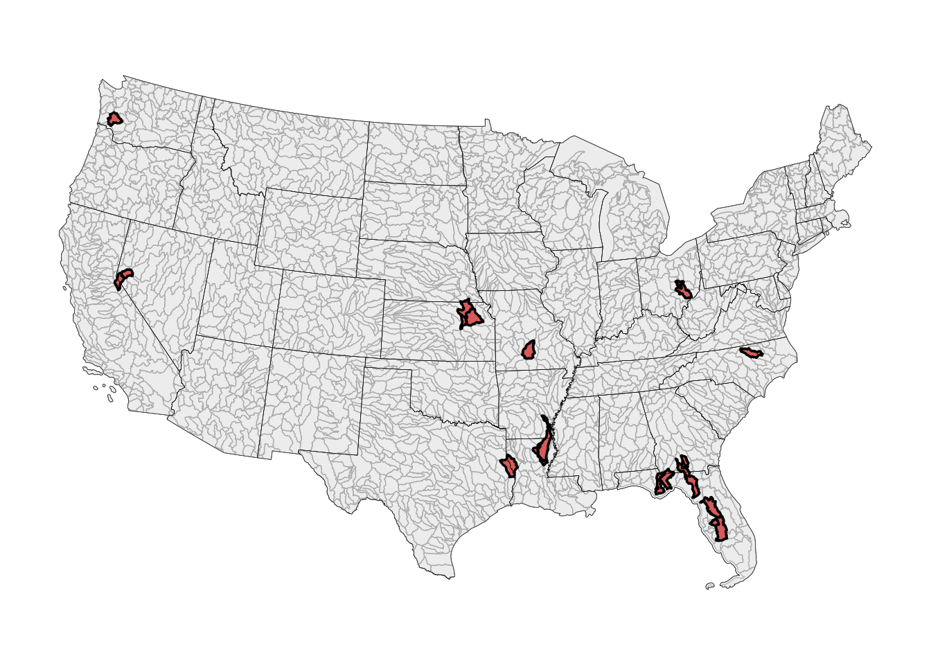
Partner FIM (sometimes called “Furnished Libraries”)
Partner FIM from NOAA found at https://water.noaa.gov/ is just as frequently used but has not yet been as tightly consolidated as their USGS counterparts. These are also developed or provided by more local and regional partners and reflect large buy-in from the many stakeholders who “furnish” them for use.
How To:
- The structure of these FIM libraries is not quite as predictable or structured as their CONUS-scaled counterparts1. Let’s explore that structure here.
References
Dewberry. 2011. Guidelines for the Development of Advanced Hydrologic Prediction Service Flood Inundation Mapping. NOAA.
Flood Inundation Mapping (FIM) Program U.S. Geological Survey. n.d. Https://www.usgs.gov/mission-areas/water-resources/science/flood-inundation-mapping-fim-program.
NOAA - National Weather Service - Water. n.d. Https://water.weather.gov/ahps/inundation.php.