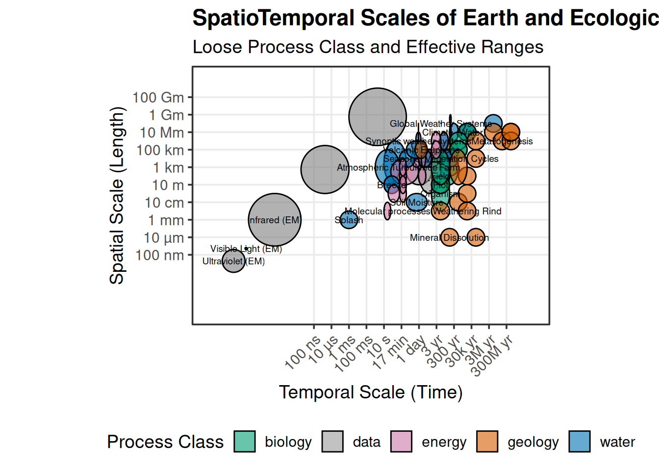
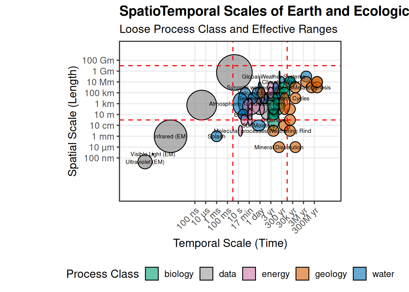
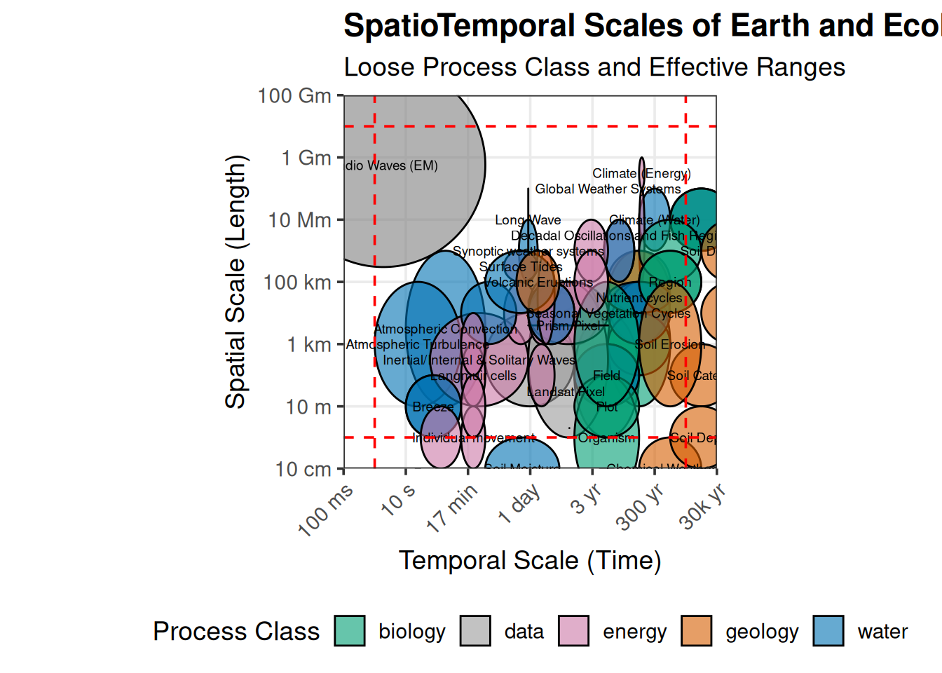
Scale
One of the next aspects to tackle after agreeing on the concerns we’re trying to tackle is the scale of your problem. Simultaneously, one of the most frustrating aspects is that scale and geographic context are more often subjective to the individual instead of the objective measures they represent, and are poorly addressed when they are addressed at all. The trans-boundary, cyclical, and critical nature of the water cycle make this an even harder problem to constrain. Scaling is not something to take trivially, it’s not easy to do well precisely because the wicked problem your working likely changes as that domain increases. While we don’t have to extend ourselves to the extremes of scales that broad humanity has defined; the processes, systems, and actors within the earth system none the less encompasses 10’s of orders of magnitudes across time and space.
Even when we narrow that range of scales down to the tangible ranges across which we measure and act at, that’s still nearly 10 orders of magnitude we are attempting to encapsulate. This is further complicated because the delineations between some of these is very artificial, and more a function of the comfort of socio-political concerns rather than on some foundation on communicating reproducible knowledge.
Scales in computation
My wicked problems with water scale even more ingracefully because those computational burdens compound as we bridge resolutions from 10’s of observations per second to 10’s of kilometers per decade. Although the Y axis is logarithmic, it still does a poor job describing how analysis and domain scale interact to calculate computational burden. As an example, let’s take three “common” scales, a watershed, a state, and CONUS, and look at how those interact as the resolution of your analyses increases.

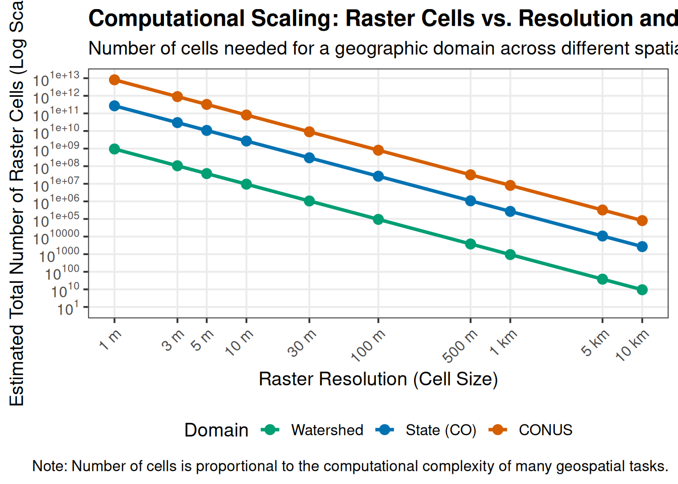
These scales become modeler choices, and we should be cognizant that decisions made here have ramifications across the entirety of our modeling efforts.