NWPS
Water
Operational
Measured
FIM
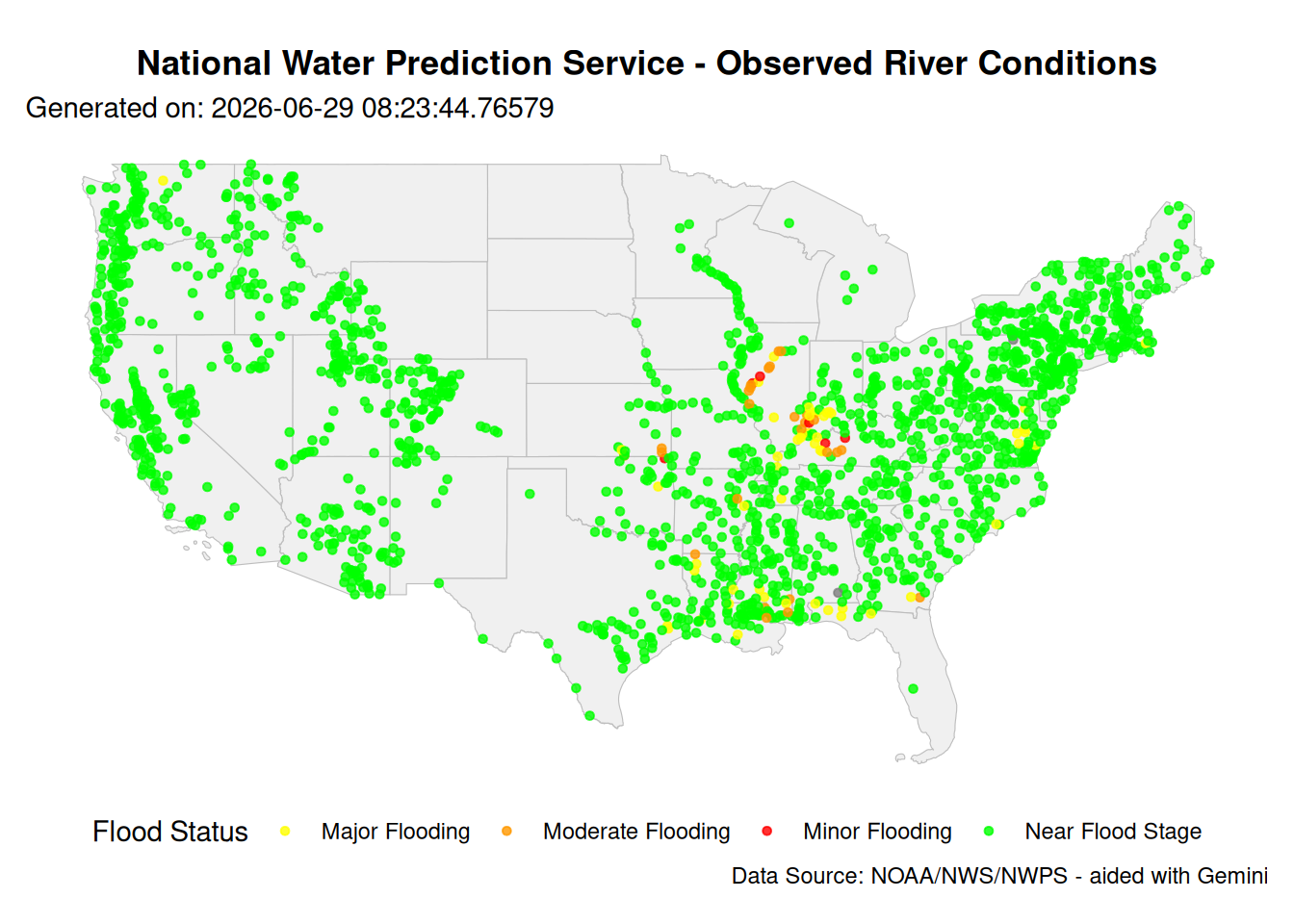
The National Water Prediction Service (NWPS) system of river gages
Back to Data Sources
The National Water Prediction Service (NWPS) (once called Advanced Hydrologic Prediction Service (AHPS) Mark Glaudemans (2024)), is the platform used to disseminate river forecasts and observations.exposing data collected by by the USGS and NOAA, and are our primary means of accounting and managing our water resources at scale and are available to download at https://water.noaa.gov/resources/downloads/. White these represent many of our nations gages, you can find subsets specifically within the coastal domain from CO-OPS gages.
Aux Bounds
See: NWS boundaries page.
References:
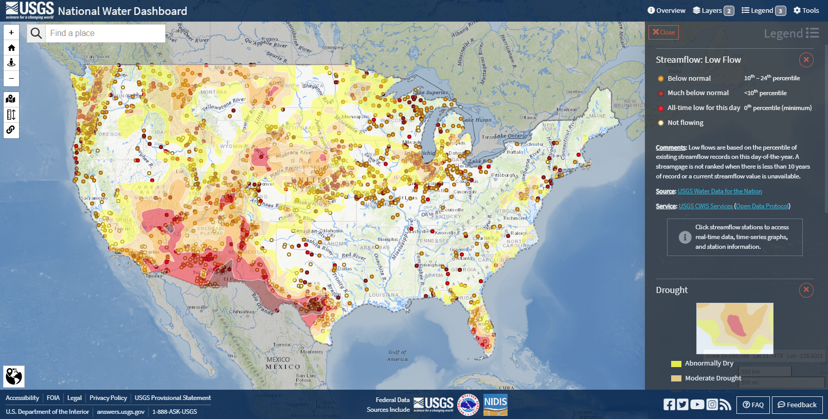
One of the most recognizable visualizations in hydrology, the gage “traffic light” or “skittles” map colors streamgages based on their current discharge relative to historical records. This visualization provides an immediate, state-wide assessment of hydrological drought or flood conditions.Formally, the color of a gage is determined by the percentile rank (\(P\)) of the current instantaneous discharge (\(Q_{now}\)) compared to the historical distribution of daily mean discharges (\(Q_{hist}\)) for that specific day of the year.
Reference
- Splash images from https://forecast.weather.gov/wwamap/png/US.png
References
Mark Glaudemans. 2024. Scn24-03_exp_nwps_website_t2o. NOAA.