CO-OPS
Water
Operational
Measured
FIM
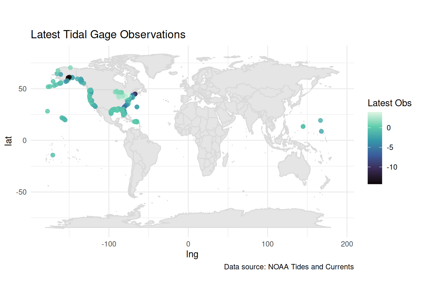
Critical ocean observation gages
Back to Data Sources
Coastal gages1 can be collected from https://tidesandcurrents.noaa.gov/inundationdb/data/ or the API at https://opendap.co-ops.nos.noaa.gov/ioos-dif-sos/, and look something like this:
HowTo:
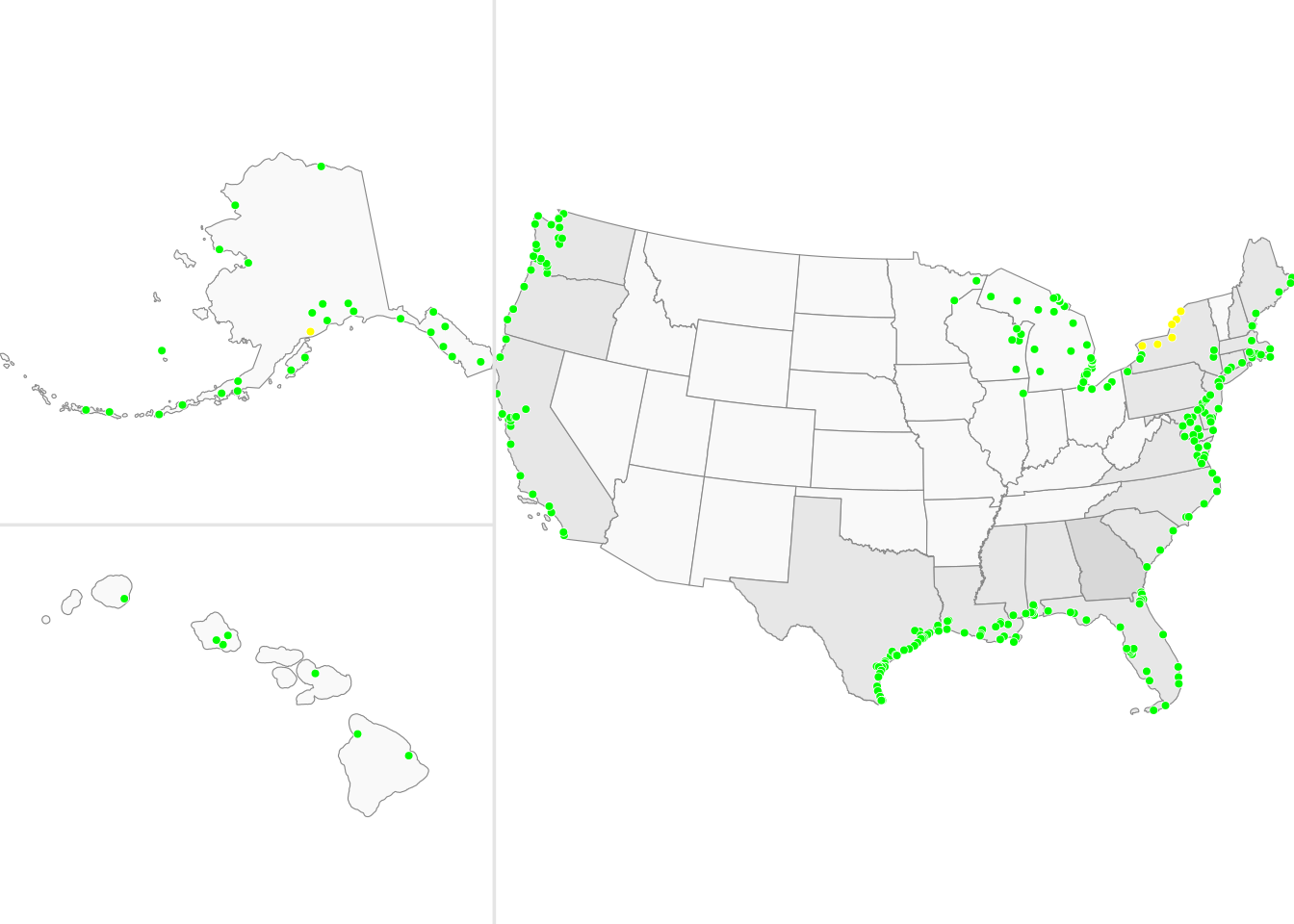
Severity map:
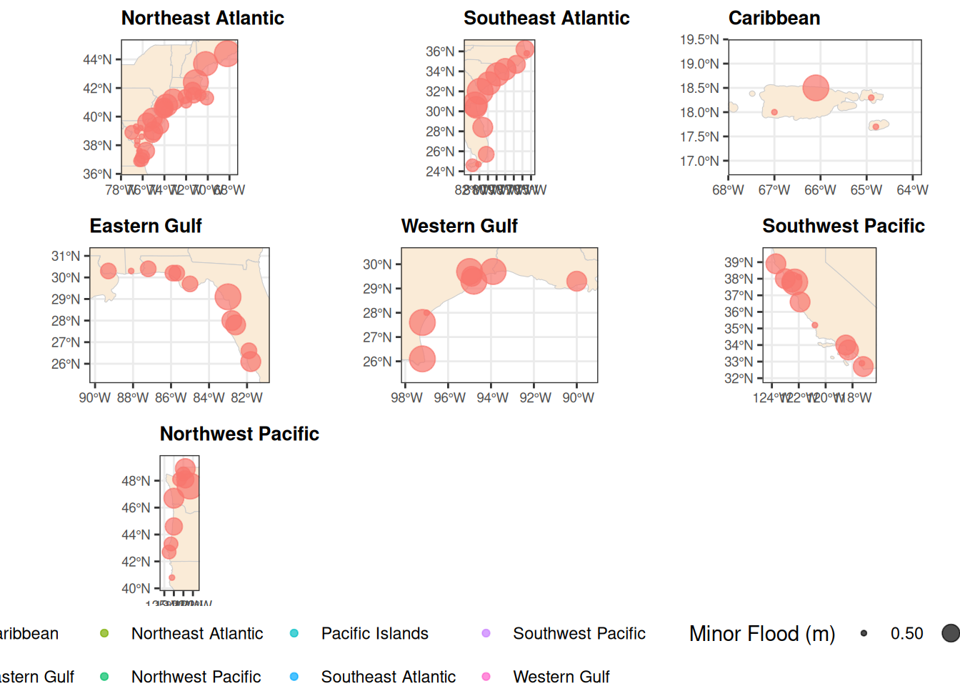
Tangentially related
Others may be collected from sources like Sweet et al. (2018), see my review/highlights for more details.
How do their values compare across stastions?
plot_data <- sweet_sf |>
  sf::st_drop_geometry() |>
  # Pivot all threshold columns into 'source' (NOAA vs Derived) and 'category' (Minor/Moderate/Major)
  tidyr::pivot_longer(
    cols = matches("^(noaa|derived)_(minor|moderate|major)"),
    names_to = c("source", "category"),
    names_sep = "_",
    values_to = "threshold_value"
  ) |>
  # Remove NAs where stations lack NOAA threshold data
  dplyr::filter(!is.na(threshold_value)) |>
  dplyr::mutate(category = factor(category, levels = c("minor", "moderate", "major")))

# 2. Generate the Violin Plot
diff_plot <- ggplot2::ggplot(plot_data, ggplot2::aes(x = category, y = threshold_value, fill = source)) +
  ggplot2::geom_violin(trim = FALSE, alpha = 0.7) +
  ggplot2::geom_boxplot(width = 0.15, position = ggplot2::position_dodge(0.9), outlier.shape = NA, alpha = 0.5) +
  ggplot2::scale_fill_manual(values = c("noaa" = "#1f78b4", "derived" = "#33a02c")) +
  ggplot2::theme_minimal() +
  ggplot2::labs(
    title = "Distribution of Coastal Flood Thresholds",
    subtitle = "Comparing NOAA Official vs. Derived Thresholds",
    x = "Flood Category",
    y = "Threshold Value (m)",
    fill = "Source"
  ) +
  ggplot2::theme(
    plot.title = ggplot2::element_text(face = "bold", size = 14),
    legend.position = "bottom"
  )
diff_plot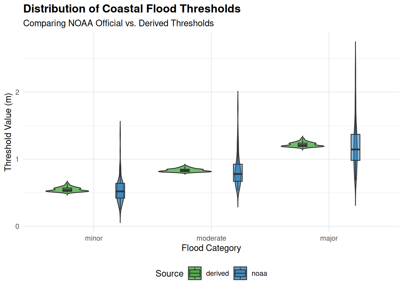
References
Sweet, William, Greg Dusek, Jayantha Obeysekera, and John J. Marra. 2018. “Patterns and Projections of High Tide Flooding Along the U.S. Coastline Using a Common Impact Threshold.” NOAA Technical Report, ahead of print, February. https://doi.org/10.7289/V5/TR-NOS-COOPS-086.