The continental flood inundation mapping (CFIM) framework
Executive Summary
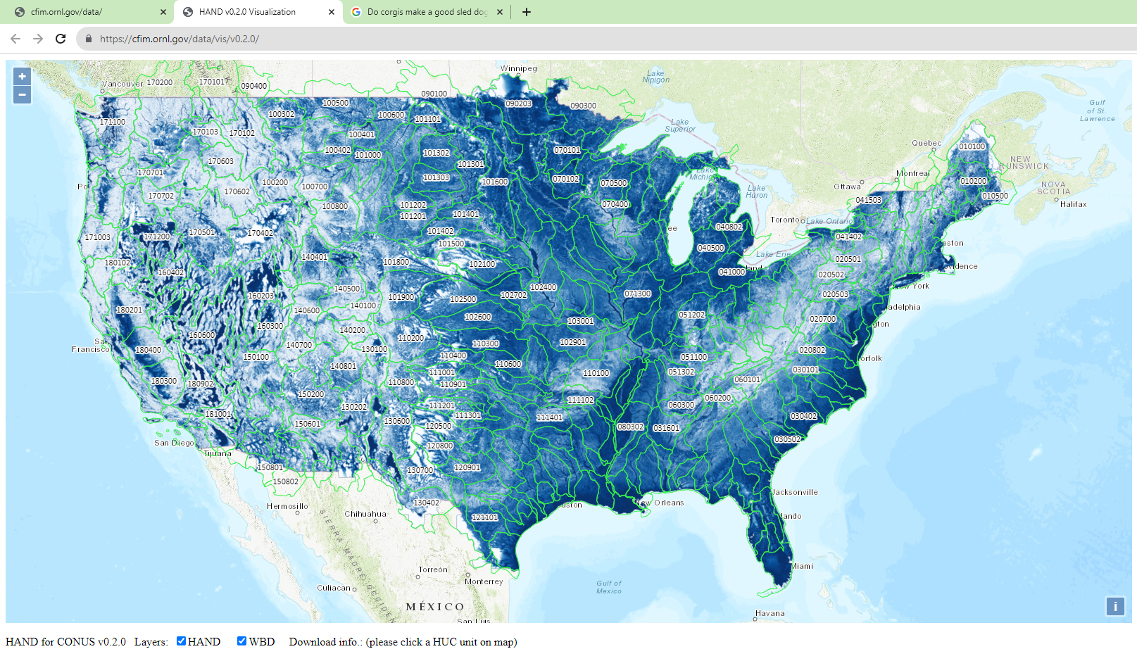
Best summerized by the developers themselves: “The continental flood inundation mapping (CFIM) framework is a high-performance computing (HPC)-based computational framework for the Height Above Nearest Drainage (HAND)-based inundation mapping methodology. Using the 10m Digital Elevation Model (DEM) data produced by U.S. Geological Survey (USGS) 3DEP (the 3-D Elevation Program) and the NHDPlus hydrography dataset produced by USGS and the U.S. Environmental Protection Agency (EPA), a hydrological terrain raster called HAND is computed for HUC6 units in the conterminous U.S. (CONUS). The value of each raster cell in HAND is an approximation of the relative elevation between the cell and its nearest water stream. Derived from HAND, a hydraulic property table is established to calculate river geometry properties for each of the 2.7 million river reaches covered by NHDPlus (5.5 million kilometers in total length). This table is a lookup table for water depth given an input stream flow value. Such lookup is available between water depth 0m and 25m at 1-foot interval. The flood inundation map can then be computed by using HAND and this lookup table based on the near real-time water forecast from the National Water Model (NWM) at the National Oceanic and Atmospheric Administration (NOAA).” - from https://cfim.ornl.gov/data/