version type ncml
1 1.2 USGS nwm_retro_full.ncml
2 2.0 USGS nwm_v2_retro_full.ncml
3 2.1 USGS nwm_v21_retro_full.ncml
url
1 https://cida.usgs.gov/thredds/dodsC/demo/morethredds/nwm/nwm_retro_full.ncml
2 https://cida.usgs.gov/thredds/dodsC/demo/morethredds/nwm/nwm_v2_retro_full.ncml
3 https://cida.usgs.gov/thredds/dodsC/demo/morethredds/nwm/nwm_v21_retro_full.ncml
startDate endDate time_units
1 1993-01-01 00:00:00 2017-12-31 23:00:00 minutes since 1970-01-01 00:00:00 UTC
2 1993-01-01 00:00:00 2018-12-31 23:00:00 Hours since 1970-01-01 00:00:00 UTC
3 1979-02-01 01:00:00 2020-12-31 23:00:00 minutes since 1970-01-01 00:00:00 UTCNational Water Model

Quick links:
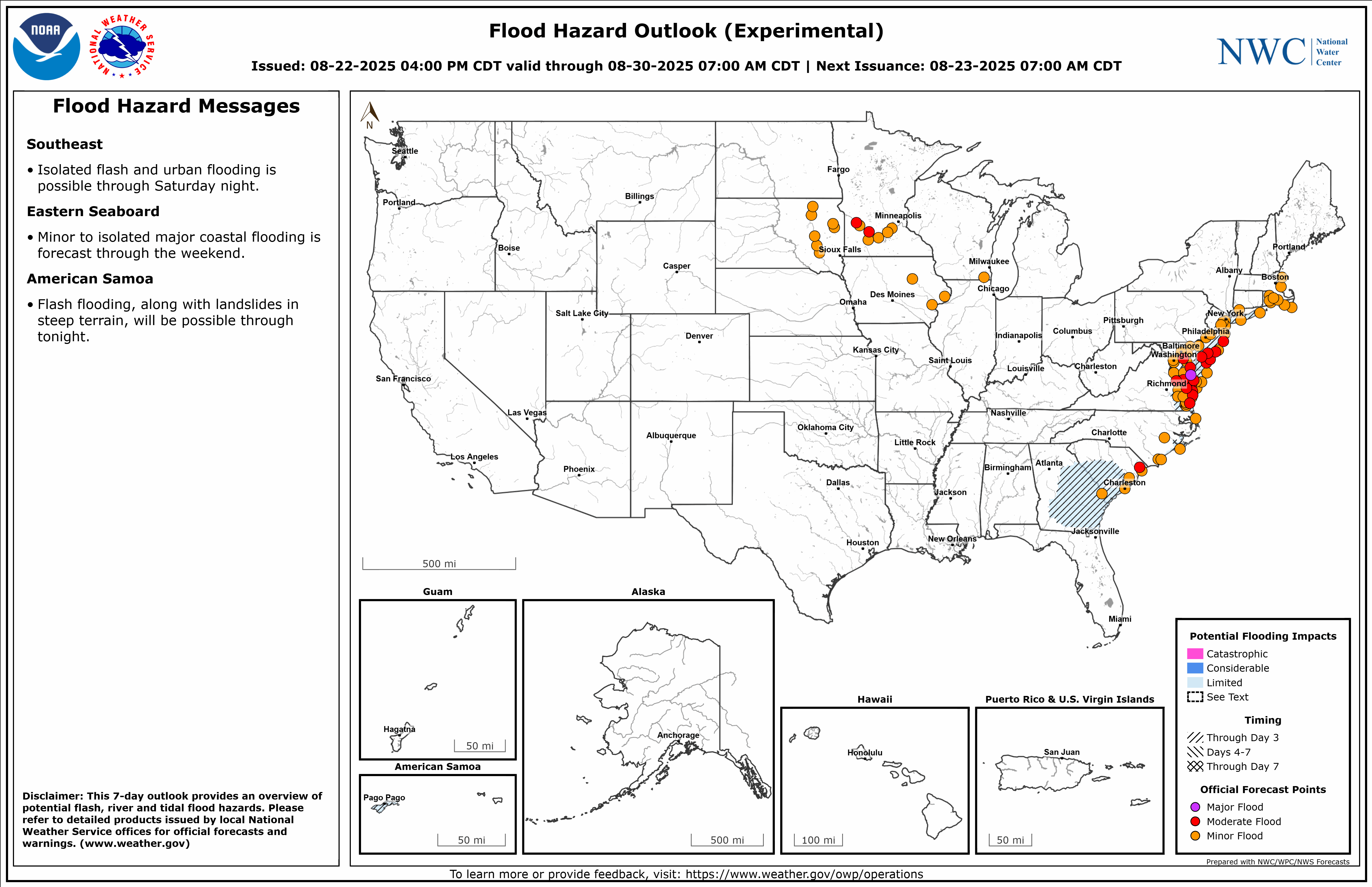
Flood Hazard Outlook (pictured IMAGE LIVE UPDATES) | National Water Center Products | NWS GIS Map
Executive Summary
Prior to 2016, the Nation relied on a piecemeal approach to forecasting the operational condition of our nations waterways; leaning on the local expertise of regional river forecast centers and the National weather service. With the release of the National Water Model, run out of the Office of Water Prediction in Tuscaloosa Alabama, the nation suddenly had a single, unified picture of the nations water ways at an unprecedented scale and resolution. Since then, improvements have enabled different model formulations to be run simultaneously which allows for the right model to be used in the right geography for the right reasons, greatly increasing the explainability of these predictions. These and other outputs from OWP are also what enable continental-scale flood inundation and impact mapping efforts. As a framework and particular implementation of the BMI standard and not any one single model, the National Water Model is currently composed of models like SCHISM and T-Route, and the outputs of these runs are used to drive FIM workflows.
HowTo
Tutorials
explanation
Concepts across the National Water Model: https://water.noaa.gov/about/nwm
Reference time: The time that the model is forecasting (At 12 z the rivers all had this value)
References
Pull NWM data from Google Cloud Platform
GCP Bucket: link
```{google cloud SDK shell}
gsutil -m cp -r "gs://national-water-model/nwm.{yyyymmdd}/short_range_coastal_atlgulf/" G:\data\raw\NWM\{yyyymmdd}\short_range_coastal_atlgulf\
gsutil -m cp -r "gs://national-water-model/nwm.{yyyymmdd}/short_range_coastal_atlgulf_psurge/" G:\data\raw\NWM\{yyyymmdd}\short_range_coastal_atlgulf_psurge\
```
And then push them to an open bucket so that the rest of the team can get to them.
```{aws}
aws s3 sync G:\data\raw\NWM\{yyyymmdd}\ s3://captian_filecopy/silly/NWM/{yyyymmdd}/
```
Retro data
Other sources: https://github.com/NOAA-OWP/hydrotools/issues/157