Geomorphic measures
Water
Thematic
Modeled
Measured
Geomorphic
Geomorphology, the hydrology of dirt
Back to Data Sources
A semantic caveat
This page references several datasets that are typically lumped into geomoprphic measures. Many include targeted representations from HEC-RAS models, while others are event specific field markers or hyper-resolution (sub-meter) scales in both system and measurement.
USGS High Water Marks
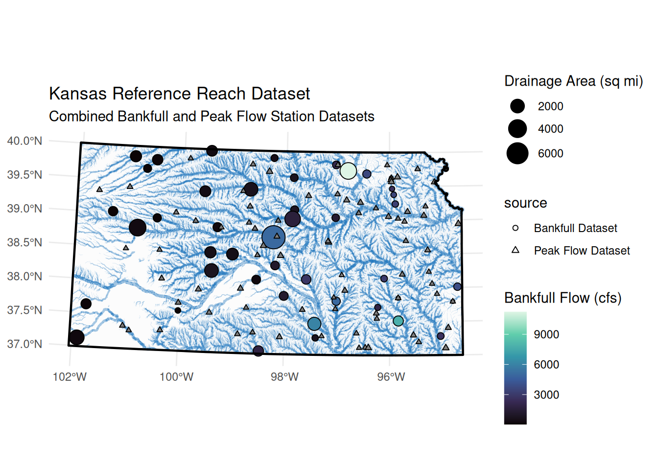
A Kansas Bankfull dataset
Based on Dr. Shelley’s PhD (Shelley (2012)), these natural geomorphic channel widths can be used across channel parameterization efforts. See my review for a little more detail.
Uses
These and At-A-Station hydraulic geometries can be used to constrain channel shape.
References
Shelley, John Edwin. 2012. “Geomorphic Equations and Methods for Natural Channel Design.” PhD thesis, University of Kansas.