NFIE
FIM
30m
The National Flood Interoperability Experiment is the grandfather of FIM
Back to Data Sources
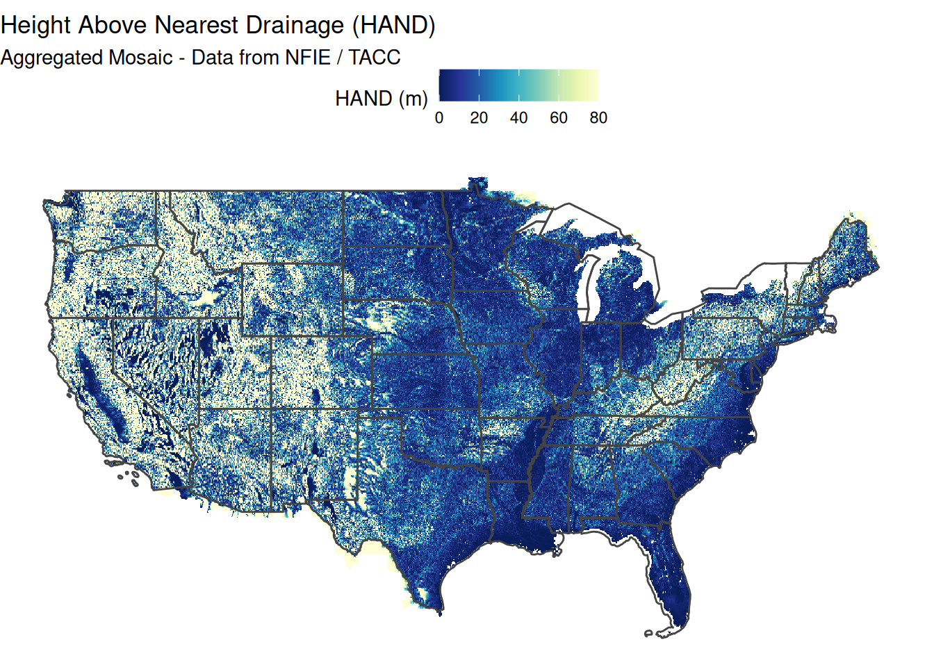
I leave this here as a foundation touchpoint, the first truly CONUS scale baseline off which to build on. This particular dataset lives on as the Continental Flood Inundation Mapping (CFIM) framework.
Since 2015, efforts towards producing real-time and future inundation forecasts for the US have resulted in the compilation of a 10 m resolution Height Above Nearest Drainage (HAND) layer for the continental United States (CONUS; Liu et al., 2018). The methodology for coupling streamflow predictions from the National Water Model (NWM) and HAND was initiated as part of the National Flood Interoperability Experiment (NFIE) (Maidment (2017)). The methodology has since been enhanced and added to the National Water Center (NWC) US flood forecasting framework (NOAA National Water Center, 2018).
The first iteration of geospatial flood mapping techniques arouse as part of the National Flood Interoperablilty Experiment hosted in the National Water centers summer Institute This iteration represented the first time the HAND/SRC was Run Country scale and operational forecasts were being released for every attachment represented in the network from there the inundation library generation software was written for every and then returned to open source software methods and what is publicly available now as Cahaba known internally as FIM3.
References:
Available to download at https://web.corral.tacc.utexas.edu/nfiedata/HAND/
References
Maidment, David R. 2017. “Conceptual Framework for the National Flood Interoperability Experiment.” JAWRA Journal of the American Water Resources Association 53 (2): 245–57. https://doi.org/10.1111/1752-1688.12474.