USFIMR - The U.S. Flood Inundation Mapping Repository
Water
Measured
FIM
A communal focal point for FIM benchmark data capturing events and metadata across CONUS
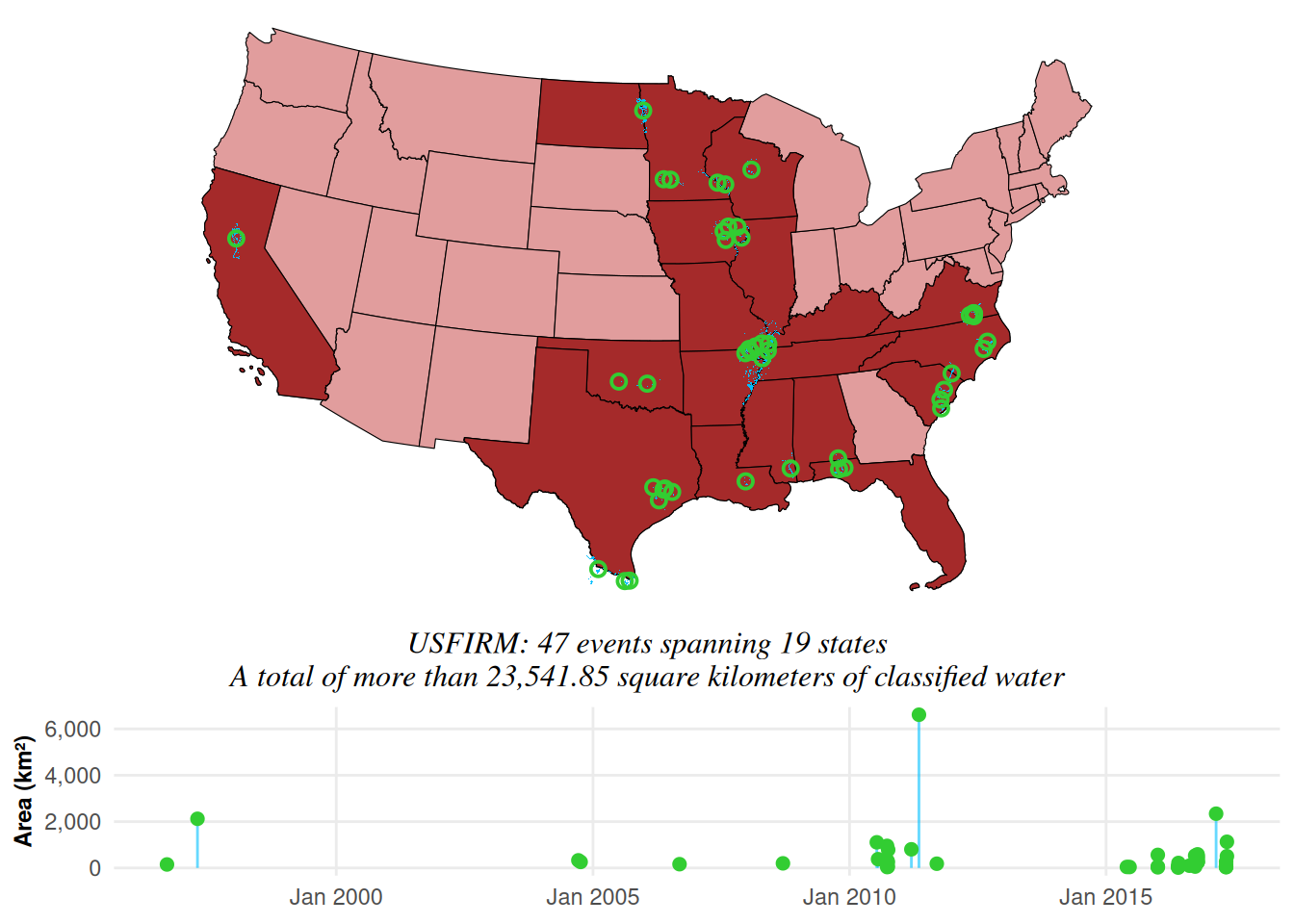
The USFIMR project commenced in August 2016 with funding from NOAA. The project’s main goal is to provide high-resolution inundation extent maps of past U.S. flood events to be used by scientists and practitioners for model calibration and flood susceptibility evaluation.
By hand digitizing and performing much of the requisite pre-processing, the US Flood Inundation Map Repository (USFIMR) database represents one of the most consolidated and published “ground truth” databases suitable as a means of performing a more consistent benchmarking of FIM results. To derive these, image classification techniques and a number of satellite sensors (e.g., Landsat, Sentinel-1, Sentinel-2) with some ground truthing based on secondary sources (e.g., news reports, social media) were combined with hand digitized water classifications to create bounds and ancillary data for an event. These maps have been widely used to evaluate FIM skill, and so even though the strict application of hydraulics was not used in the process, these maps have a high degree of skill and utility in that they have been used as the means of demonstrating process improvements from version to version of FIM libraries, and because a human (well-trained or in training graduate student) was used in the generation process the results are akin to a deeper dive into the area than an unsupervised classifier might apply.