WaDE and UCOL
Back to Data Sources
Executive Summary
This primer gratefully pilfered from https://westernstateswater.org/wade/wade-data-summary/
The Water Data Exchange Program (WaDE) is a centralized and cloud-based data system committed to assisting the eighteen Western States Water Council (WSWC) member states in making their water rights, water supply, water use, and administrative and regulatory overlay data more findable, accessible, interoperable, and reusable (FAIR) through a streamlined and standardized platform.
WaDE centralizes and transforms disparate data sources from self reported data from water users. Because these data are aggregated by user, the standardization of form and vocabulary is different. To address this, they built complex, interactively executed data cleaning and conflation pipelines using Jupyter Notebooks. This pattern, while manually intensive, ensures reproducibility and accessibility.
The current iteration of WaDE, WaDE 2, organizes data into categories (gratefully pilfered and reused here, from e.g.: https://github.com/WSWCWaterDataExchange/MappingStatesDataToWaDE2.0/tree/master/Colorado)
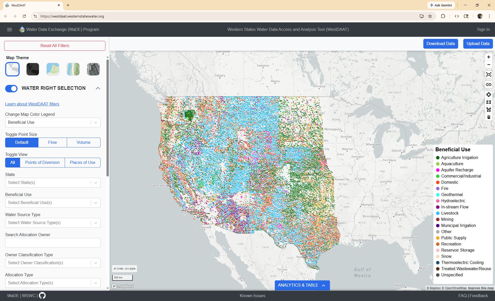
- WaterAllocation
In the western U.S., water rights (a.k.a., water allocation) are based on the prior appropriation doctrine “First in time, first in right.” Each water right has an allocated amount of water (based on a volumetric quantity or a flow rate) with a designated beneficial use (e.g., agriculture) and sometimes multiple uses, which may come from one or many specified water sources.
- Regulatory
Regulatory boundaries related to water right administration or regulation purposes.
- AggregatedAmounts
Aggregated water use, supply, and transfers may be estimated or calculated from user-reported data over-reporting units (i.e. water budgets). A water resource agency’s water budget estimate is most often estimated annually with a one-year lag time. Water budgets within a basin have historically been categorized by both withdrawals (i.e., how much water was taken from a stream, spring, or reservoir) and consumptive use (i.e., how much water was used or depleted by the application of the water withdrawal).
- SiteSpecificAmounts
Knowing river and reservoir status can help with long-term planning and flood forecasting modeling. Two relative measurements often used are discharge and gage height. Discharge is the rate at which a volume of water passes by a particular location. Gage height is a measurement of the distance between the water’s surface above the stream gage’s datum reference point (i.e., a unique reference point used to accommodate for changes in a stream channel over time).
Extra resurces:
The WaDE standards and data diagram.
An ESRI storyMap and a user senario report