3DEP
Elevation
30m
10m
Point Cloud
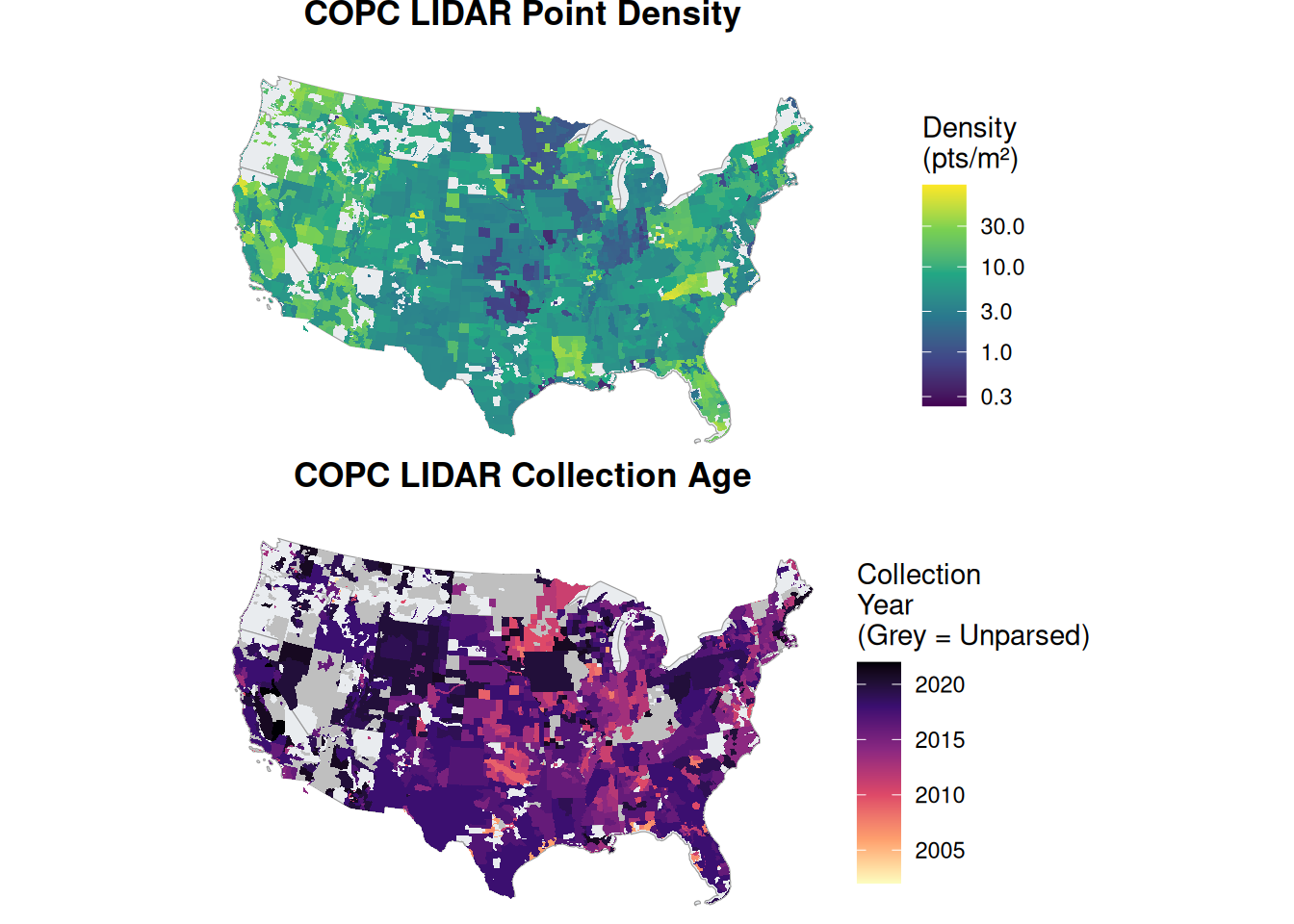
The 3DEP products and services available through The National Map consist of LIDAR point clouds and digital elevation models (DEMs) at various horizontal resolutions.

Back to Data Sources
Note that the 3D elevation products and 3D hydrography products are distinct outputs, although both stem from point cloud measurements.
https://usgs.entwine.io/, the footprints live here.