Drone Mapping
Need help passing your part 107? I can recommend the following resources:
One of the most exciting aspects of working in the Environmental Sciences is in exploring how the application of new tools and technologies has allowed us to reimagine and streamline how we observe, process, understand, and communicate the state of the world. Take for instance, the humble terrain surface. Although I’m not quite old enough to recall walking to school uphill both ways in a snowstorm, there was once a time when the USGS topo maps were the gold standard in terms of how closely we could replicate the undulations of landforms, and can recall many a boy scout meeting where we used these maps to plan our next adventure. 
In early 2000, we brought these representations to the digital domain with the flight of the Shuttle Radar Topography Mission. This gave us a digital representation of the world at a ~25-meter resolution across much of the globe. Fantastic for most large-scale representations, this is still entirely too large to be relevant at a building scale.
The next major milestone wouldn’t be seen until early 2016 with the USGS announcement of the [3D Elevation Program (3DEP)] (https://www.usgs.gov/core-science-systems/ngp/3dep). This program set standards for the collection and curation of Airborne LIDAR (Light Detection and Ranging). These data are high resolution point representations of elevation, with an average spacing of >4 points per square meter with less than 6 cm of variation across a flat surface.
 This represents a major leap forward but is not without its drawbacks. Firstly, although LIDAR collects elevations, it does not collect imagery, which makes viewing the surface much less intuitive than it would otherwise be. Additionally, although the resulting elevations are accurate, they are still not dense enough or accurate enough to compete with high precision surveys, and depending on the use case, may be out of date by more than 3 years. In these instances, small Unmanned Aerial Systems, more commonly known as drones, offer a unique solution to some of these shortcomings. Using commercially available hardware and cutting-edge software, we are able to fly over an area and collect imagery which we use to create our own custom point clouds and 3D models.

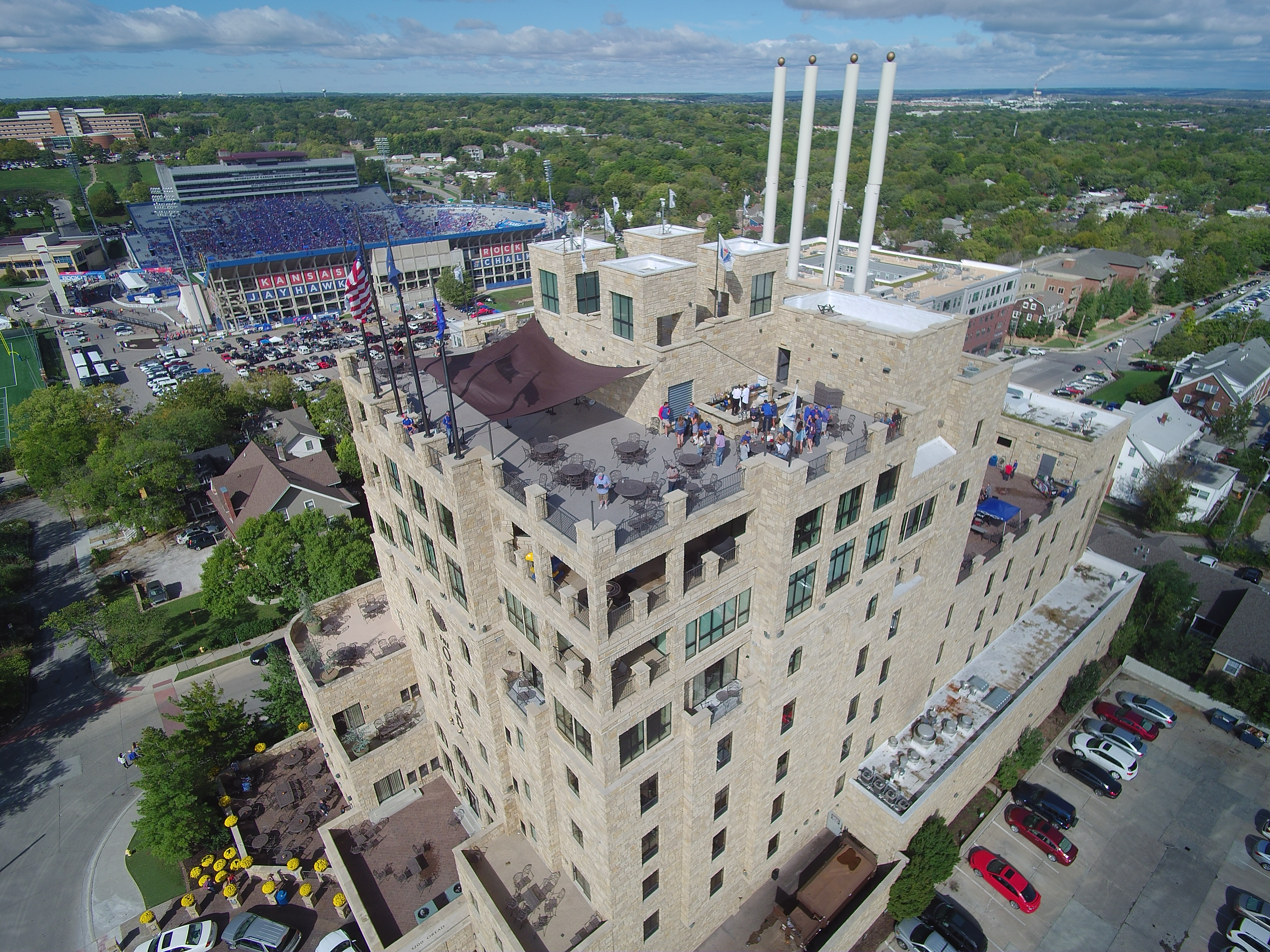 As part of my dissertation, I am interested in flying areas to determine what factors go into an effective terrestrial mapping effort. The above images are a small sampling of outputs I generate, but these can also include 3D point clouds, photo-realistic models, updated aerial maps, and standard aerial photography outputs. If you have an area you would like flown, particularly if it has interesting and complex geometry or if it’s near a body of water, please contact me at jcoll AT ku.edu and we’ll see if we can find a way to collaborate.
A small presentation for KU Natural History Museum’s Science on Tap | Free State Brewing CO.